|
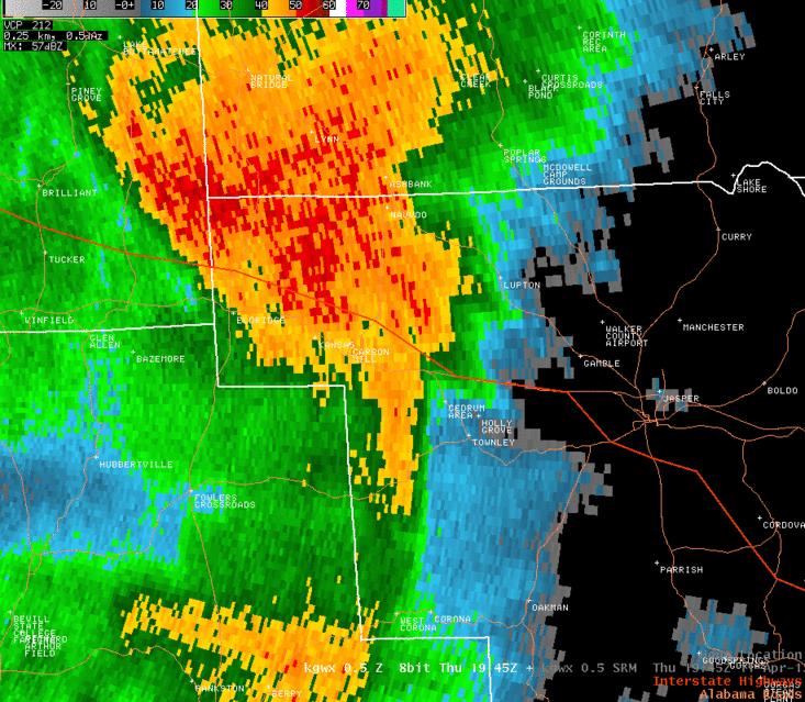
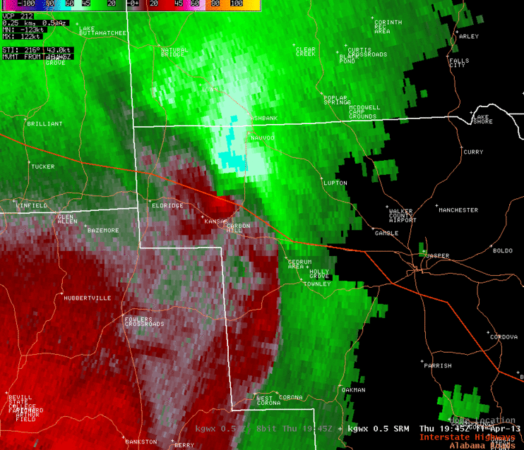
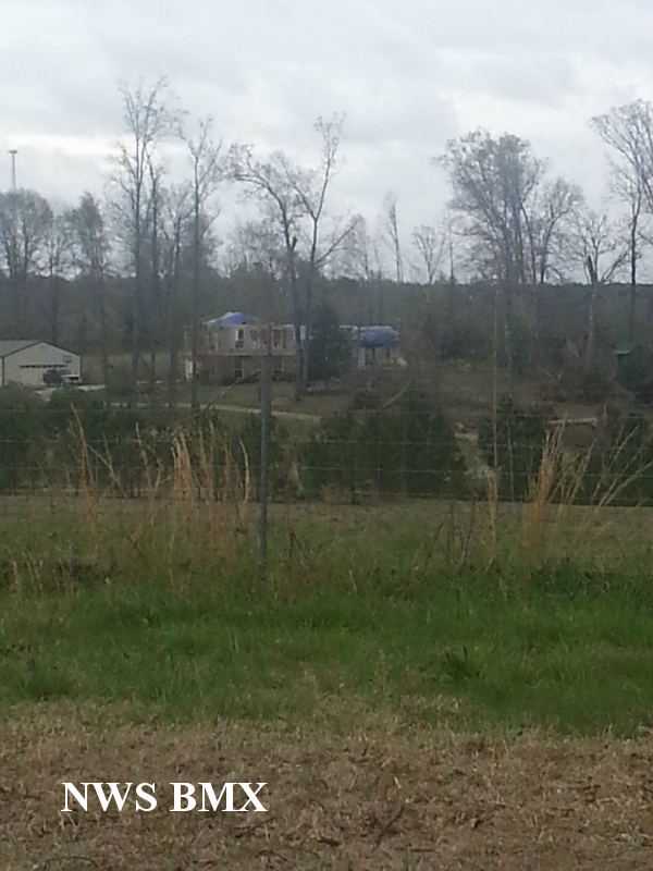
National Weather Service meteorologists surveyed the damage in northwest Walker County and have determined that the damage was due to an EF-1 tornado.
The tornado touched down approximately 3/4 of a mile southwest of Dogtown Road, near Seamore Mountain. This was in the Mill Creek watershed. The tornado tracked northeast and crossed Dogtown Road where it uprooted several trees. The tornado continued northeast and crossed Highway 78 and Ritter Road. This was the location where the most significant damage occurred. Dozens of trees were uprooted and one single family home had portions of its roof and roof decking removed. The tornado continued northeast and crossed Nix Road, Nauvoo Road, Jagger Road, Johnson Road, and Slick Lizzard Road. Some minor structure damage was observed along these roads along with tree damage. The tornado finally lifted northeast of Slick Lizzard Road before it crossed Highway 5. This damage could not be linked to the tornado in southern Winston County at Poplar Springs. |