National Weather Service United States Department of Commerce

Notasulga (Macon and Lee) EF-2 Tornado
April 11, 2013

 
EF-2
Estimated Maximum Wind:
120 mph
Injuries/Fatalities:
1 Injury
Damage Path Length:
5.08 miles
Maximum Path Width:
200 yards
Approximate Start Point/Time:
32.5327/-85.7365 at 834 pm
Approximate End Point/Time:
32.5967/-85.6934 at 844 pm
 

National Weather Service meteorologists surveyed the damage in Macon and Lee Counties and have determined that the damage was due to an EF-2 tornado. The tornado initially touched down along St. John’s Church Road at Saint John’s Church. Several tree branches were damaged along with several overturned grave markers. The tornado continued north-northeast crossing Hardwich Street where several outbuildings sustained damage. The tornado proceeded to cross County Road 39 and State Road 14 where several more homes and outbuildings were damaged or destroyed. On County Road 39, one brick home sustained major roofing loss and window glass breakage. One minor injury was caused from flying glass. Also in the same area, one mobile home had significant damage while another was completely destroyed. The tornado crossed State Road 14 and it was here where it reached its maximum intensity. It significantly damaged a well-built two-story home. There was a considerable loss of roof material along with one outer wall completely destroyed and another outer wall significantly damaged. It should be noted that the family of five took cover in an interior closet on the lowest level which kept them from significant injury. The tornado then tracked further northeast where it damaged an additional outbuilding pavilion. It lifted along Roxana Road just inside Lee County.


Radar Data 

Radar Image
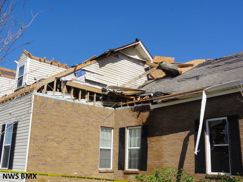
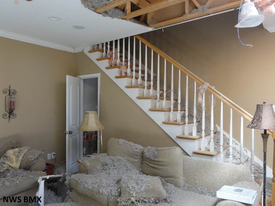
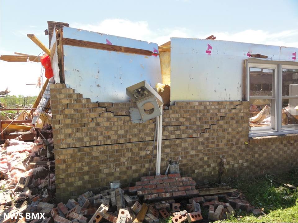
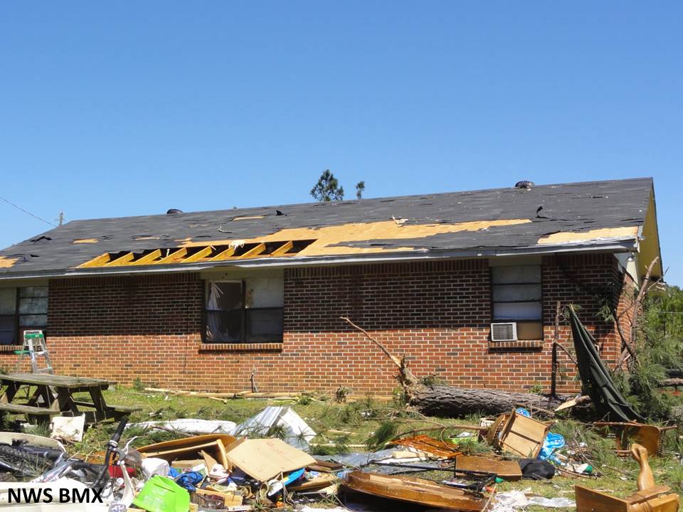
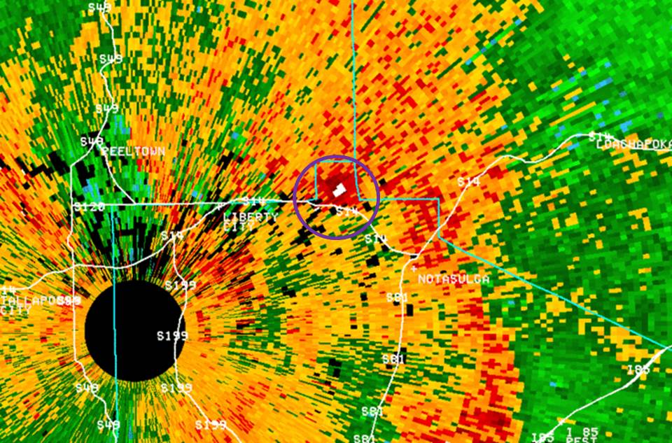
This is an image of the reflectivity from KMXX at 842 pm. Due to how close the tornado is to the radar, you are actually seeing a debris ball within the reflectivity (white pixels). 
The tornado is on the ground at this time.  The solid black circle is the "cone of silence" where KMXX is unable to sample storm data directly above the radar.

Radar Image
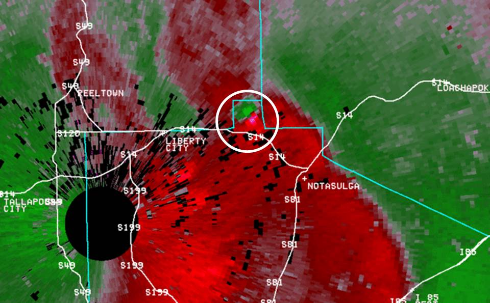
This is an image of the base velocity from KMXX at 
842 pm. The green and red pixels side by side in the white circle indicate a tight wind circulation.  The tornado is on the ground at this time. The solid black circle is the "cone of silence" where KMXX is unable to sample storm data directly above the radar.

 
Damage Pictures 

Storm Damage
Roof damage to a well-built home

Storm Damage
Inside of the home on the left

Storm Damage
Roof removed from well-built home.  Main indicator of EF-2 damage

Storm Damage

Minor roof damage to well-built home

Mobile home damage
Roof removed from mobile home 

Storm Damage
Inside mobile home on the left