|
Event Summary
|
|
EF-0
|
|
Estimated Maximum Wind:
|
80 mph
|
|
Injuries/Fatalities:
|
None |
|
Damage Path Length:
|
1.79 miles
|
|
Maximum Path Width:
|
350 yards
|
|
Approximate Start Point/Time:
|
2 SE Stone Wall
33.5878/-87.7504
at 434 pm
|
|
Approximate End Point/Time:
|
2 E Stone Wall
33.6136/-87.7472
at 436 pm
|
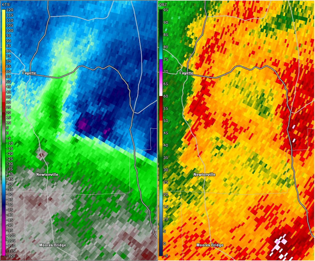
National Weather Service meteorologists surveyed the damage in southern Fayette County and determined it was the result of an EF-0 tornado.
A tornado touched down along CR 35 southeast of Fayette in far southeastern Fayette County. The tornado moved northward along CR 89, causing minor tree damage consisting of broken branches and uprooted trunks, between Mt. Pleasant/Burrow Road and County Road 35. The tornado damage path was 1.79 miles long and was 350 yards wide at its widest point. The maximum winds were estimated around 80 mph. The tornado affected mostly rural locations.
|