|
Event Summary
|
|
EF-2
(EF-2 WFO HUN)
|
|
Estimated Maximum Wind:
|
115 mph
|
|
Injuries/Fatalities:
|
3 Injuries |
|
Damage Path Length:
|
12.70 miles
|
|
Maximum Path Width:
|
350 yards
|
|
Approximate Start Point/Time:
|
2 WSW Walnut Grove
34.0721/-86.3249
at 610 pm
|
|
Approximate End Point/Time:
|
1 S Boaz
34.1871/-86.1543
at 621 pm
|
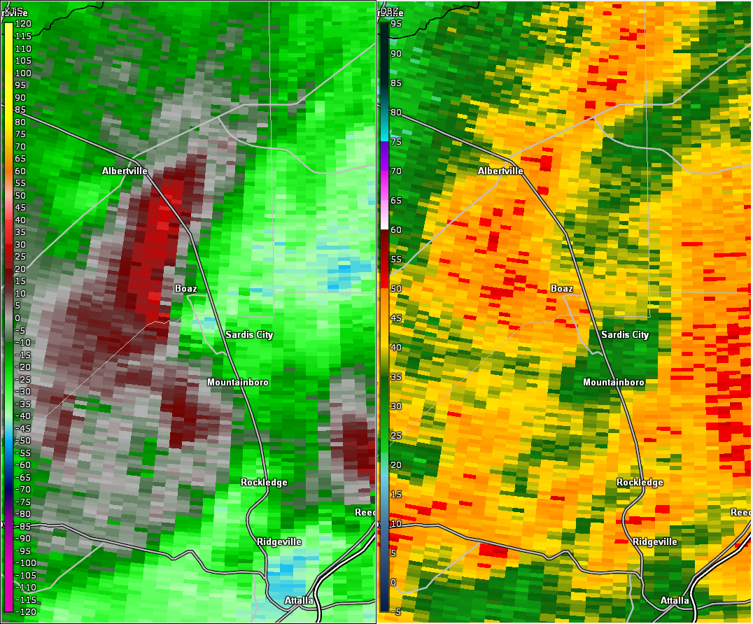
National Weather Service meteorologists surveyed the damage in northern Etowah County and determined it was the result of an EF-2 tornado.
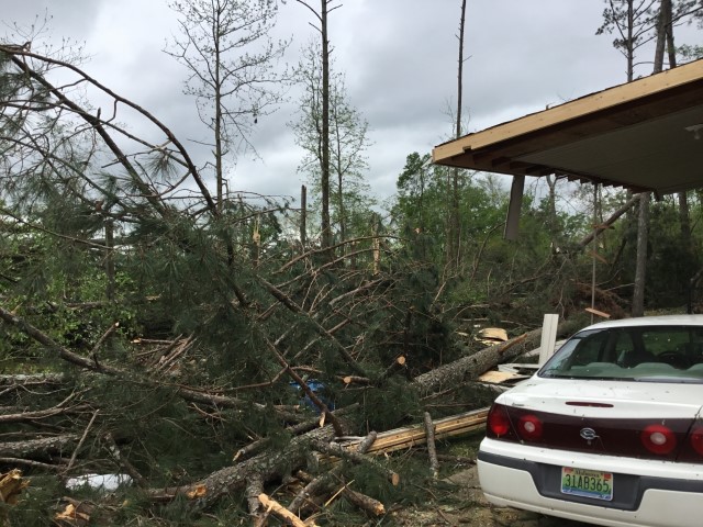
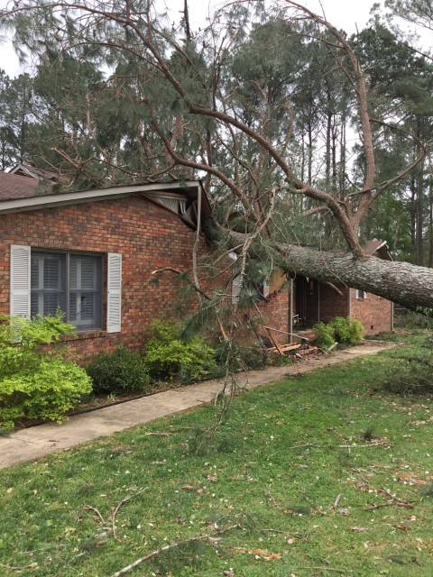
The tornado first touched down near the Walnut Grove community along the Blount-Etowah County line. Here sporadic tree damage was noted with some large limbs snapped and trees uprooted along Highway 278. The tornado tracked northeast tracking along the ridgeline in northern Etowah County. Sporadic tree damage was noted along Cove Spring Road and Cove Road. The tornado began to strengthen as it moved northeast toward the southern portions of Boaz. Several homes were damaged in this area some from falling trees and others from direct tornado damage. At least one home near the intersection of Highway 179 and Glover Road sustained significant structural damage. A large industrial building in this area also sustained significant damage. At this point, the tornado reached its maximum intensity in Etowah County at 115 mph with a width of approximately 350 yards. The tornado continued to move northeast through Boaz with homes and structures damaged along Pleasant Hill Road and Highway 205. Significant tree damage with uprooted and snapped trees were noted in this area. The tornado continued to track northeast through the city of Boaz and into Marshall County.
|