|
Event Summary
|
|
EF-1
|
|
Estimated Maximum Wind:
|
110 mph
|
|
Injuries/Fatalities:
|
3 Injuries |
|
Damage Path Length:
|
2.90 miles
|
|
Maximum Path Width:
|
1000 yards
|
|
Approximate Start Point/Time:
|
2 SW Carbon Hill
33.8795/-87.5472
at 812 pm
|
|
Approximate End Point/Time:
|
1 NE Carbon Hill
33.9072/-87.5081
at 816 pm
|
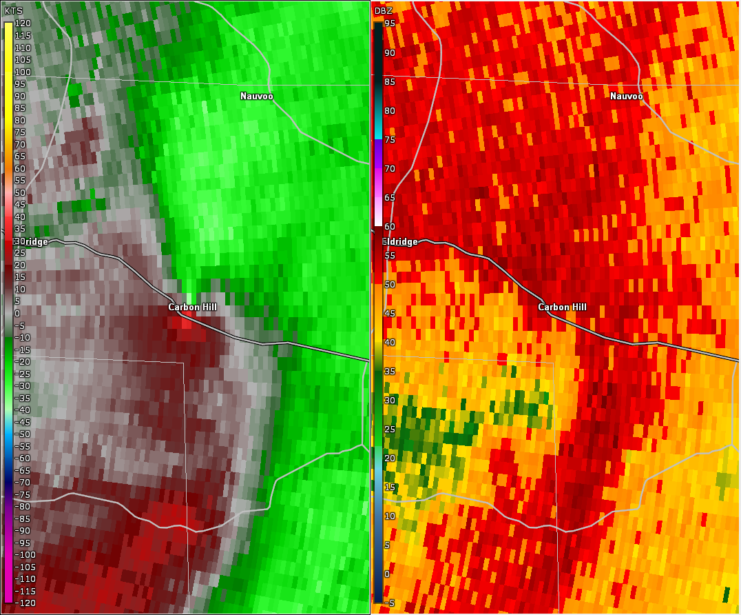
National Weather Service meteorologists surveyed the damage near Carbon Hill in Walker County and determined it was the result of an EF-1 tornado.
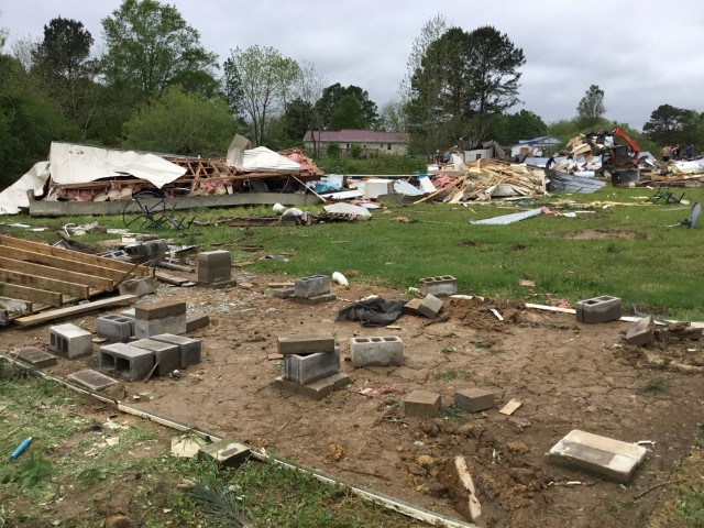
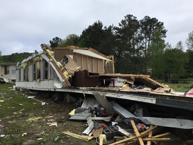
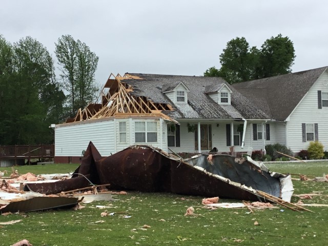
A short-lived but intense tornado touched down near Nubbin Ridge Road in far northwestern Walker County. At this location, several trees were snapped and uprooted. As the tornado tracked into the town of Carbon Hill, dozens of trees were uprooted or snapped off throughout the town center. Various residential and professional buildings sustained structural damage, including sections of roofing blown off of a site-built home as estimated winds peaked at 110 mph. The area of greatest structural damage occurred along Nauvoo Lane where at least 5 manufactured homes and outbuildings were either rolled and completely destroyed, shifted from block piers, or suffered substantial loss of roof and walls. The tornado continued towards Nauvoo Court and snapped off a few large branches before ending just south of Interstate 22. The tornado damage path was 2.90 miles long and was 1000 yards wide at its widest point. The maximum winds were estimated around 110 mph.
|