|
Event Summary
|
|
EF-2
|
|
Estimated Maximum Wind:
|
115 mph
|
|
Injuries/Fatalities:
|
None |
|
Damage Path Length:
|
5.56 miles
|
|
Maximum Path Width:
|
500 yards
|
|
Approximate Start Point/Time:
|
1 SSW Fairview
33.9384/-86.5677
at 550 pm
|
|
Approximate End Point/Time:
|
1 E Rosa
33.9827/-86.4876
at 557 pm
|
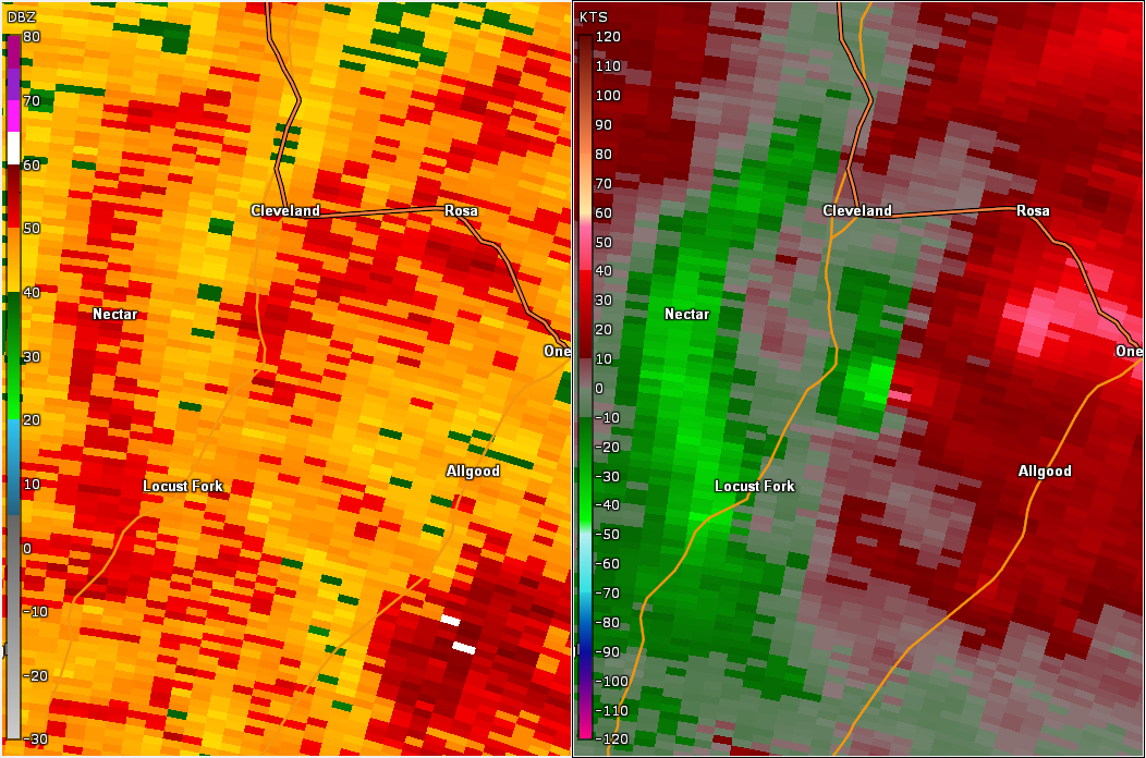
National Weather Service meteorologists surveyed the damage just west of Oneonta in Blount County and determined it was the result of an EF-2 tornado.
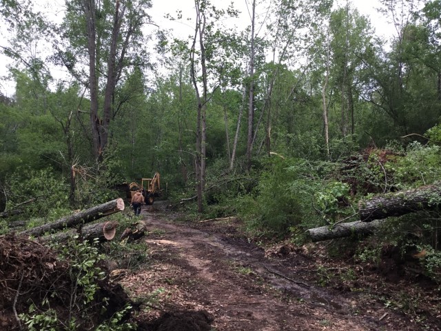
A tornado touched down near Moss Road and County Road 33. This location is in central Blount County in an open farm pasture. The tornado quickly intensified as it began to snap and uproot various trees near the farm, and also destroying a farm shed. Numerous trees were uprooted as the tornado began to cross Highway 33, before impacting two residences. It was here where the damage survey team found the most significant damage as one residence sustained moderate roof and siding damage, and another was completely swept off its foundation, moving nearly 60 ft to the north. Wind estimates at this location placed the tornado at EF-2, 115 mph. Dozens of trees were also snapped and uprooted on these properties as the tornado ran parallel to the highway in a northeasterly direction. Tracking northeast, the tornado crossed County Road 1 where another corridor of significant tree damage was observed. Just to the north, a shed was overturned and blown to the southeast. From here, the tornado continued northeast where structure damage was observed near Highway 33. Various farm buildings sustained significant damage and at least one residence sustained roof damage (winds estimated at 100 mph). Damage became more sporadic in nature and less severe northeast of this location, though another brief corridor of EF-1 damage was observed near the intersection of Shady Lane and US Highway 231, where numerous trees were snapped and uprooted. After crossing Highway 231, the tornado continued northeast and approached Palisades Park before dissipating along Ebell Road. The tornado damage path was 5.56 miles long and was 500 yards wide at its widest point. The maximum winds were estimated around 115 mph.
The National Weather Service would like to thank Blount County EMA for their assistance with tornado damage assessments across the county.
|