|
Event Summary
|
|
EF-0
|
|
Estimated Maximum Wind:
|
75 mph
|
|
Injuries/Fatalities:
|
None |
|
Damage Path Length:
|
1.51 miles
|
|
Maximum Path Width:
|
200 yards
|
|
Approximate Start Point/Time:
|
3 SSE Ethelsville
33.3697/-88.1937
at 401 pm
|
|
Approximate End Point/Time:
|
3 E Pine Grove
33.3820/-88.1722
at 403 pm
|
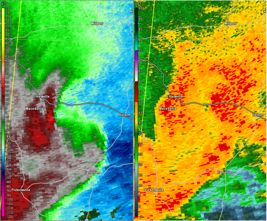
National Weather Service meteorologists surveyed the damage near Ethelsville in northwest Pickens County and determined it was the result of an EF-0 tornado.
The tornado formed near the intersection of Willie Wright Road and St Johns Road, about three miles south-southeast of Ethelsville. The tornado moved northeast almost parallel to Willie Wright Road and dissipated near the intersection of Mount Moriah Jones Road. Several large tree limbs and trees were downed along the path. The tornado damage path was 1.51 miles long and was 200 yards wide at its widest point. The maximum winds were estimated around 75 mph. The tornado affected mostly rural locations.
|