|
Event Summary
|
|
EF-1
|
|
Estimated Maximum Wind:
|
110 mph
|
|
Injuries/Fatalities:
|
None |
|
Damage Path Length:
|
8.98 miles
|
|
Maximum Path Width:
|
950 yards
|
|
Approximate Start Point/Time:
|
1 S Gorgas Steam Plant
33.6319/-87.2022
at 504 pm
|
|
Approximate End Point/Time:
|
2 SSE Dora
33.7027/-87.0731
at 516 pm
|
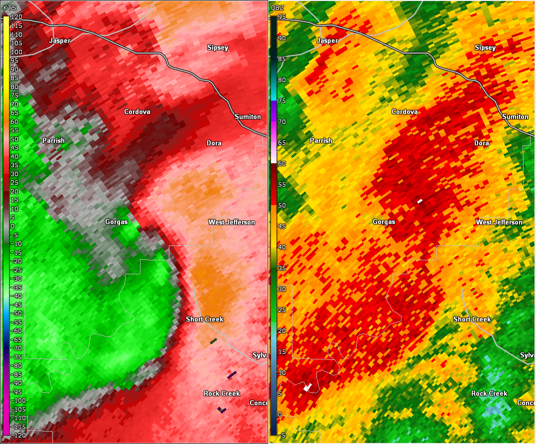
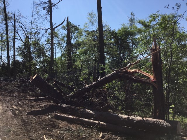
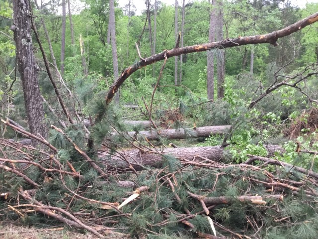
National Weather Service meteorologists surveyed the damage in southeastern Walker County and determined it was the result of an EF-1 tornado.
A tornado developed just south of the Gorgas Power Plant along the Mulberry Fork near Copeland Bend. The most focused area of damage occurred along Rainwood Lodge Road where numerous trees were snapped and uprooted, some of which fell on homes. In addition, minor roof damage was observed at several residences along the road. The tornado continued northeastward, uprooting several more trees and breaking branches before crossing Interstate 22. Numerous trees were snapped and uprooted near a convenience store on Sharon Blvd with one tree falling on a nearby manufactured home just before the tornado dissipated. The tornado damage path was 8.98 miles long and was 950 yards wide at its widest point. The maximum winds were estimated around 110 mph.
|