|
Event Summary
|
|
EF-0
|
|
Estimated Maximum Wind:
|
80 mph
|
|
Injuries/Fatalities:
|
None |
|
Damage Path Length:
|
3.80 miles
|
|
Maximum Path Width:
|
400 yards
|
|
Approximate Start Point/Time:
|
4 NE Belnap
32.2440/-86.9515
at 1027 pm
|
|
Approximate End Point/Time:
|
3 S Tyler
32.2791/-86.9016
at 1031 pm
|
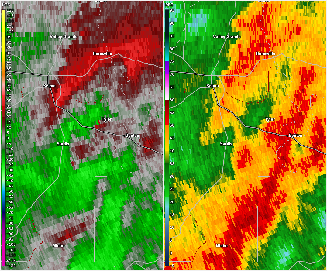
National Weather Service meteorologists surveyed the damage in eastern Dallas County and determined it was the result of an EF-0 tornado.
A tornado near the intersection of County Road 62 and County Road 417, about three miles southeast of the Sardis community in Dallas County. The tornado moved northeast, causing tree damage along County Road 471, County Road 30 and County Road 451. The tornado lifted at County Road 451. The tornado damage path was 3.80 miles long and was 400 yards wide at its widest point. The maximum winds were estimated around 80 mph.
|