|
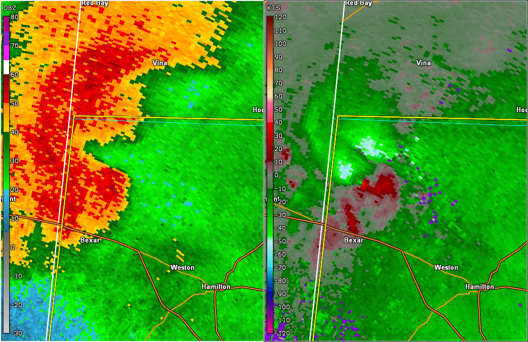
Event Summary
|
|
EF-1
|
|
Estimated Maximum Wind:
|
90 mph
|
|
Injuries/Fatalities:
|
None |
|
Damage Path Length:
|
1.21 miles
|
|
Maximum Path Width:
|
440 yards
|
|
Approximate Start Point/Time:
|
2 SSW Shottsville
34.2415/-88.1425
at 1157 pm
|
|
Approximate End Point/Time:
|
1 WSW Shottsville
34.2589/-88.1392
at 1159 pm
|
National Weather Service meteorologists surveyed the damage in northwestern Marion County and determined it was the result of a tornado with maximum sustained winds of 95 mph.
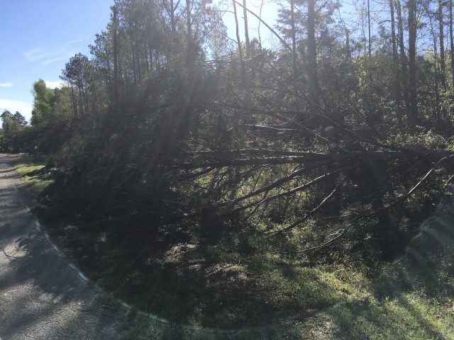
The tornado touched down just southeast of the intersection of County Road 13 and Grant Road. It rapidly intensified as it moved northward and crossed County Road 13, where it uprooted dozens of pines and a few hardwoods in the area. The tin was partially torn off a small barn and was deposited to the west of the path. Just as quickly as the tornado intensified, it dissipated just north of County Road 13 before reaching County Road 56.
|