|
Event Summary
|
|
EF-0
|
|
Estimated Maximum Wind:
|
70 mph
|
|
Injuries/Fatalities:
|
None |
|
Damage Path Length:
|
2.97 miles
|
|
Maximum Path Width:
|
125 yards
|
|
Approximate Start Point/Time:
|
2 WNW Calera
33.1109/-86.7851
at 414 am
|
|
Approximate End Point/Time:
|
2 SSE Shelby County Airport
33.1527/-86.7748
at 419 am
|
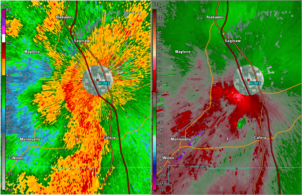
National Weather Service meteorologists surveyed the damage in southern Shelby County between Calera and Montevallo and determined it was the result of a tornado with maximum sustained winds of 70 mph.
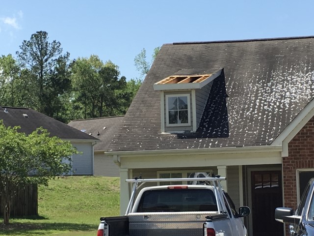
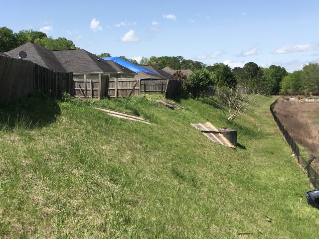
The tornado formed near Salter Lake just east of a quarry west of Calera and moved northeast, causing minor timber damage across Shelby County Road 16 that blocked the roadway. The tornado continued to the north-northeast through inaccessible forested areas and crossed the northern extent of the quarry where no damage was reported by personnel. The tornado moved nearly due north and caused some minor timber damage as it crossed Shelby County Road 22 and uprooted trees as it moved across Sharpsburg Circle. A nearby home had a portion of its wooden fence supports broken due to the winds. Behind a house three trees were uprooted. The home was undergoing a roof replacement. No damage to the home was found other than the winds lofting plywood, shingles and tools used for the work. Some of the plywood and shingles were found a few hundred yards north in the adjacent neighborhood. A few trees were uprooted at the eastern end of Ivanhoe Lane. Further to the north, the tornado crossed Rossburg Drive and Rossburg Place. Here it caused significant roof damage to one home, broke apart portions of five fences, deposited plywood and some roofing material on the roof an other homes, uprooted a few trees and tore a small portion of roof off of an upstairs room. The tornado then continued northward, between Little John Circle and Nottingham Drive, where it dissipated.
|