|
Event Summary
|
|
EF-0
|
|
Estimated Maximum Wind:
|
70 mph
|
|
Injuries/Fatalities:
|
None |
|
Damage Path Length:
|
1.00 miles
|
|
Maximum Path Width:
|
150 yards
|
|
Approximate Start Point/Time:
|
3 W Henderson
31.6594/-86.1261
at 650 am
|
|
Approximate End Point/Time:
|
3 WNW Henderson
31.6735/-86.1222
at 652 am
|
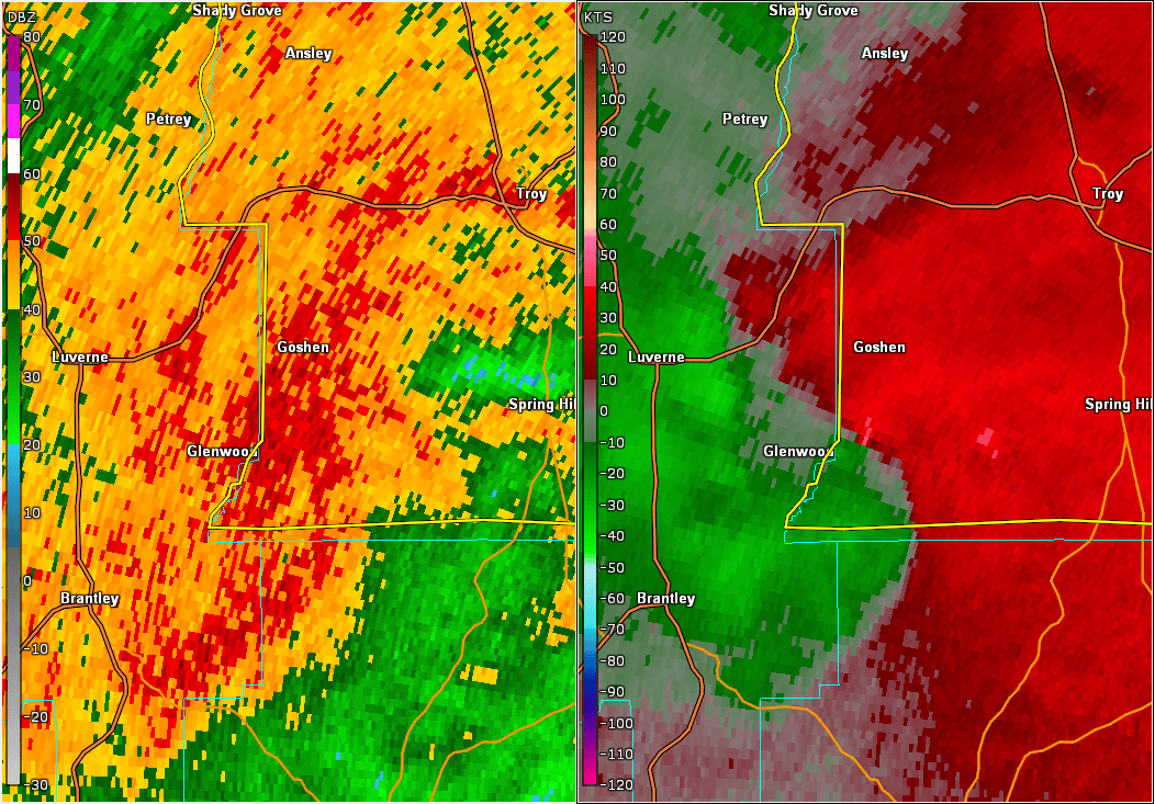
National Weather Service meteorologists surveyed the damage in extreme southwestern Pike County and determined it was the result of a tornado with maximum sustained winds of 70 mph.
The tornado initially touched down north of County Road 6, several miles south of Goshen. It then moved north-northeast mainly over rural farmlands and open fields. Due to the lack of road access, the path width and length were estimated pending any further data. Wind speeds were based on trees uprooted west of County Road 2243. The survey was prompted by a distinct TDS from the Fort Rucker WSR-88D.
|