|
A tornado began over an inaccessible and unpopulated wooded area just southwest of a bend in the Tombigbee River in Sumter County. The tornado intensified quickly, with EF-1 level tree damage being noted via satellite imagery. The tornado crossed the river into Greene County, where tree damage continued and became more intense as it approached County Road 69. Here, in addition to numerous downed trees, a site-built home had significant damage to an open air attached carport and much of the roof and rear, south-facing wall. Two residents inside were uninjured. A shed behind the house was destroyed as well. A single-wide manufactured home on the east side of the house was also destroyed, with the frame blown northward around 100-125 yards and wrapped around a tree next to CR 69. Much of this stand of trees directly south of the roadway was snapped or uprooted. Just north of the site-built home, a vacant block/brick building that formerly housed the Morning Star Baptist Church was completely destroyed. West of this building, a manufactured home with two occupants was flipped and rolled to the south. Both occupants were ejected, and one was injured and transported to the hospital. Damage in this area was rated low-end EF-2, generally in the 115-120 mph range.
From here, the tornado continued northeastward across mostly open fields. Along a railroad, numerous trees were uprooted or snapped. The tornado was likely at its widest point here, approximately 325 yards wide. Debris from the manufactured home with the injured occupant was reportedly found along the railroad, approximately 0.7 miles away. Tree damage, at times significant, continued to County Road 20, where the Rose Chapel CME and an adjacent manufactured home-like structure were damaged. Across the road the First United Baptist Church also sustained minor damage. An article of clothing from the house on CR 69 was recovered near the church building, which was approximately 1.2 miles downstream. Another area of significant tree damage was noted on satellite between CR 20 and U.S. Highway 43. Tree damage continued northeastward to around the northern end of Dunlap Rd before continuing north-northeastward across fields and wooded areas until dissipating. As this tornado moved across areas northwest of Forkland, another EF-2 tornado began east of Forkland and moved into Hale County.
Additional damage around Parkers Fish Camp and along and near Lloyd Chapel Rd was determined to not be directly related to the tornado and was likely associated with the rear flank downdraft.
This tornado was officially documented in June 2025 based on satellite analysis, a local newspaper article, and social media pictures and videos, as well as a ground survey that retraced the path and interviewed residents who had been directly affected.
A Tornado Warning was in effect from 418 pm until 515 pm.
|
|
| |
 |
 |
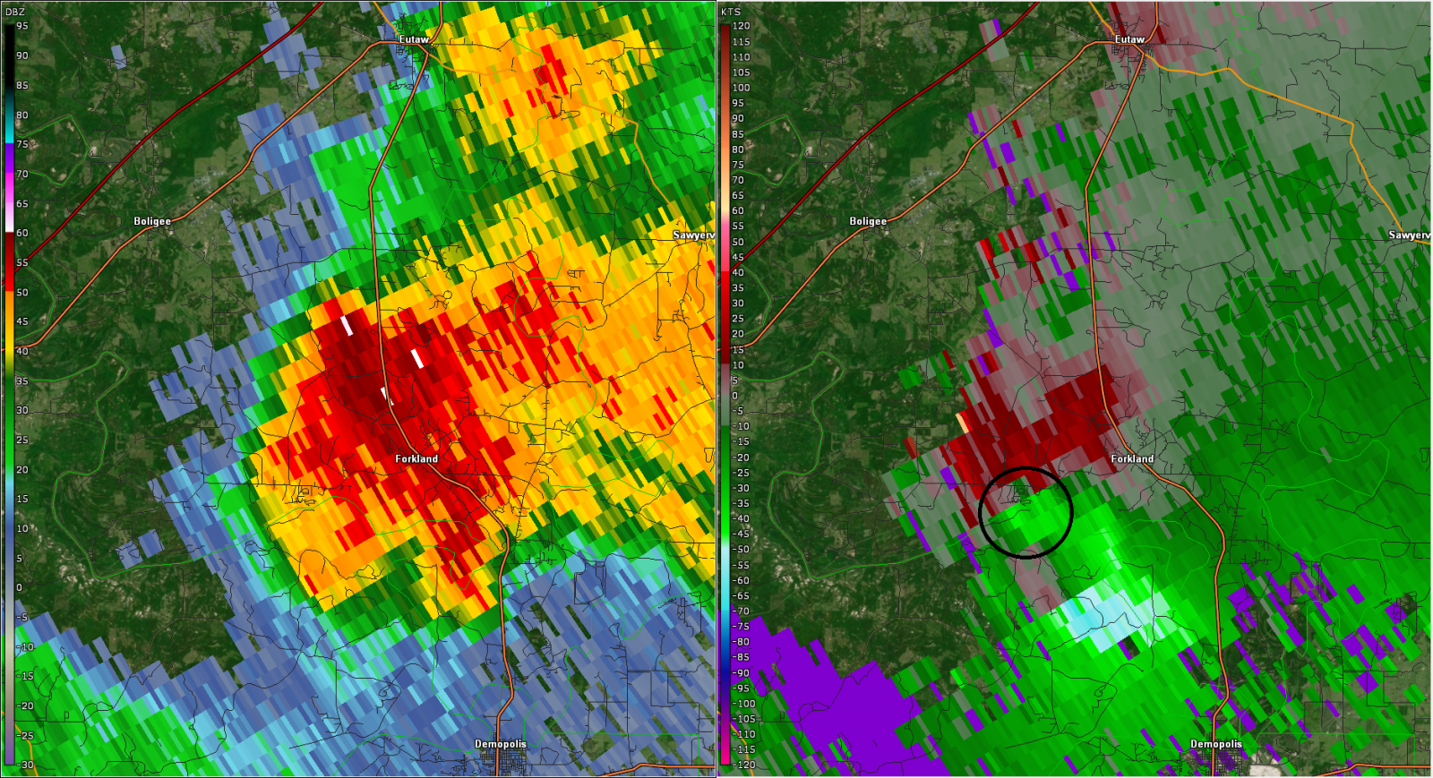
| Reflectivity/Storm Relative Velocity at 436 pm, as the tornado neared the Tombigbee River. |
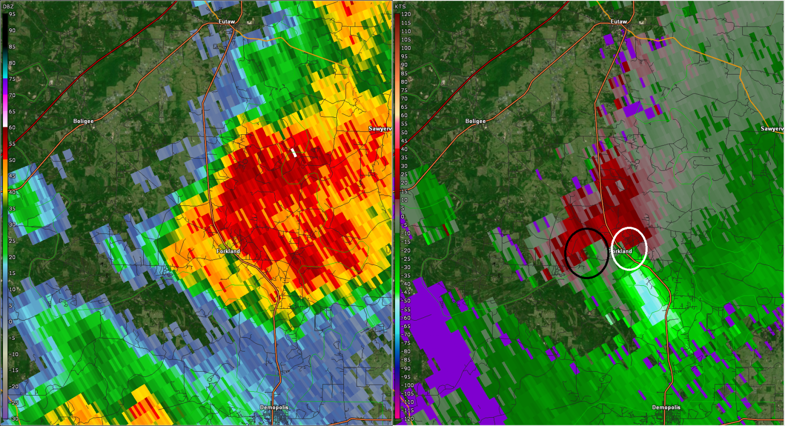
Radar at 441 pm, as the tornado is near County Road 69, denoted by the black circle on velocity. The white circle is a developing circulation that will become a new tornado east of Forkland. |
 |
 |
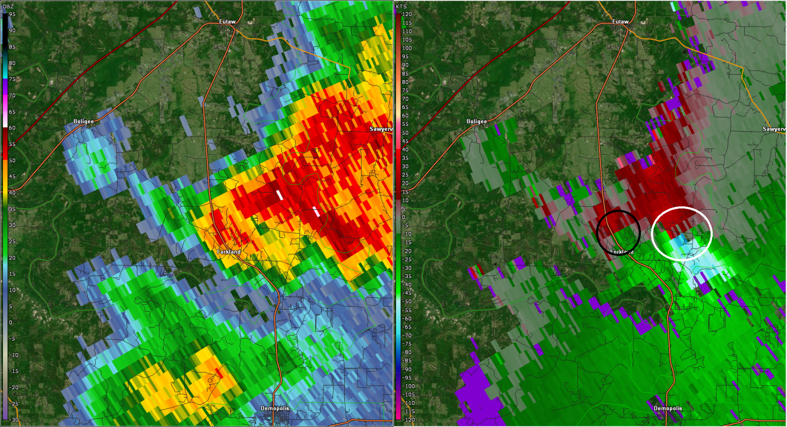
| Radar at 446 pm, as the tornado moved NNE in an occlusion north of Forkland. A new tornado is beginning with the now dominant circulation (white circle). |
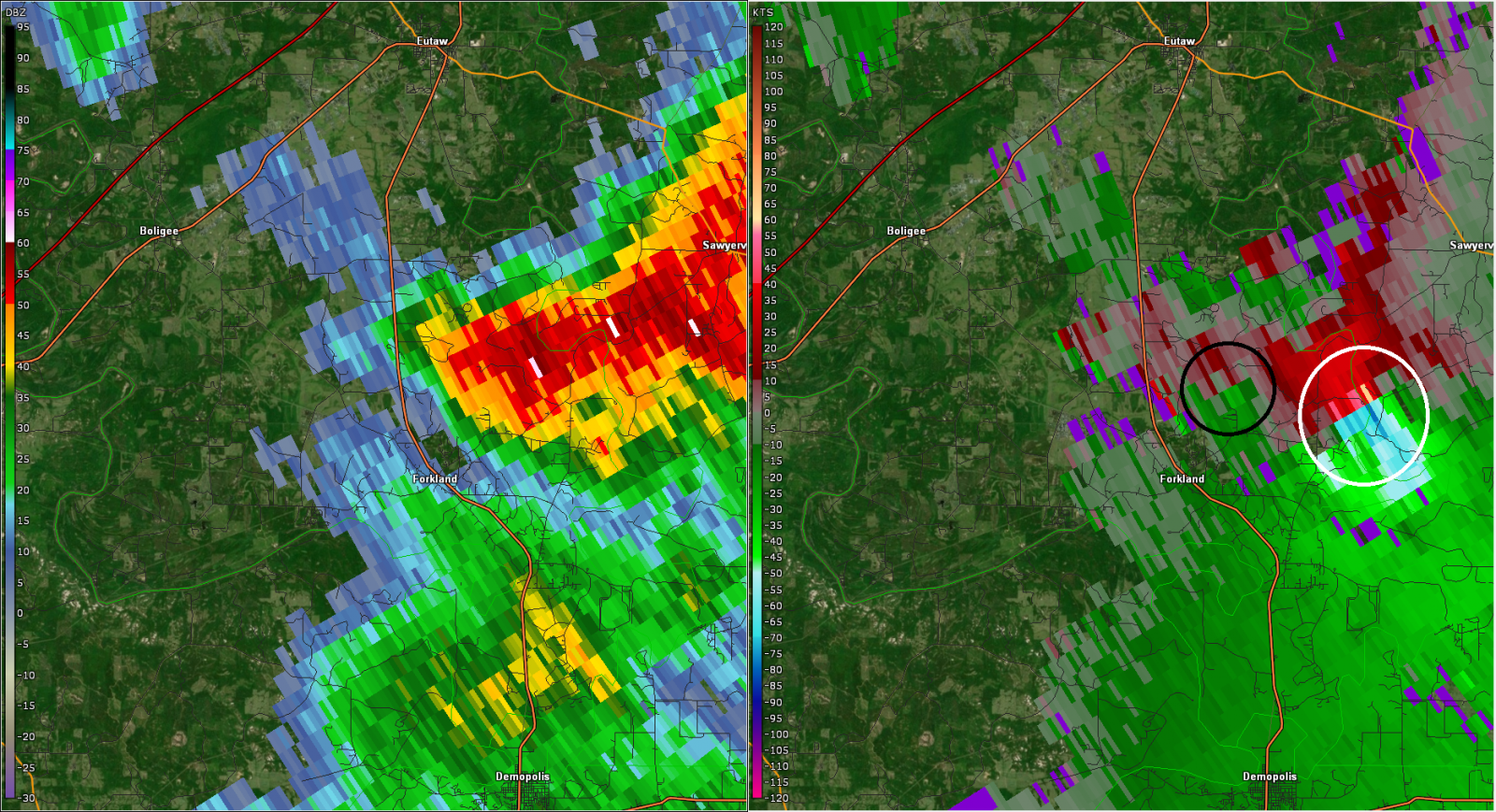
Radar at 450 pm, shortly before the tornado dissipated (black circle). The new tornado east of Forkland (white circle) is crossing into Hale County. |
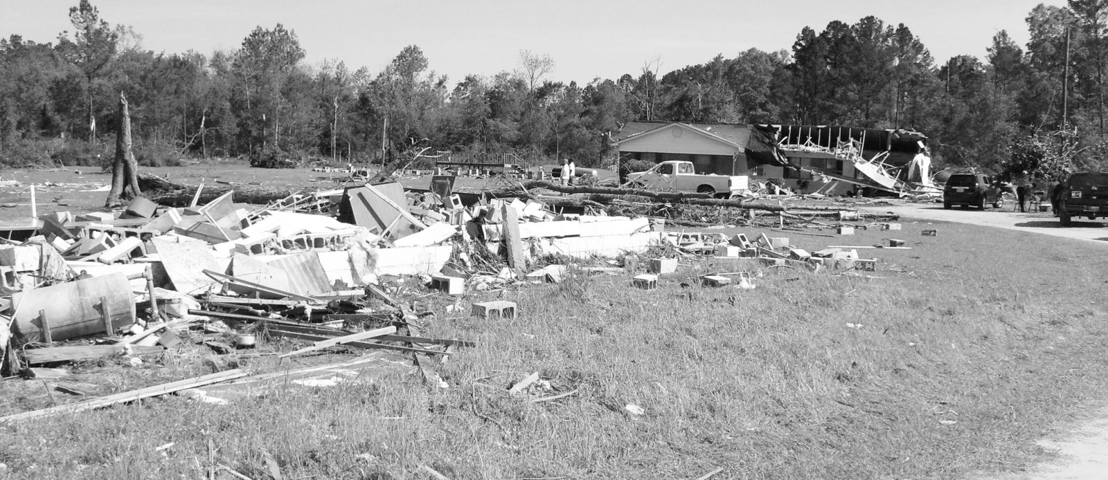 |
| Damage along County Road 69, showing a destroyed block building that formerly housed the Morning Star Baptist Church, a damaged home, and the remaining porch of the manufactured home that had been blown to the north (left) of the image. (Greene County Democrat) |
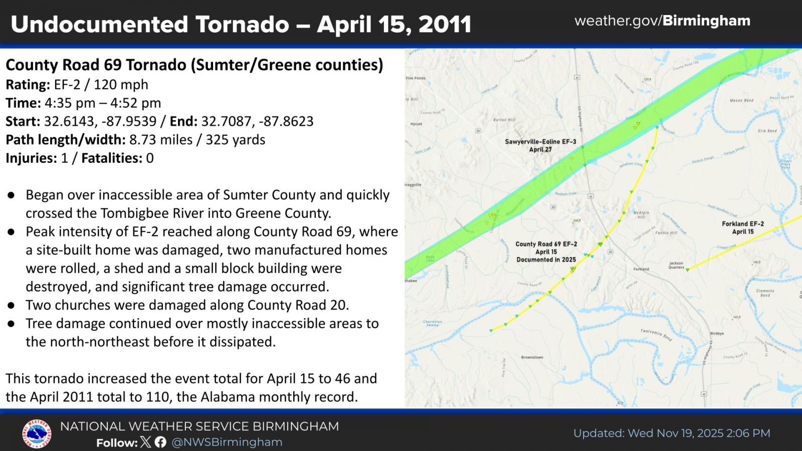 |
| A graphic published in November 2025 as part of a press release on the tornado documentation. |
|

