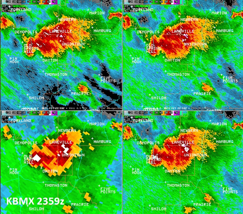
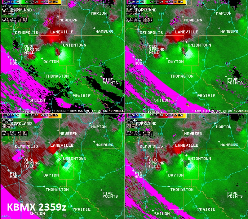
National Weather Service meteorologists surveyed the damage south and southeast of Uniontown. It has been determined that the damage was consistent with a tornado. Winds were estimated around 85 mph. The tornado touched down just north of Cooper Road off Highway 65. It traveled east-northeast to just south of Highway 80 off of Tayloe Road. The tornado uprooted and snapped numerous trees and did significant damage to 2 outbuildings. The damage path was 4.65 miles long and was 150 yards wide at its widest point.
A Tornado Warning was in effect from 530 pm until 630 pm.