|
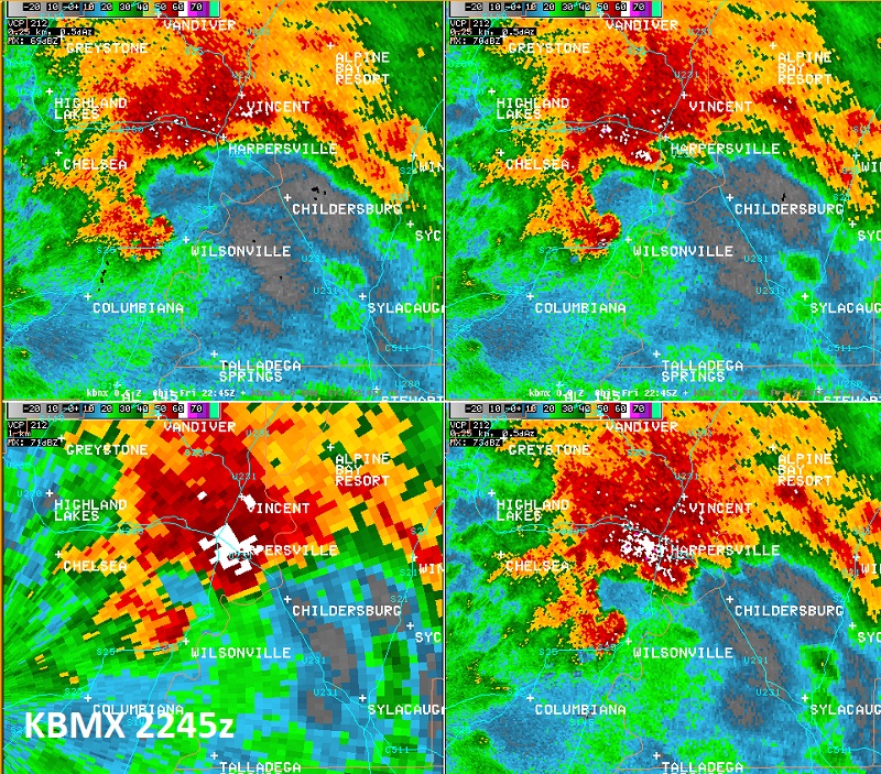
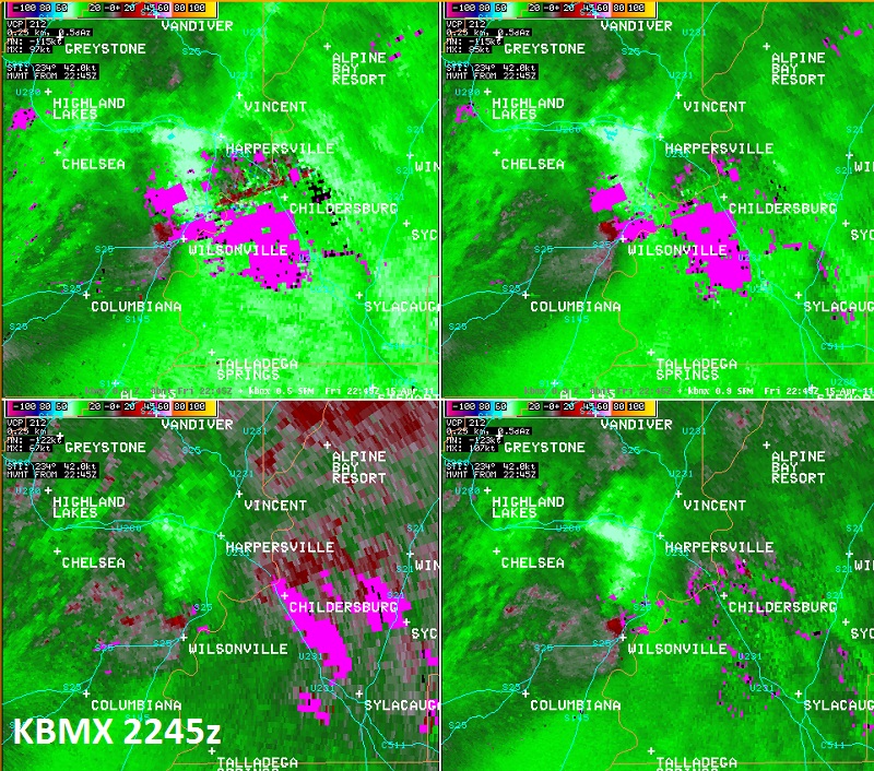
National Weather Service meteorologists surveyed the damage near Wilsonville. It has been determined that the damage was consistent with a tornado. Winds were estimated between 85 and 90 mph. The tornado touched down 2.5 miles northwest of Wilsonville on Largin Road. Several trees were snapped off or were uprooted in this location. The tornado tracked northeastward and moved just north of Wilsonville. The tornado lifted just north of Highway 25 near the Lay Lake Inlet. The most concentrate damage occurred at the very end of the damage path near County Road 441. Several trees were snapped off or were uprooted from County Road 441 to the end point. Additionally, one home suffered roof damage and one horse trailer was thrown at least 100 yards. Much of the tornado damage path was much weaker damage and was generally limited to broken tree limbs. The tornado damage path was 4.38 miles long and was 100 yards wide at its widest point.
A Tornado Warning was in effect from 526 pm until 615 pm.
|