|
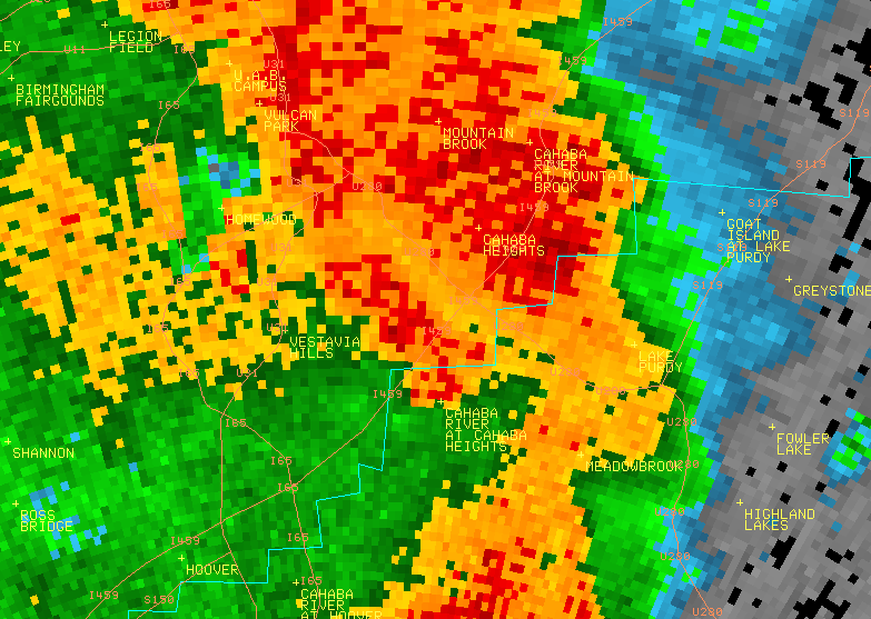
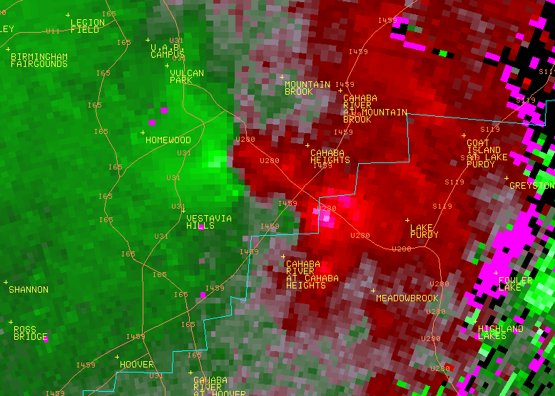
National Weather Service meteorologists surveyed damage across the Altadena area in extreme northern Shelby County and southern Jefferson County. It has been determined the damage was consistent with a tornado. Maximum winds were estimated up to 100 mph. A tornado developed along a Quasi-Linear Convective System. It touched down in far northern Shelby County, less than one mile west of the intersection of Valleydale Road and Caldwell Mill Road, and tracked northeastward into southern Jefferson County. The tornado produced damage consistent with an EF1 rating and winds of 100 mph. Numerous trees were knocked down which caused damage to homes, apartment buildings, vehicles and power lines. The tornado crossed into Jefferson County just east of the intersection of Caldwell Mill Rd and Pahokee Trace. The tornado weakened to an EF0 rating and produced tree damage until it lifted near the intersection of Acton Place and Caldwell Mill Rd.
A Tornado Warning was in effect from 529 am until 600 am.
|