|
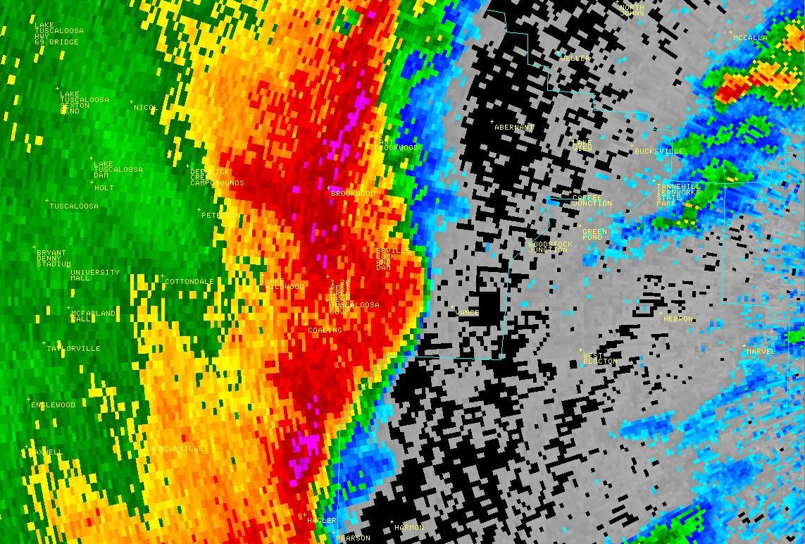
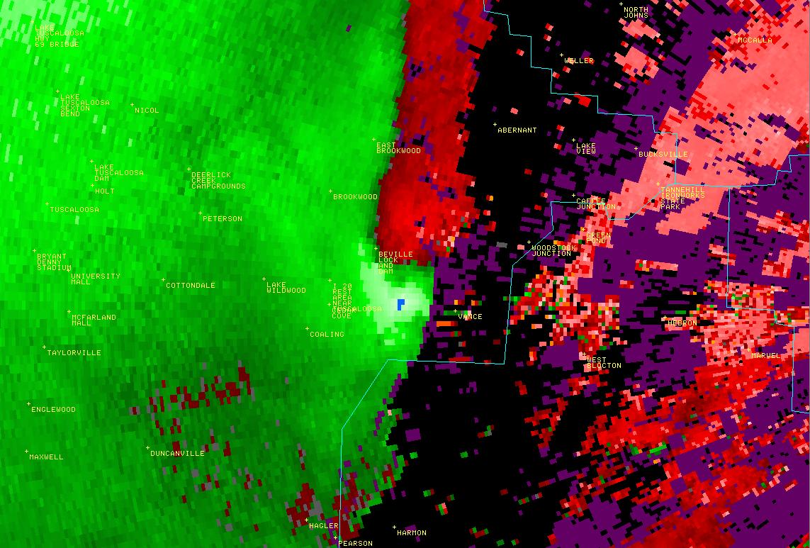
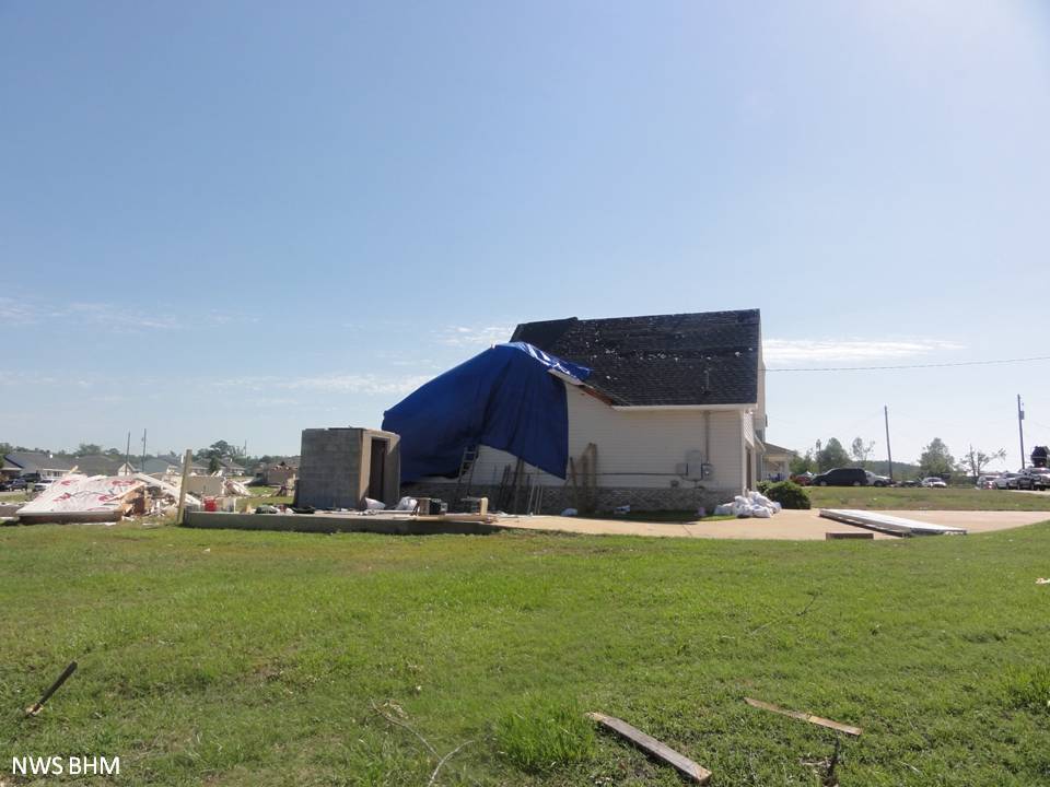
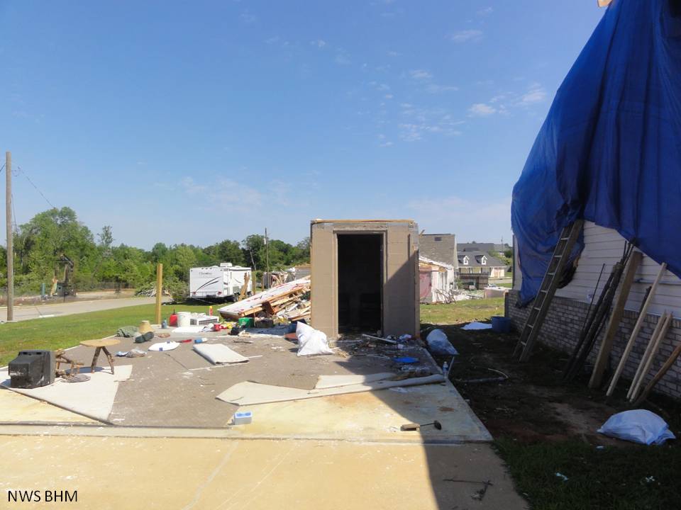
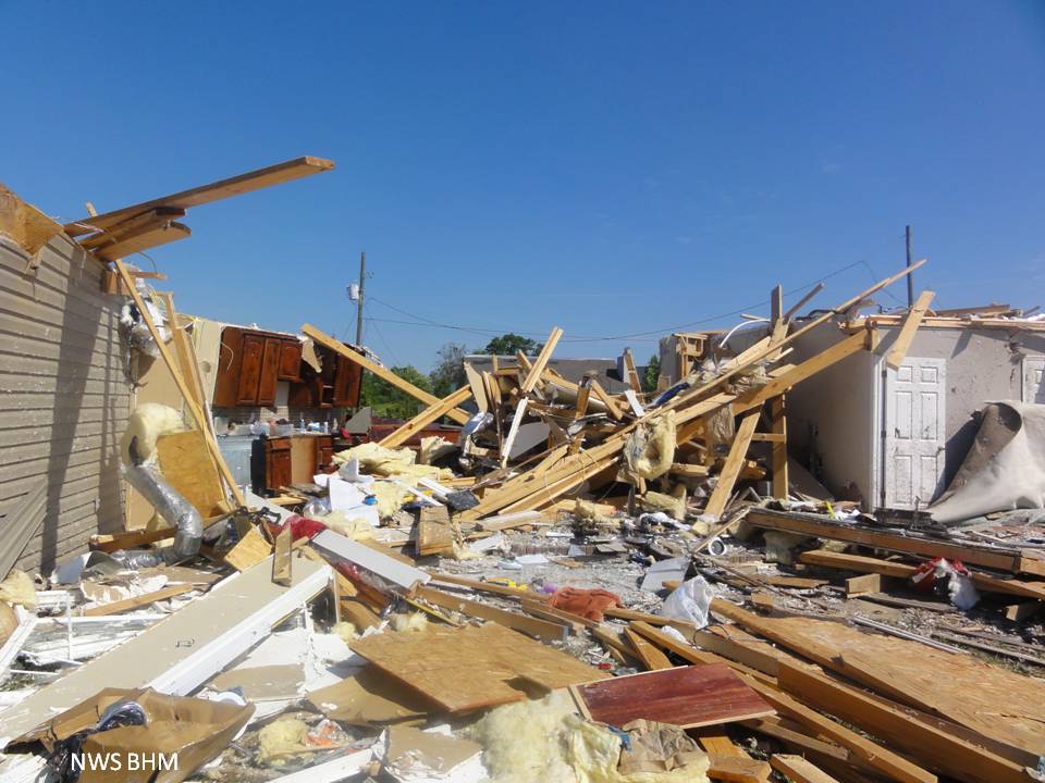
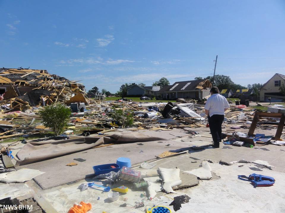
National Weather Service meteorologists surveyed damage across eastern Tuscaloosa and far southwest Jefferson Counties. It has been determined that the damage was consistent with a tornado. Winds were estimated up to 155 mph. This tornado developed along a Quasi-Linear Convective System in southeast Tuscaloosa County, near Coaling and moved northeastward for approximately 18 miles. It crossed into Jefferson County between Interstate 20 and Bucksville, then continued for nearly 2 miles into Jefferson County. The tornado touched down in the southwestern extent of Coaling, north of CR 14, along Staghorne Dr where it damaged many trees. The tornado quickly strengthened as it moved through Coaling to an EF3 rating with winds of 155 mph as it remained south of US Hwy 11. At least a dozen homes sustained damage. Several homes were completely destroyed. The tornado weakened as it moved east of Coaling and crossed US Hwy 11. The tornado moved across the Mercedes Plant where it caused minor roof damage to one building. It also knocked down several light poles along Interstate 20 and snapped numerous trees. This damage was consistent with an EF1 rating and winds of 100 mph. The tornado continued to cause tree damage as it moved northeast and approached the Jefferson County line.
The tornado crossed into Jefferson County between Interstate 20 and Bucksville and continued for nearly 2 miles into Jefferson County. The tornado weakened as it entered Jefferson County near Tingle Springs Circle to an EF0 and its path width gradually became less until the tornado lifted near the intersection of Old Tuscaloosa Highway and Lowetown Rd. Along its path in Jefferson County, the tornado caused tree damage.
|