|
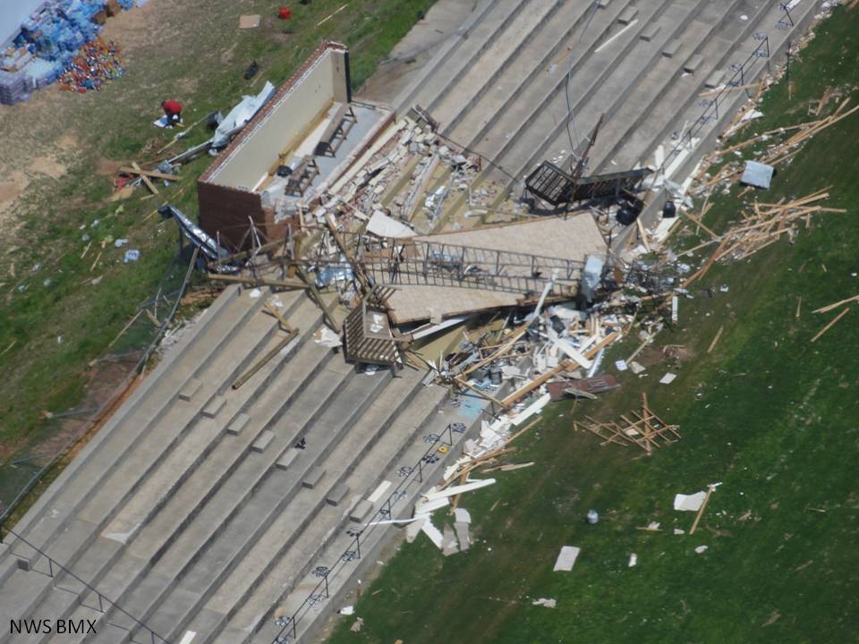
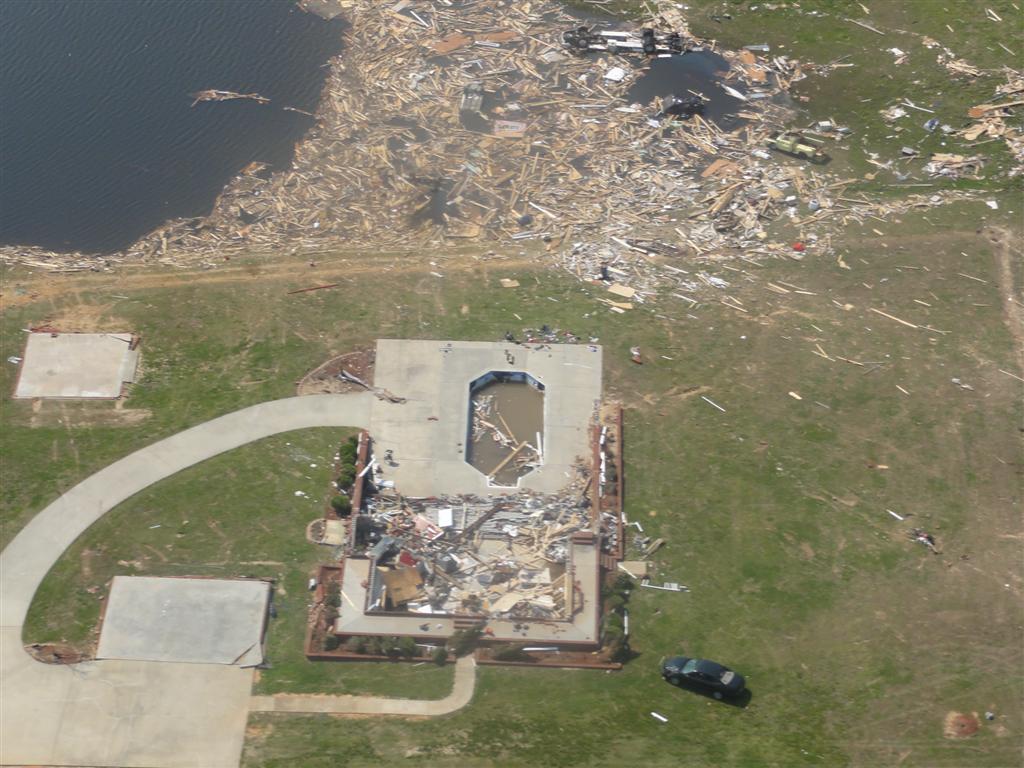
National Weather Service meteorologists surveyed damage across Marion County that impacted the Hackleburg area. It has been determined that the damage was consistent with a violent tornado. The strongest winds were estimated to be up to 210 mph. The tornado initially touched down southwest of Hamilton in southwest Marion County and moved northeast. The tornado caused devastating damage to the city of Hackleburg. The tornado continued through northern Alabama and into southern Tennessee , before it dissipated in Franklin County Tennessee. The tornado touched down west of AL Hwy 19 near Sipsey Creek and moved northeast and crossed Corridor X/Future Interstate 22. Here it caused significant tree damage. The tornado strengthened north of Hamilton and caused roof damage to at least one home. The storm strengthened further as it approached US Hwy 43, southwest of Hackleburg, to a violent EF4 rating with winds estimated at 170 mph. The tornado tracked parallel to US Hwy 43 toward Hackleburg and strengthened more to an EF5 with winds up to 210 mph, as its path widened to 0.75 mile (1320 yds). Several subdivisions and businesses, Hackleburg High School, Middle School, and Elementary School, and the Wrangler Plant were destroyed. Vehicles were tossed up to 200 yards. One well built home with 4 brick sides was completely leveled and the debris from the home was tossed over 40 yards to the north. The tornado moved northeast of Hackleburg and continued to parallel US Hwy 43. It crossed into Franklin County just east of the highway. Along the damage path in Marion County, thousands of trees were downed, several hundred structures were damaged, and at least 100 of these structures were completely destroyed as many homes were leveled. Eighteen fatalities are attributed to this tornado in Marion County, as well as numerous injuries.
National Weather Service meteorologists, along with the foremost expert in storm damage assessment reviewed the damage in Hackleburg in Marion County. The main indicators of Hackleburg having EF-5 damage is the tossing of vehicles upwards of 150-200 yards, one well built home with 4 sides brick was completely leveled and the debris from the home was tossed to the north over 40 yards, and there was large amounts of wind rowing, the strewing of building materials in straight lines, around the city of Hackleburg.
This violent tornado tracked into Franklin, Lawrence, Morgan, Limestone and Madison Counties in northern Alabama. It continued into the Tennessee Counties of Lincoln and Franklin before it lifted in Franklin County. Therefore, the total tornado damage path length was 132 miles. The tornado was at its widest point in Lawrence County Alabama where it was 2200 yards wide. The tornado was rated an EF-5 in Marion, Franklin and Lawrence Counties of Alabama. This tornado was responsible for 72 fatalities and at least 145 injuries.
A Tornado Warning was in effect from 259 pm until 345 pm.
Special thanks to Sergeant Jeremy Keeton, the Florence Police Department, the Hackleburg Police Department and the Lamar County EMA for their assistance during damage surveys. Also, special thanks to the Alabama National Guard for their assistance with the aerial surveys over this track.
|