|
National Weather Service meteorologists surveyed damage across far eastern Pickens and Tuscaloosa Counties impacting the Holman area. It has been determined that the damage was consistent with a
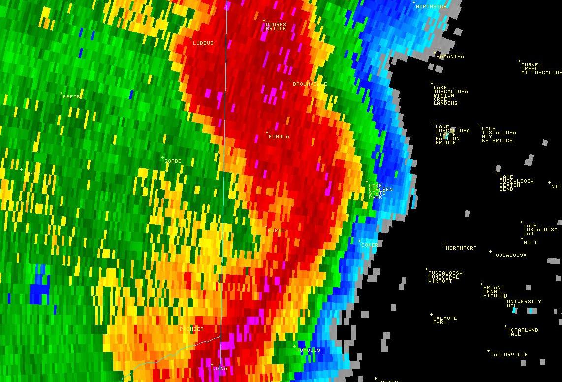
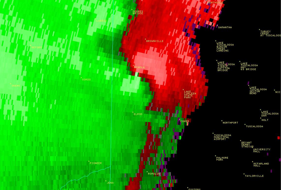
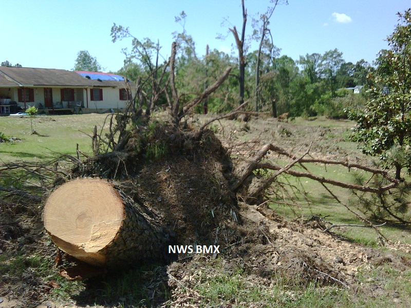
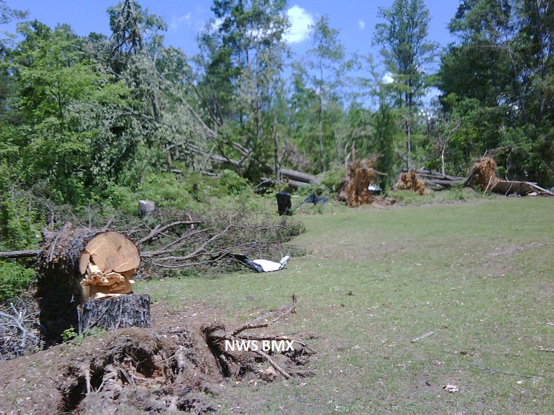
tornado. Winds were estimated to be around 140 mph. This tornado developed along a Quasi-Linear Convective System in far eastern Pickens County, 5.5 miles south southeast of Gordo and moved northeastward for 3.46 miles. It crossed into Tuscaloosa County just to the west of Holman, south of AL Hwy 140. This tornado continued for almost 19 miles in Tuscaloosa County before it dissipated 2.5 miles east northeast of Samantha. The tornado touched down east of AL Hwy 63, along Grover Plate Rd where it uprooted many hardwood trees. The tornado continued to cause tree damage as it moved northeast and approached the Tuscaloosa County Line. The tornado damage in Pickens County was consistent with an EF1 rating and winds of 90 mph.
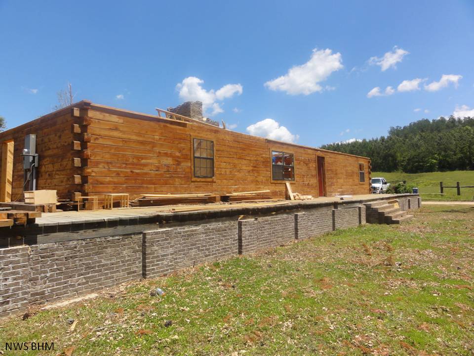
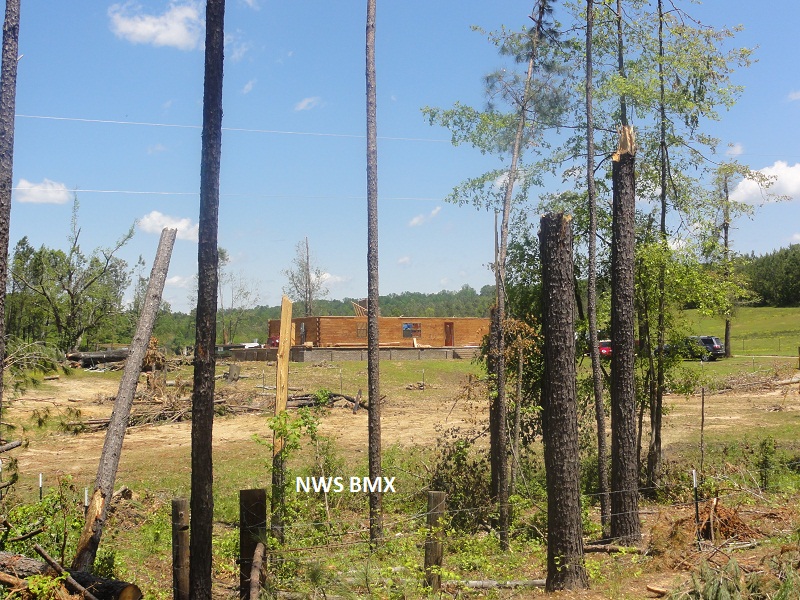
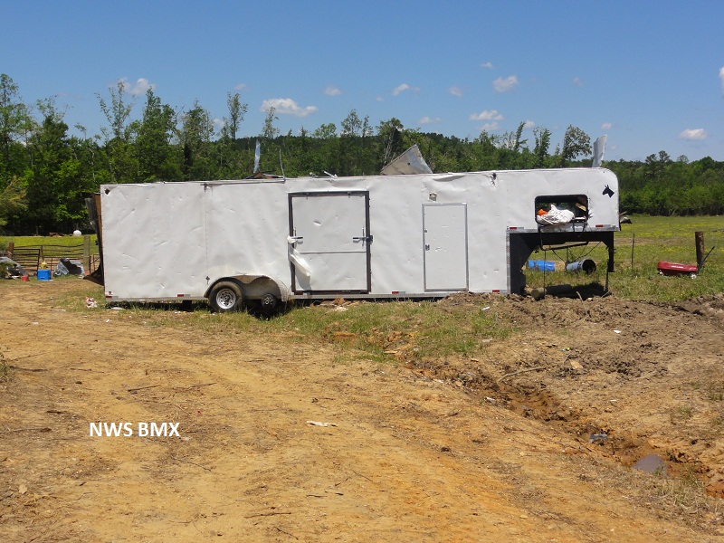
This tornado continued for almost 19 miles in Tuscaloosa County before it dissipated 2.5 miles east northeast of Samantha. As the tornado entered Tuscaloosa County and crossed US Hwy 82, its path widened to near 400 yds and it strengthened to an EF2 where it uprooted numerous trees. Northeast of Holman, the tornado strengthened to an EF3 with winds of 140 mph and caused significant damage to a home. It removed the roof and tossed it at least 200 yds. A 3500 pound trailer was thrown about 100 yds. The tornado continued northeast where it crossed AL Hwy 171 and US Hwy 43. Thousands of trees were snapped or uprooted and many homes sustained damage due to the fallen trees. In addition, at least 3 outbuildings sustained damage or were destroyed. The tornado tracked south of Samantha and dissipated along North Hagler Rd.
A Tornado Warning was in effect from 444 am until 515 am.
|