|
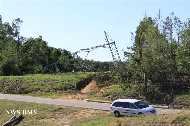
National Weather Service meteorologists surveyed damage from central Elmore County, eastward across central Tallapoosa County and the Lake Martin area, to western Chambers County. It has been determined that the damage was consistent with a violent tornado. After further review from tornado damage experts, it has been determined that the Lake Martin tornado was consistent with EF-4 damage at its strongest, with winds up to 170 mph.
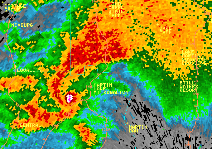
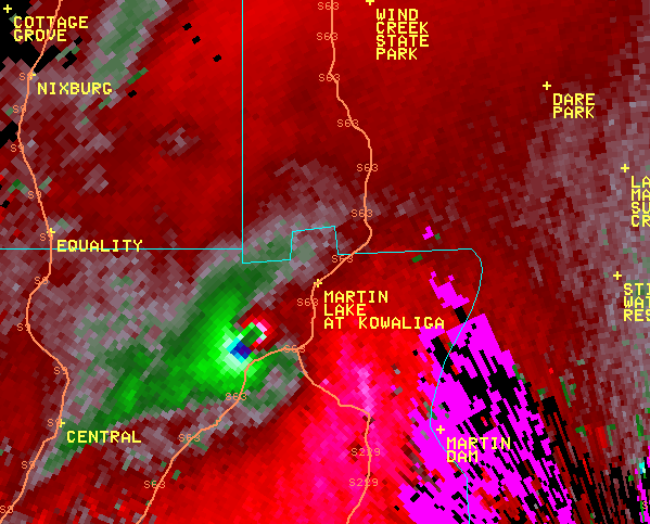
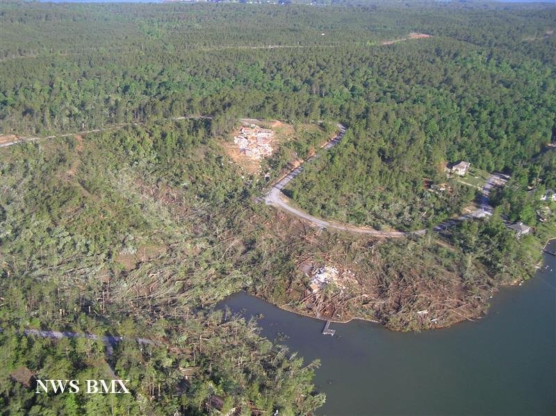
The tornado touched down along County Road 209 near Meadowview Drive where a few snapped trees were noted. From there, the tornado quickly intensified as it moved northeast through Dexter, where it widened and produced EF-2 damage to several homes. From there, it continued across Highway 9 and damaged several homes, and then intensified to EF-3 strength as it moved through a mobile home park at the intersection of Middle Road and Auction Barn Road. Here, the tornado completely destroyed 10 mobile homes and killed 4 people. The tornado continued east to the Mount Hebron Road area and destroyed several homes, businesses, 2 churches, and an agricultural nursery. The tornado then crossed Lake Martin, just south of the Highway 63 Bridge. The tornado produced significant damage to numerous homes around the Windermere area. At this point, the tornado was nearly 1/4 mile wide.
The tornado then moved into Tallapoosa County just south of County Road 34, where it widened to nearly 1/2 mile and strengthened to EF-4 intensity. Here the damage was the most widespread and severe with several well built multi-story homes totally destroyed with no walls remaining on floors above basement level. The tornado continued at this strength but became narrower to nearly 400 yards wide as it crossed Highway 49 just north of Jones Road where it destroyed 2 homes and rolled a pick-up truck 120 yards. The tornado continued northeast and weakened to EF-3 strength with winds of 155 mph. It crossed U.S. Hwy 280 just east of Dadeville where it produced significant damage to several homes and businesses, and caused one fatality. The tornado crossed into Chambers County west of Lafayette, south of CR 48.
The tornado crossed into western Chambers County and passed just to the north of Sikes. Along County Road 54 north of Sikes, one home was completely destroyed. The tornado weakened as it moved northeast across County Road 66 and ended just north of County Road 51.
Tornado Warnings were in effect for Elmore, Tallapoosa and Chambers Counties from 733 pm until
915 pm.
|