National Weather Service United States Department of Commerce


Williams Mill Branch EF-0 Tornado (Barbour County)
  April 27, 2017


Event Summary

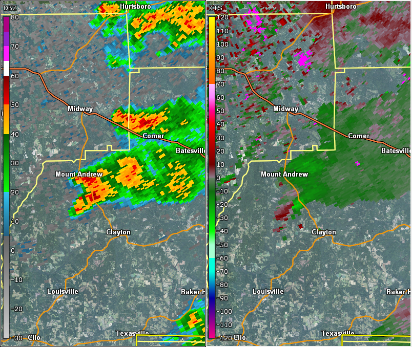
NWS Meteorologists surveyed damage in central Barbour County and determined it was the result of a tornado.

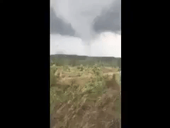
The tornado touched down in a wooded area between Williams Spur and CR 51. This location is northwest of Clayton. The tornado caused sporadic tree damage, mostly branches. Some of the areas were completely inaccessible for survey purposed. Two hunters filmed the tornado as it went by. The tornado damage path was 1.18 miles long and was 75 yards wide at its widest point.

EF-0
Estimated Maximum Wind:
60-65 mph
Injuries/Fatalities:
None
Damage Path Length:
1.18 miles
Maximum Path Width:
75 yards
Approximate Start Point/Time:
4 NW Clayton
31.9209/-85.5103
at 418 pm
Approximate End Point/Time:
4 NNW Clayton
31.9250/-85.4908
at 422 pm


Reflectivity (left) and velocity (right) of the tornado as it touched down.
Images are from KMXX at 418 pm.


Video courtesy of Patrick & Bryant Norrell