|
Event Summary
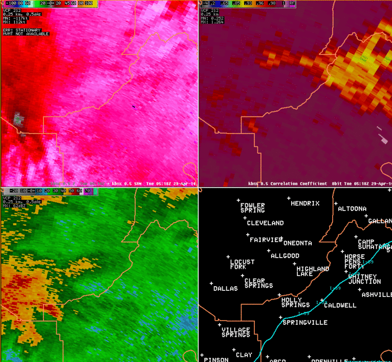
National Weather Service meteorologists surveyed damage in extreme northwestern St. Clair County, eastern Blount County, and extreme western Etowah County and have determined that the damage is consistent with an EF-2 tornado. Maximum winds were estimated to be 130 mph.
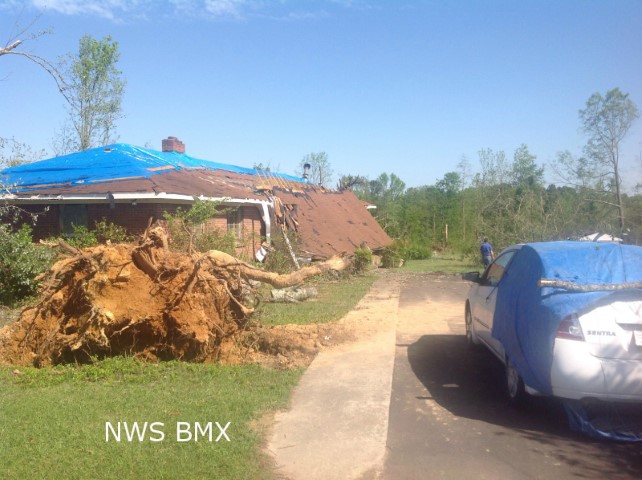
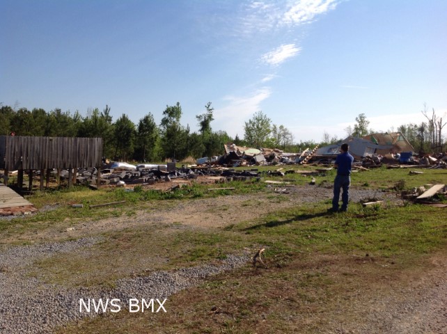
The tornado touched down just north of Mountain View Lane in extreme northwestern St. Clair County. The tornado strengthened as it moved to the northeast with some of the most extensive damage occurring just north of Pine Mountain Road. At this location, a home that was under construction but almost completely finished, was swept off its foundation and thrown about 50 yards into a lake. A small utility trailer was also thrown about 25 to 50 yards. Dozens of trees were either snapped or uprooted in this area as well. The tornado maintained its intensity as it moved northeast, snapping and uprooting thousands of trees. A single wide and double wide manufactured home were completely destroyed on Dumas Bridge Road, and at this location there were two injuries. The tornado continued northeastward and crossed Highland Lake. As the tornado crossed the lake, it was 1000 yards wide and mowed down forested areas, snapping or uprooting every tree in its path. On the shores of the lake, several homes received major damage directly from tornadic winds. On Echo Lane, a well-built single family home had its roof completely removed, while 2-by-6 exterior walls remained standing, and non-loadbearing walls were buckled. The neighboring home also had its roof torn off with some exterior walls collapsed. A three story home across the slough had major structural damage and was partially shifted off its foundation. The tornado continued to ravage the north shore of Highland Lake as it continued northeastward, snapping and uprooting more trees and damaging several more homes. The tornado seemed to weaken somewhat as it crossed County Road 29 with tree damage more sporadic than it had been. The tornado crossed Rogers Road and began a slight turn to the right as it weakened somewhat and damage became more sporadic. After the tornado crossed US-231, it began to narrow and weaken further before ending on Hutchins Drive near the Blount and Etowah County line.
|