|
Event Summary
|
|
EF-1
|
|
Estimated Maximum Wind:
|
95 mph
|
|
Injuries/Fatalities:
|
None |
|
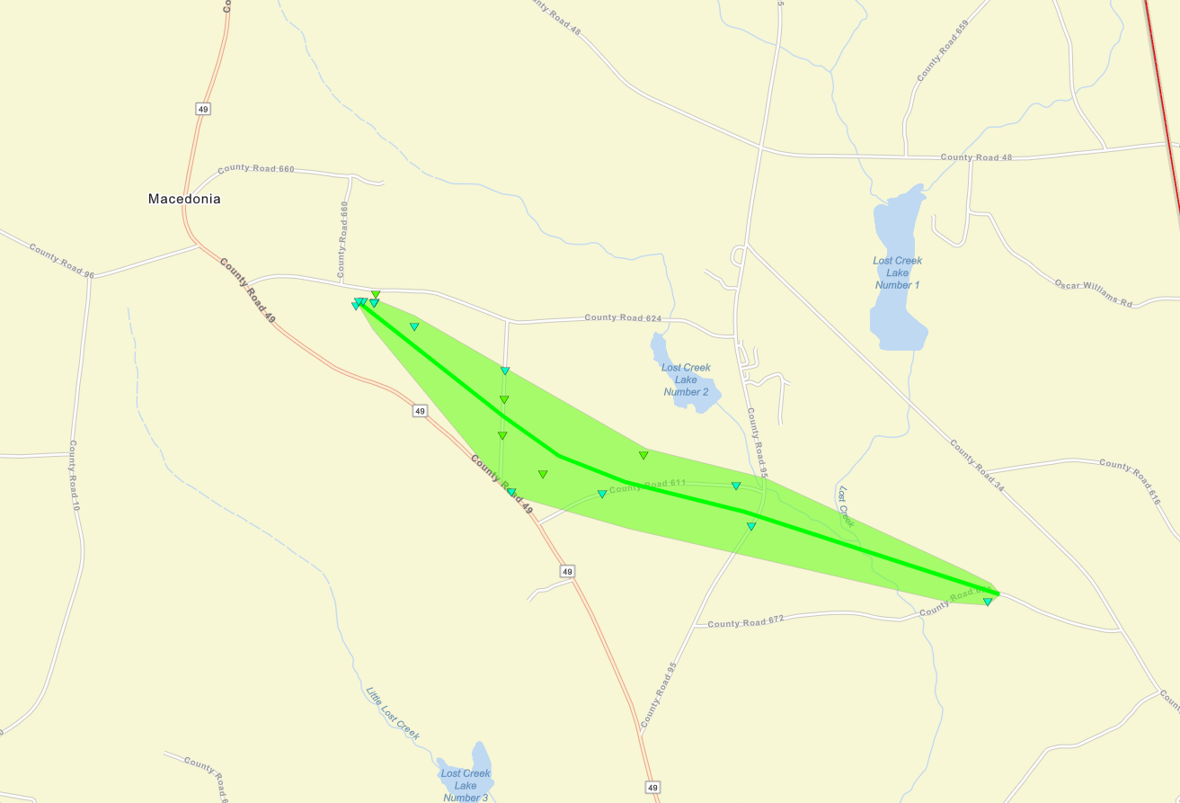
Damage Path Length:
|
1.97 miles
|
|
Maximum Path Width:
|
550 yards
|
|
Approximate Start Point/Time:
|
3 NNW Ranburne
33.5740/-85.3624
at 12:25 am CDT
|
|
Approximate End Point/Time:
|
2 N Ranburne
33.5625/-85.3320
at 12:30 am CST
|
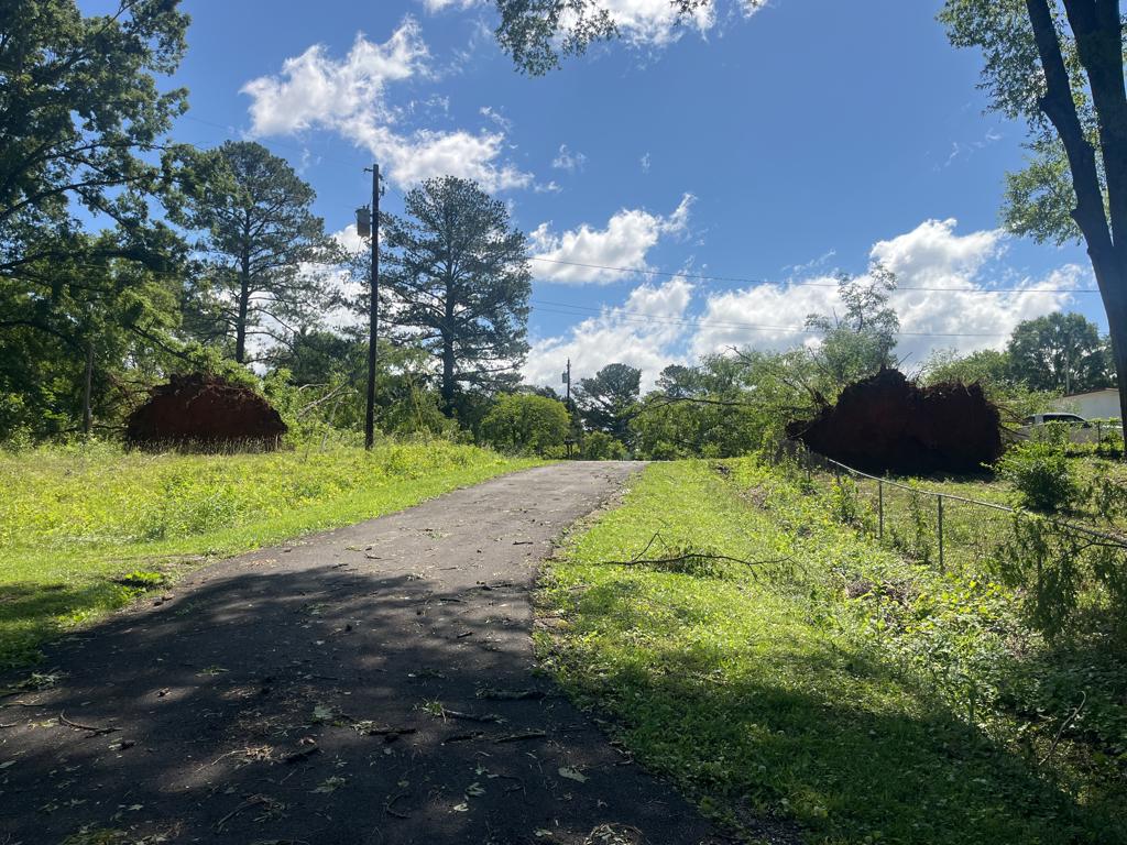
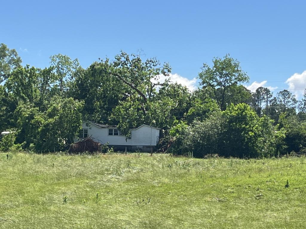
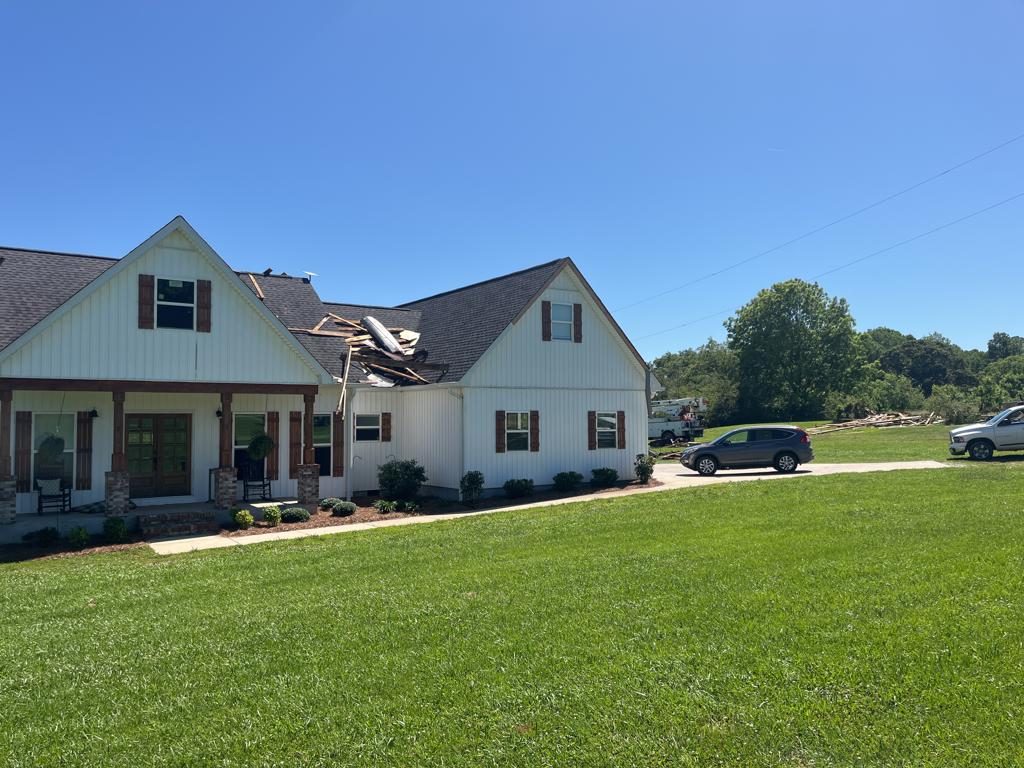
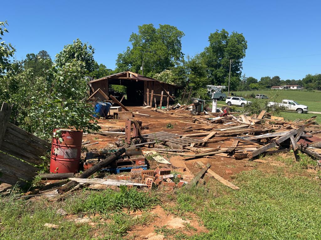
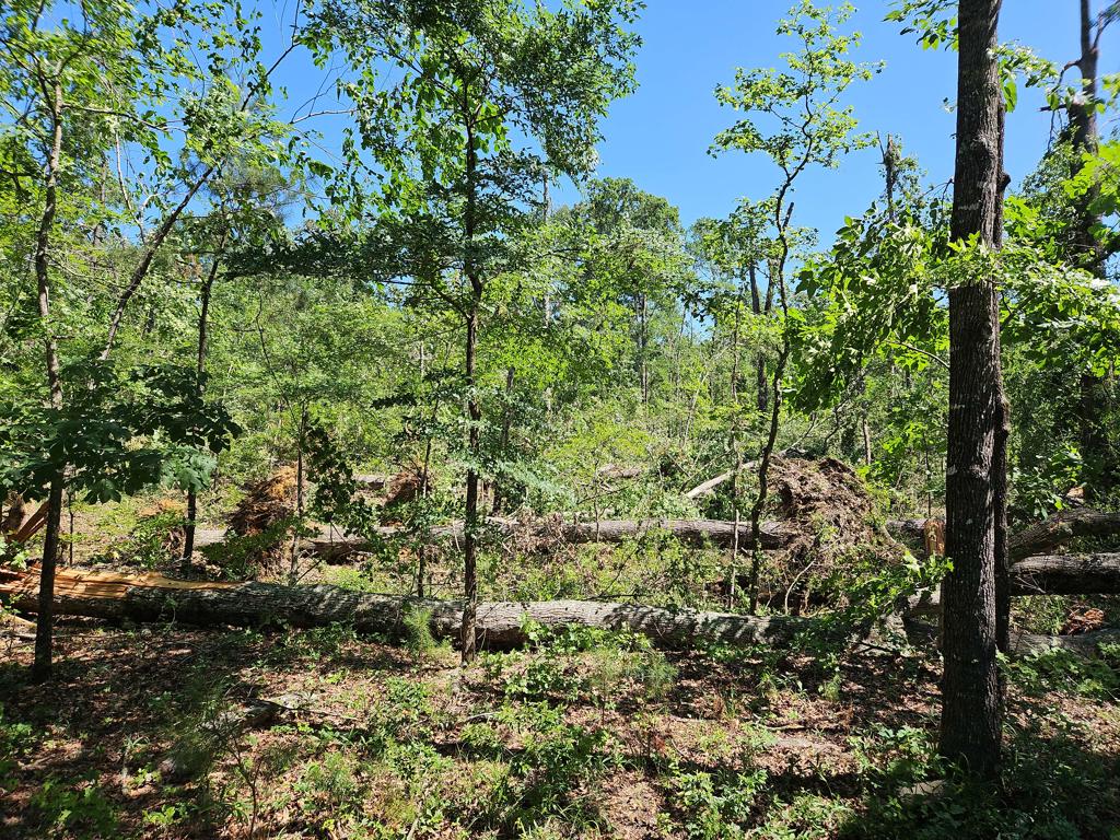
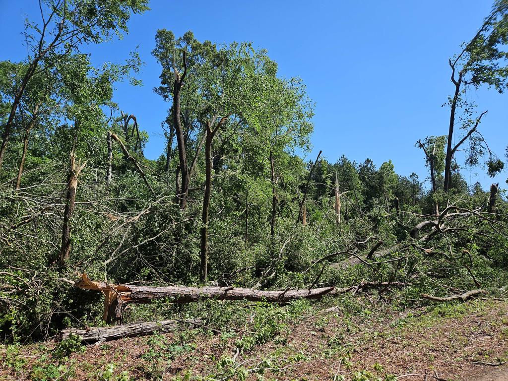
The tornado first touched down in a field just south of Cleburne County Road (CR) 67 about 0.3 miles east of CR 49. The tornado proceeded to destroy a half of an old barn, lofting and tossing debris both upstream and downstream, as well as laterally. A large portion of the barn roof landed on a home about 30 yards downstream, with several missiles embedded in the roof as well as the surrounding yard. There was notable splatter on the right side of the house not facing the direction of the damaged barn. Direct wind damage to the home was minor, with fascia damage and a partially collapsed garage door. Debris from the barn was also found hundreds of yards away in an adjoining pasture. From there, the tornado proceeded to the ESE snapping and uprooting hardwood trees as it crossed CR 67, CR 611, and CR 95. From there, the tornado weakened and caused only a few tree branches to be damaged along CR 672 before it dissipated before reaching CR 34.
|