|
Event Summary
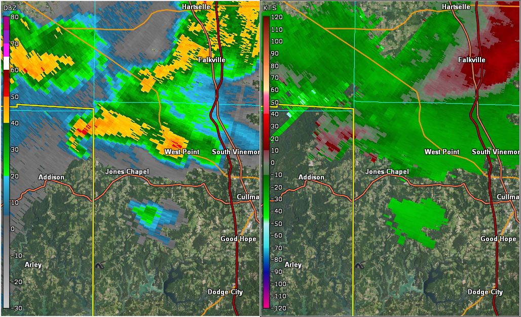
National Weather Service meteorologists surveyed damage in extreme
northeastern Winston County and determined that it was consistent
with an EF-0 tornado. The tornado began in a wooded area just east
of the County Road 80 bridge over Rock Creek. The tornado crossed
County 80 where a tree was uprooted. County Road 80 criss-crossed
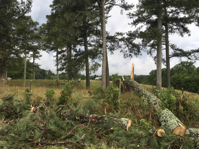
the tornado's path a couple times as it moved eastward. Sporadic
tree damage occurred with several large branches broken and a few
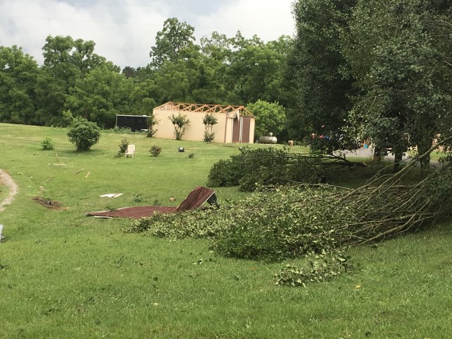
trees uprooted or snapped. The roof was removed from a newer large
shed, and tin was peeled back from a couple old barns. The tornado
continued into Cullman County and the county warning area of the
Huntsville forecast office just west of County Road 1069. For
information on the Cullman County portion of the track, please visit
the National Weather Service Huntsville webpage.
|
|
|
|
EF-0
|
|
Estimated Maximum Wind:
|
70 mph
|
|
Injuries/Fatalities:
|
None |
|
Damage Path Length:
|
1.48 miles
|
|
Maximum Path Width:
|
260 yards
|
|
Approximate Start Point/Time:
|
1 NNW Sardis
34.2415/-87.1344
at 646 pm CDT
|
|
Approximate End Point/Time:
|
2 NNE Sardis
34.2482/-87.1101
at 650 pm CDT
|
|