The Grant Tornado
The following information was compiled by National Weather Service meteorologists who conducted a ground survey of the destruction that was caused in the Grant area of northern Marshall County.
Around 1:50 am today, September 28, a short-lived but strong tornado struck in northern Marshall County in the Grant area. The tornado began about 2.5 miles south-southeast of Grant just off County Road 503. The tornado moved northeastward through the Free Home Church area destroying trees and several houses. The tornado dissipated about 3 miles east of Grant just south of County Road 34.
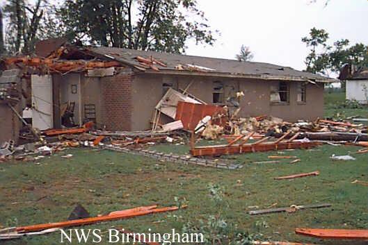
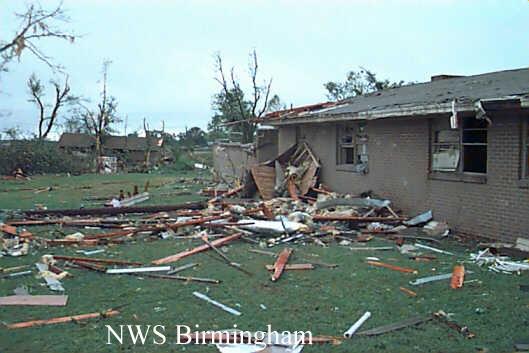
The tornado path was about 80 yards wide at its widest and the damage track extended for 2.5 miles. The tornado has been rated an F2 on the Fujita tornado-intensity scale. This places the tornado in the strong category. Wind speed estimates within this category vary from 113 to 157 miles an hour.
Marshall County Emergency Management officials reported 6 houses destroyed with 6 additional buildings with damage. No injuries occurred with the tornado. Even though 6 houses were destroyed several of them were empty at the time the tornado struck. One family left a house that was completely swept off its foundation for a much stronger brick home nearby.
No watches or warnings were in effect at the time the tornado occurred, but a Special Weather Statement had been issued. Meteorologically, this tornado was apparently associated with a collapsing thunderstorm. In the collapsing phase, weak to strong tornadoes are possible.
Climatologically, September is the least likely month for tornadoes. Since 1950, there have only been 28 tornadoes in September.
To view a larger image, click on one of the pictures. File sizes are of the larger images.
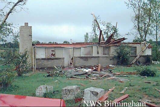
Figure #1 and #2 are of the same house at different angles.
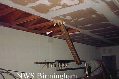
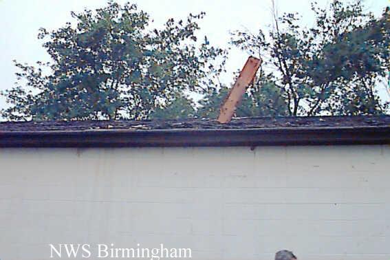
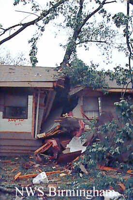
Figure #3 and #4 show a wooden beam, inside and outside image, that pentrated a roof another house.
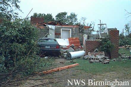
Figure #5 and #6 show damage to another home at different angles.
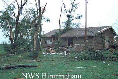
Figure #7 and #8 are of a house that was pushed off its foundation and a nearby tree sliced into the house.
 #1 36 kb |
 #2 31 kb |
 #3 13 kb |
 #4 36 kb |
 #5 33 kb |
 #6 25 kb |
 #7 24 kb |
 #8 29 kb |

