National Weather Service United States Department of Commerce

Severe Weather including Leonard Drive EF-1 Tornado (Lamar County)
November 6, 2018   

Event Summary for Central Alabama

A line of storms moved through Central Alabama during the early morning hours of Tuesday, November 6th, 2018. Strong wind shear was already in place, with a northward moving instability axis that aided in a window for storm intensification and more robust rotation. One of these storms moved into Southern Lamar County from Mississippi. After some interaction between the storm's couplet and a southeastward moving wind shift, part of the larger convective line, the couplet intensified as it moved into the Millport area. This feature ended up producing a tornado on the eastern side of town. 

The information contained below is from 1 individual tornado track that occurred. The data is PRELIMINARY and may be subject to change.


Tornado Event Summary


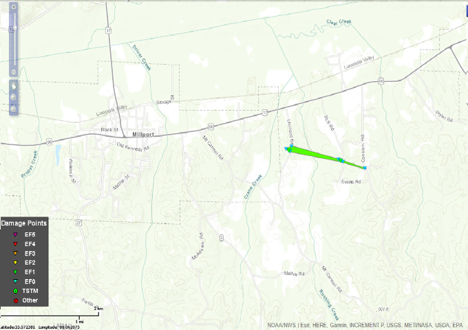
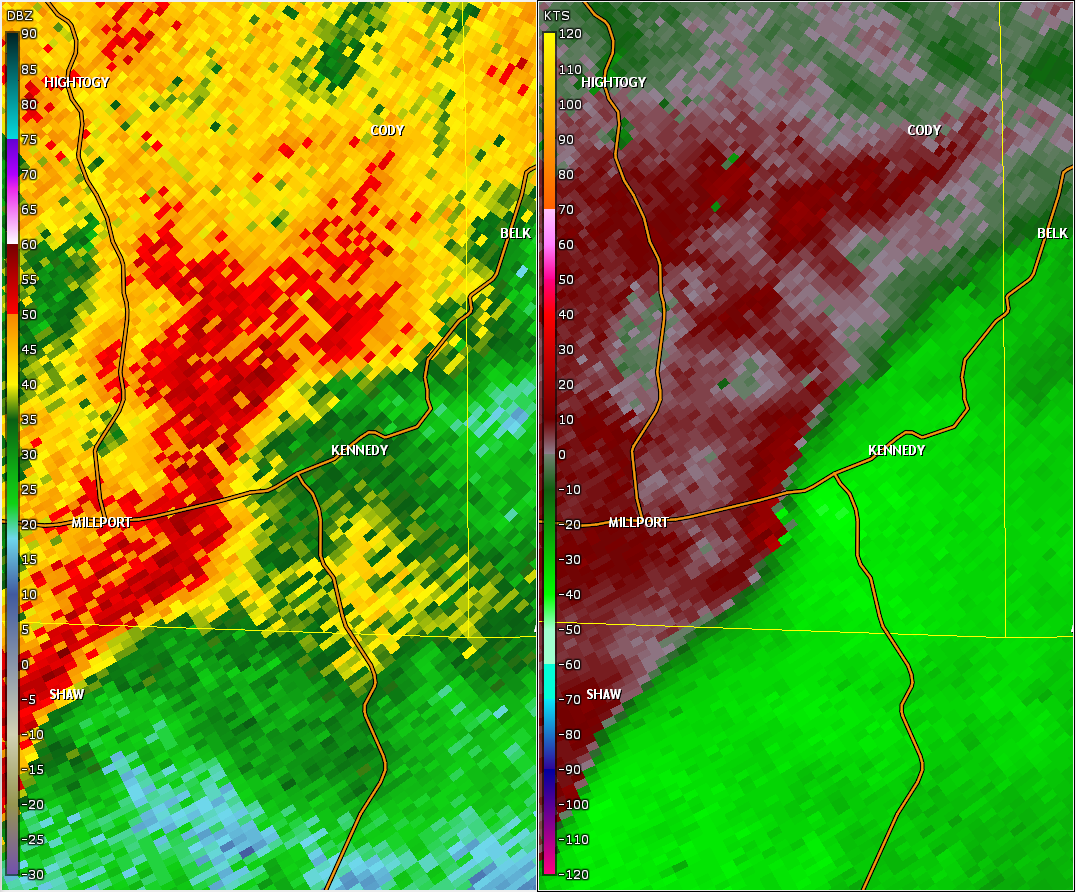
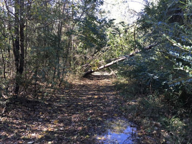
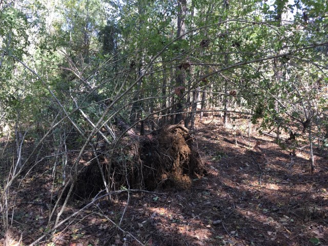
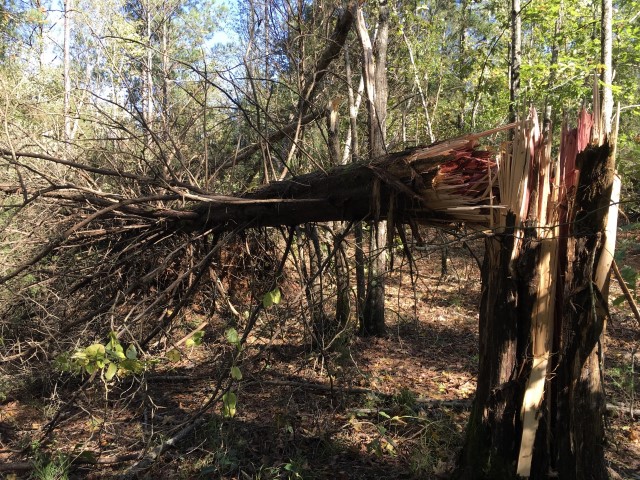
National Weather Service meteorologists surveyed minor damage in Far Southern Lamar County and determined that it was consistent with a low end EF-1 tornado.  The tornado touched down in a wooded area about 150 yards west of Leonard Drive, over a grassy plot, and then uprooted and snapped a dozen pine trees across a utility right of way.  The worst damage, which tipped the rating into the low end, EF-1 range, occurred where the tornado first began.  The tornado then continued east-southeastward across Leonard Drive, producing minor sporadic tree damage for the remainder of the path, which crossed Evans Road/SLS Road, just south of South Lamar High School.  Sporadic tree damage continued to just across Conklan Road, where several large limbs and tree tops were twisted but still intact. 

The tornado damage path was 1.0 mile long and was 115 yards wide at its widest point. 


Rating:
(Click for EF Scale)

EF-1

Estimated Maximum Wind:

85-90 mph

Injuries/Fatalities:

None

Damage Path Length:

1.0 miles

Maximum Path Width:

120 yards

Approximate Start Point/Time:

2 ESE Millport  33.5583/-88.0453
at 217 am CST

Approximate End Point/Time:

3 ESE Millport  33.5552/-88.0281
at 219 am CST

 
Interactive Tornado Map Coming Soon 
 
Tornado Path
 
Radar  Data & Damage Pictures
Radar
This is an image of the 0.5 degree reflectivity (left) and velocity data (right) from KGWX radar at 219 am while the tornado was on the ground.
 
Tree Damage  Tree Damage  Tree Damage    
                               Tree Damage                                                         Tree Damage                                                          Tree Damage


Severe Weather Episode Data 

250 mb
250 mb Analysis
November 5 at 6 pm

500 mb
500 mb Analysis
November 5 at 6 pm

700 mb
700 mb Analysis
November 5 at 6 pm

250 mb
250 mb Analysis
November 6 at 6 am

850 mb

850 mb Analysis
November 5 at 6 pm

500 mb
500 mb Analysis
November 6 at 6 am

925 mb

925 mb Analysis
November 5 at 6 pm

700 mb
700 mb Analysis
November 6 at 6 am

Surface

Surface Analysis
November 5 at 6 pm

850 mb
850 mb Analysis
November 6 at 6 am

925 mb
925 mb Analysis
November 6 at 6 am

Surface
Surface Analysis
November 6 at 6 am

Severe Threats
Local Severe Outlook
Issued November 4 at 116 am

Severe Threats
Local Severe Outlook
Valid November 5 at 320 pm

Storm Reports
Storm Reports
Nov 5 6 am - Nov 6 6 am

KBMX Sounding
KBMX Sounding
November 5 at 6 pm

KBMX Sounding
KBMX Sounding
November 6 at 12 am

KBMX Sounding
KBMX Sounding
November 6 at 6 am

Radar Loop
Radar Loop
 November 6 12 am - 6 am


Rainfall Plot
Rainfall Plot
Nov 5 7 am - Nov 6 7 am