Hamilton Crossroads F2 Tornado - November 15, 2006
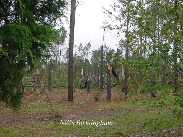
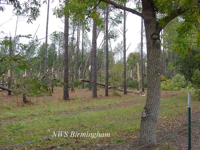
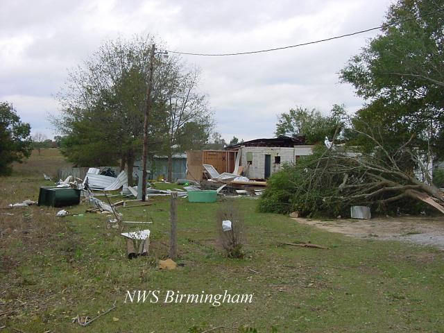
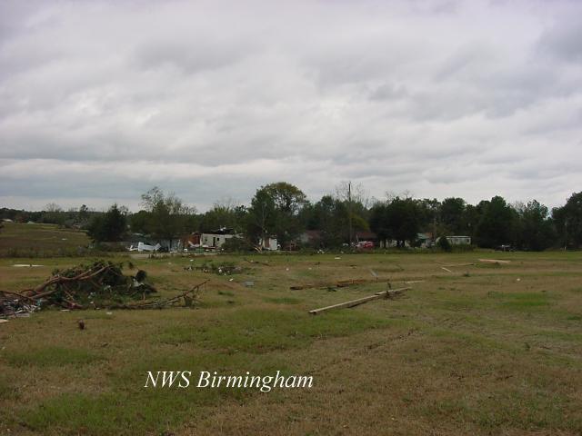
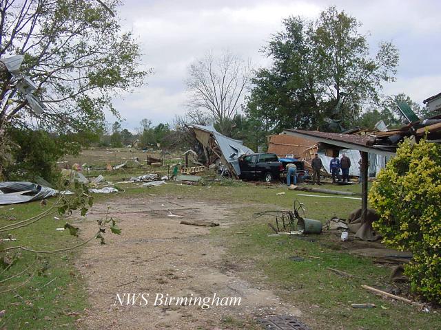
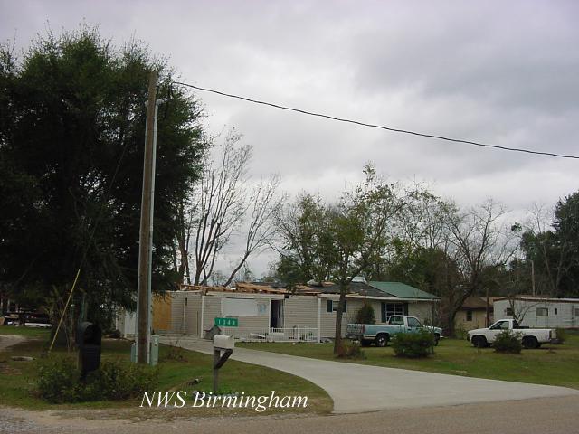
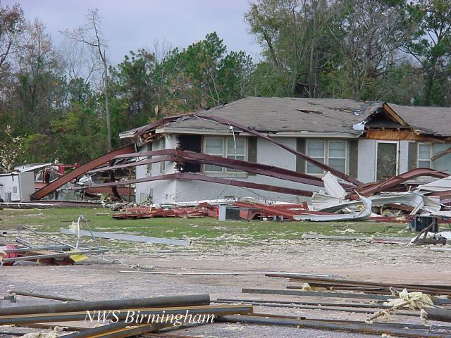
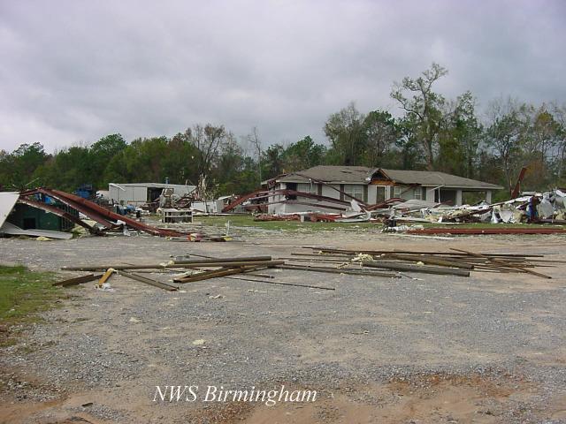
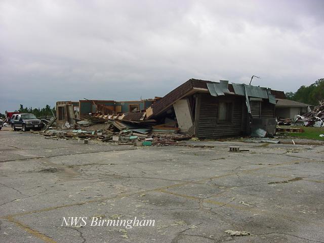
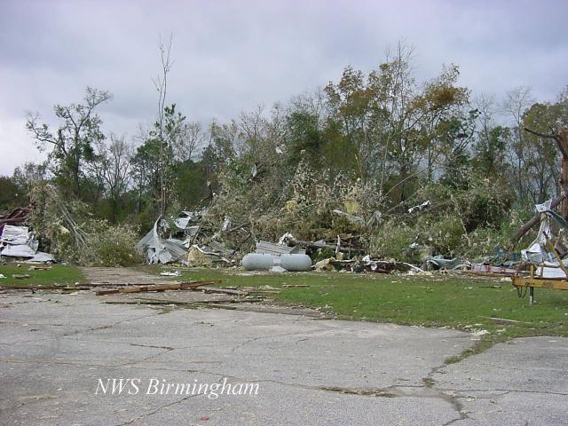
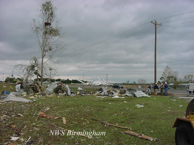
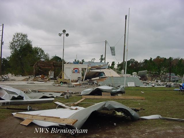
National Weather Service meteorologists surveyed the storm damage that affected areas near Brundidge. It has been determined that the damage was the result of a tornado. The tornado has been rated an F2 on the Fujita Damage Intensity Scale.
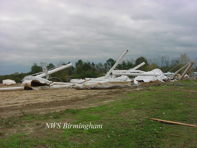
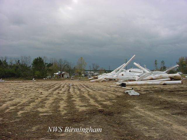
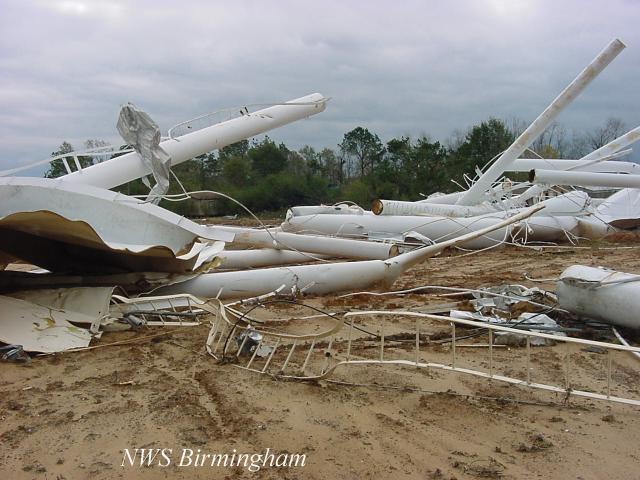
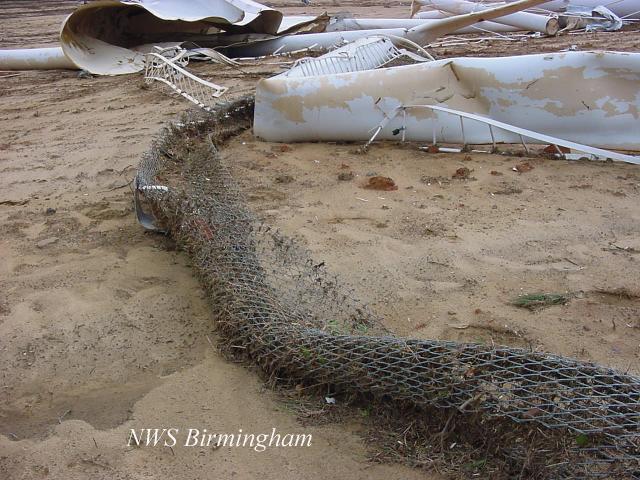
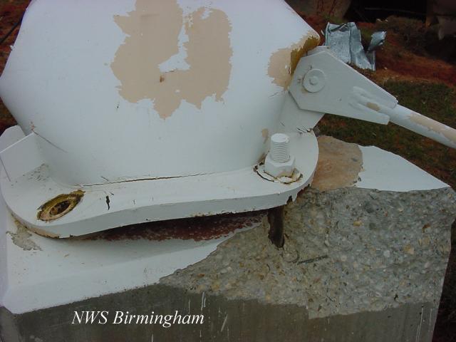
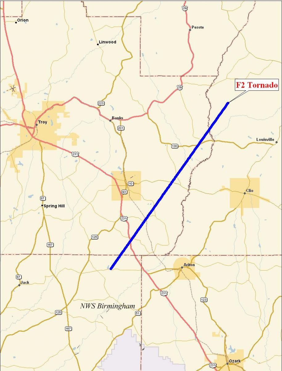
The tornado is believed to have initially touched down just across the Coffee County line near the Roeton community. In Pike County...the tornado started about 1.5 miles southwest of Hamilton Crossroads and lifted just into western Barbour County... east of the Pea River and about 2.5 miles south of Boot Hill. The tornado track crossed US Highway 231, State Highway 10 and State Highway 130 before crossing the Pea River into western Barbour County. Numerous trees were blown down or snapped off along the path. Numerous structures suffered significant damage. One water tower was destroyed. The tornado damage path was 18.1 miles long and 650 yards wide at its widest point...in Pike and Barbour Counties. The tornado touched down at approximately 1214 PM CST and lifted around 1236 PM CST. A Tornado Warning was in effect for Pike County from 1208 PM CST to 1245 PM CST. A Tornado Warning was in effect for Barbour County from 1229 PM CST to 130 PM CST.
|
|
|||||||||||||||||||||||||||