|
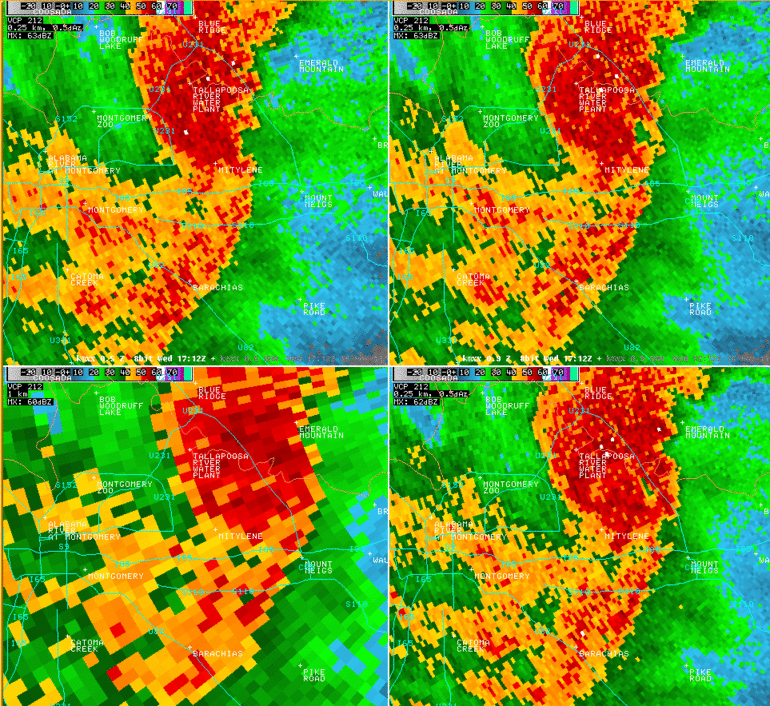
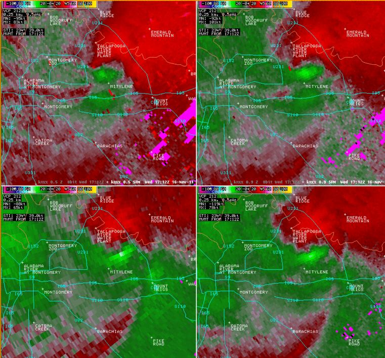
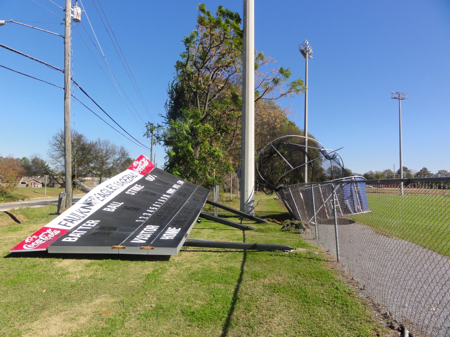
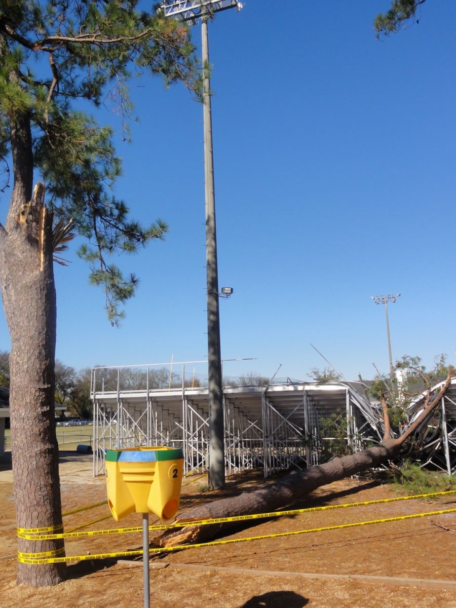
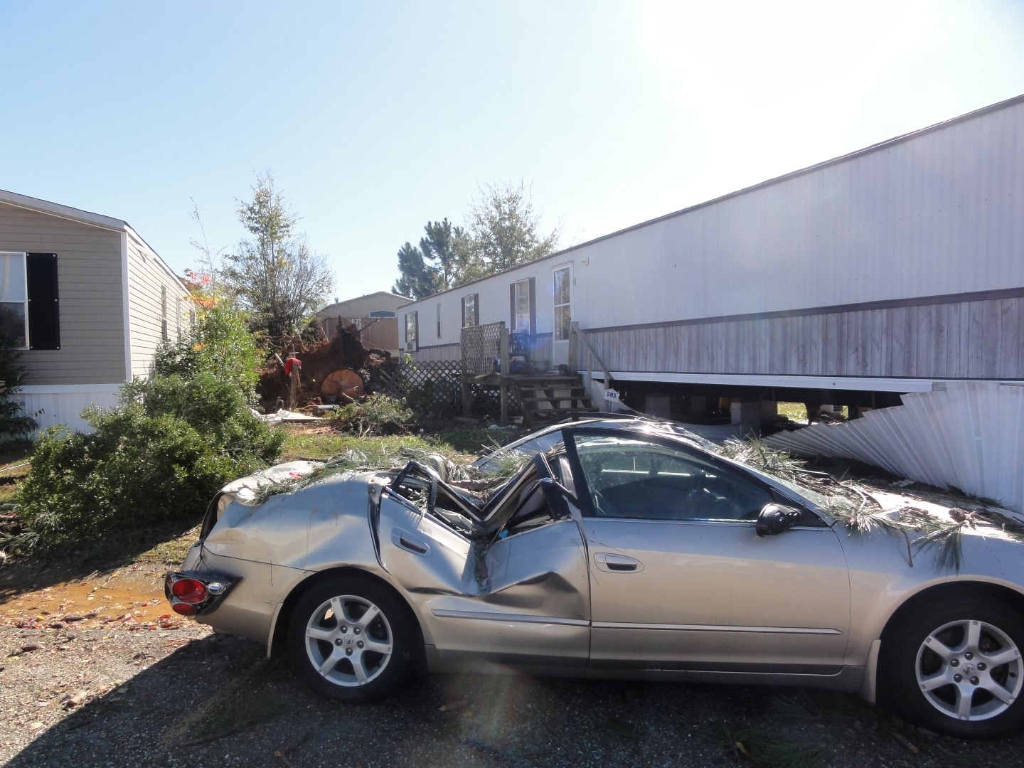
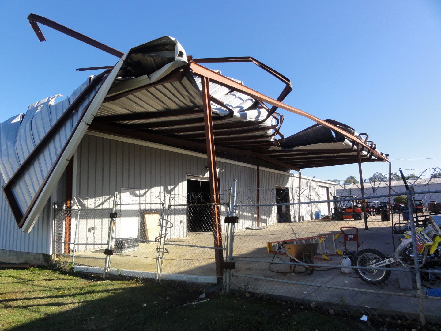
National Weather Service ground and aerial survey crews have assessed damage in Montgomery County and found evidence of a brief EF-1 tornado on the northeast side of the city of Montgomery. The tornado initially touched down near the Alabama Christian Academy football field where a large pine tree snapped and collapsed a section of bleachers. The scoreboard on the nearby Faulkner University baseball field also collapsed and the batting cage was blown across the entire field. The tornado continued northeastward where it crossed Wares Ferry Rd, where several homes sustained minor roof damage. Farther to the northeast, the most widespread damage occurred at the Sunshine Valley Mobile Home Park, where numerous mobile homes sustained minor to moderate roof damage and the undercarriages were blown out, and small outbuildings and sheds were blown over. Several trees were also snapped or uprooted, which included one very large pine tree that crushed a vehicle. From there, the tornado crossed U.S. HWY 231 and struck Adams Motorsports, where a section of metal roof was peeled back. The tornado lifted just northeast of Adams Motorsports. The damage path was approximately 0.89 miles long and was 75 yards wide at its widest point.
|