NWS Birmingham, Alabama
Weather Forecast Office
Autaugaville Tornado
National Weather Service Meteorologists surveyed the extensive damage across southern Autauga County. The damage occurred during the pre-Thanksgiving Day severe weather outbreak. The tornado has been rated an F2.
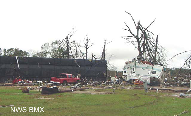
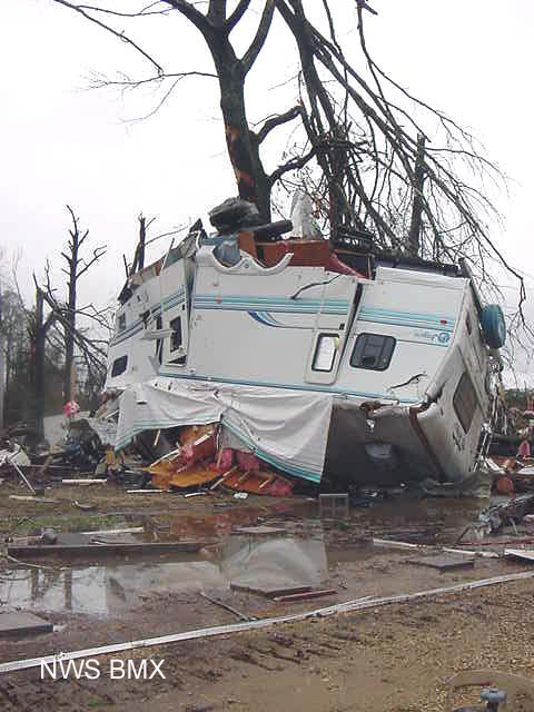
The tornado touched down 2.5 miles to the southwest of Autaugaville. The tornado then moved northeastward across Clark's Landing, where it destroyed several mobile homes, travel campers, and boats.
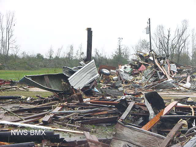
After crossing Swift Creek, the tornado crumpled 2 high-voltage powerline towers before moving across the Forester Community, where it partially damaged or completely destroyed several structures. Shortly after crossing CR 14, the tornado dissipated.
The tornado damage path was 9.7 miles long and was 500 yards wide at its widest point. There were no injuries or fatalities reported. The tornado was on the ground from 624 am CST until 637 am CST.
 |
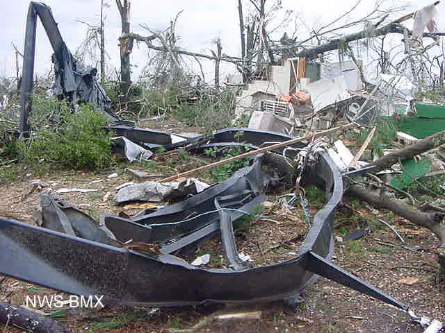 |
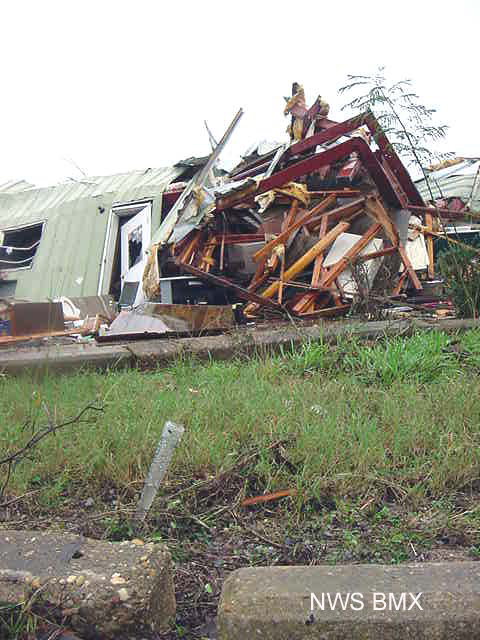
| Overturned trailer near Autaugaville. | Close up look at the remaining frame of a trailer. |
 |
 |
| Pontoon boat and camper, both wrapped around a tree, near Autaugaville. | Canoe wrapped around a post near the Forester Community. |
 |
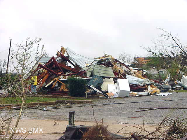 |
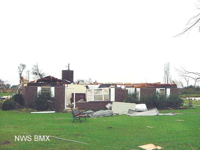
| Roof damage on a house near Forester. | Note the safe, in the middle of this debris pile near Forester. |
 |
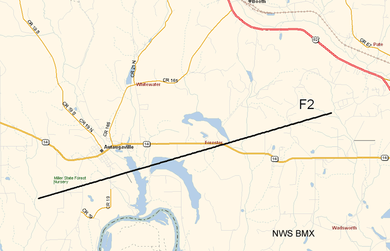 |
| Rain gage in foreground, damaged building in the background. | Map of damage path of Autaugaville Tornado |
Current Hazards
National Outlooks
Tropical
Local Storm Reports
Public Information Statement
Graphical Hazardous Weather Outlook
Current Conditions
Regional Weather Roundup
Rivers and Lakes
Drought Monitor
Forecasts
Fire Weather
Aviation Weather
Graphical Forecasts
Forecast Discussion
Air Quality
Climate and Past Weather
Past Events
Storm Data
Tornado Database
Daily Rainfall Plots
Tropical Cyclone Reports
Monthly Climate
Annual Climate
Warnings and Other Products
Tornado Warnings
Severe Thunderstorm Warnings
Flash Flood Warnings
Winter Weather Warnings
Special Weather Statements
Non-Precipitation Warnings
Flood/River Flood Warnings
Productos en Español
Conciencia y Preparación
Previsión de 7 Días
Weather Safety
NOAA Weather Radio
Severe Weather Preparedness
Severe Safety Rules
Tornado Safety Rules
Severe Safety w/ ASL
Awareness Weeks
Severe Weather
Hurricane Preparedness
Summer Safety Campaign
Winter Weather
US Dept of Commerce
National Oceanic and Atmospheric Administration
National Weather Service
NWS Birmingham, Alabama
465 Weathervane Road
Calera, AL 35040
205-664-3010
Comments? Questions? Please Contact Us.

