NWS Birmingham, Alabama
Weather Forecast Office
Pell City Tornado
|
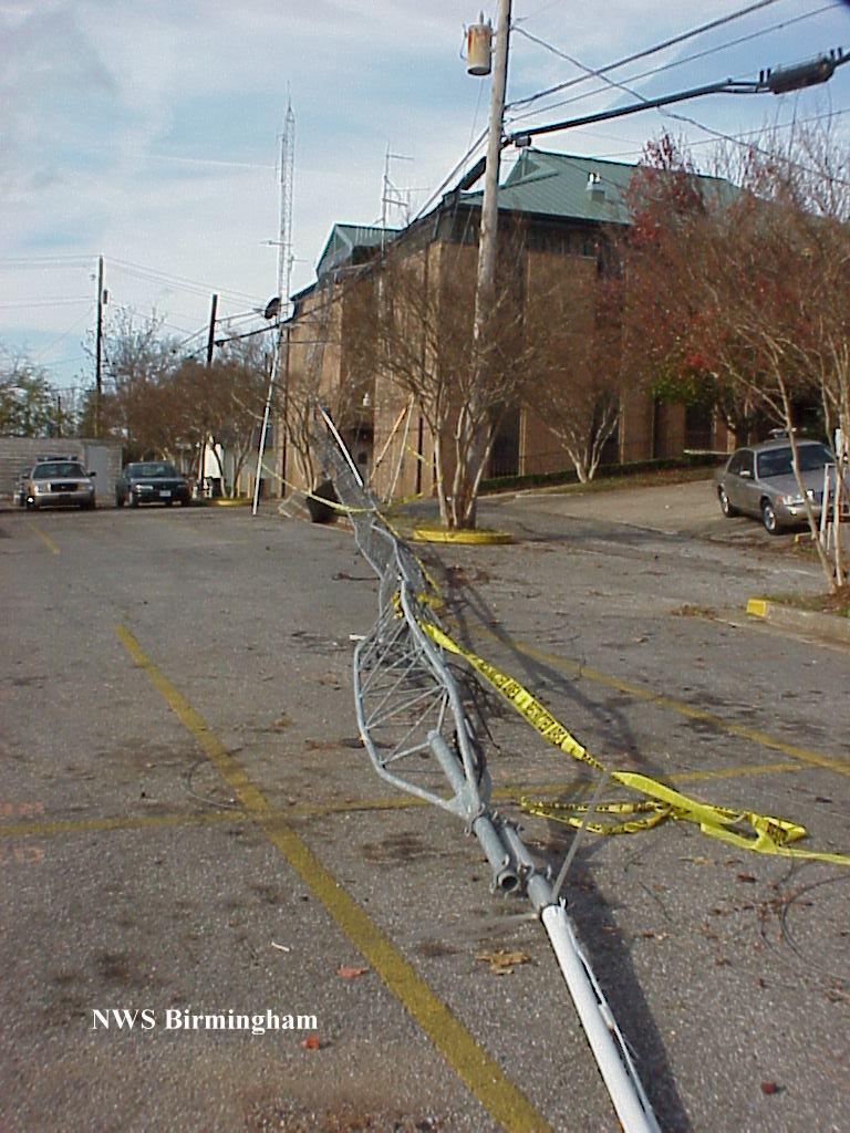
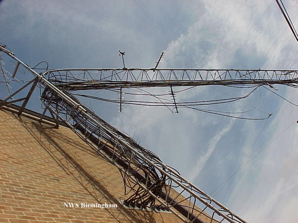
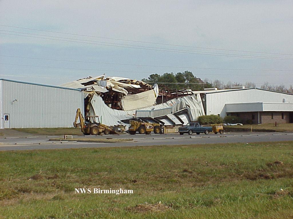
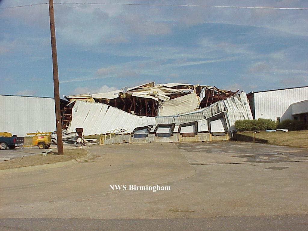
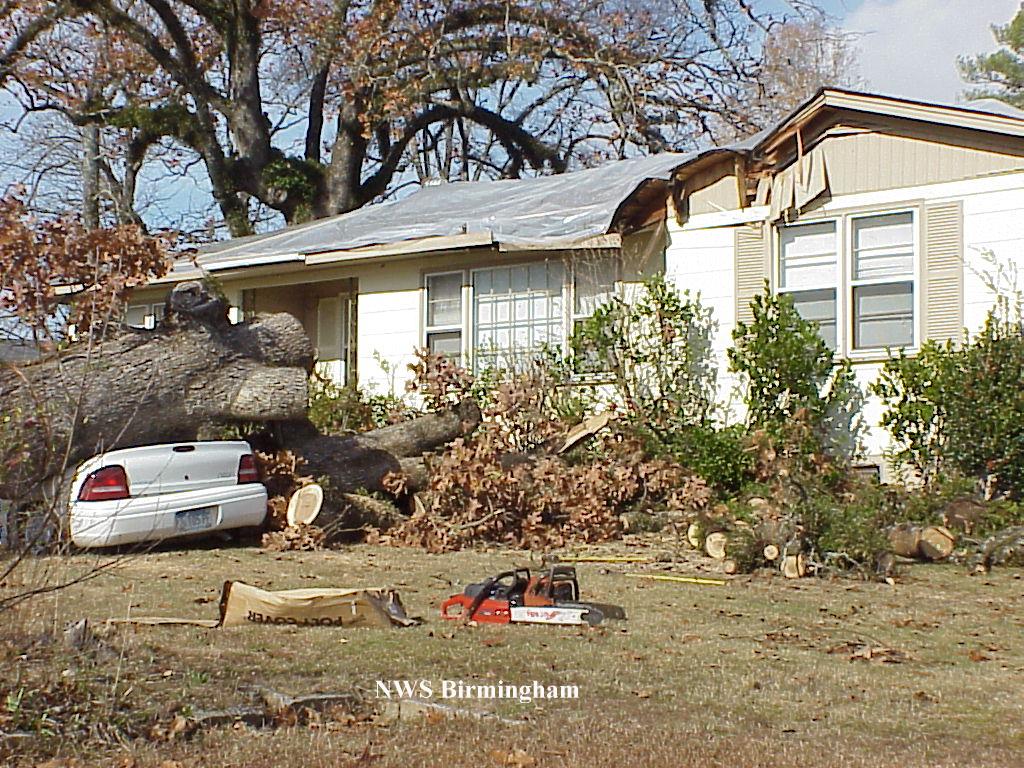
A tornado rated an F2 began weakly on the west-southwest side of Pell City just behind the school at 3:10 PM CST. The tornado traveled on an east-northeast path downing a communication tower at the EMA/911 office and doing minor roof damage. The storm then crossed over downtown Pell City where a number of buildings sustained light to moderate roof damage along with awnings damaged and some 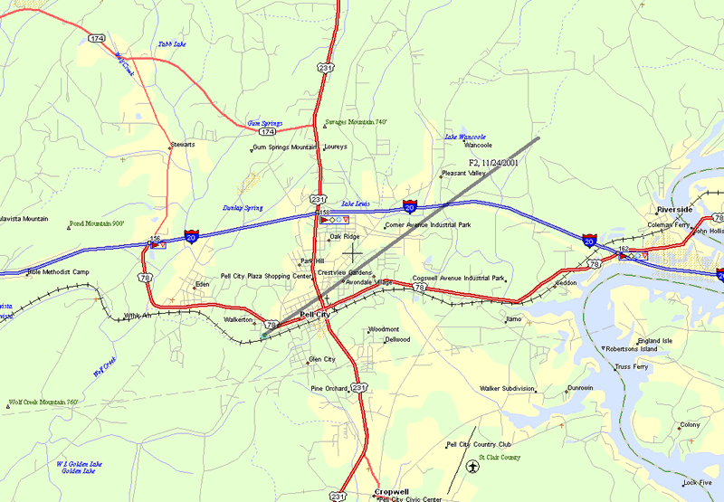 windows broken. The tornado crossed US 231 and became very weak, possibly lifting for a little more than a mile, before slamming into a number of buildings in an industrial park. Some of the greatest destruction was done here. The tornado crossed Interstate 20 and ended after damaging a couple of houses on Sprayberry Road at approximately 3:17 PM CST. windows broken. The tornado crossed US 231 and became very weak, possibly lifting for a little more than a mile, before slamming into a number of buildings in an industrial park. Some of the greatest destruction was done here. The tornado crossed Interstate 20 and ended after damaging a couple of houses on Sprayberry Road at approximately 3:17 PM CST.The tornado path was 4.5 miles long and approximately 100 yards wide at the widest. No deaths occurred in this tornado but there were two injuries, both classified as minor. A tornado watch was issued at 9:12 AM CST valid from 9:30 AM CST to 3:00 PM CST that included St. Clair County, and a Severe Thunderstorm Warning was issued at 2:43 PM CST valid until 3:30 PM CST. Click on the images to see a larger view. |
|
Current Hazards
National Outlooks
Tropical
Local Storm Reports
Public Information Statement
Graphical Hazardous Weather Outlook
Current Conditions
Regional Weather Roundup
Rivers and Lakes
Drought Monitor
Forecasts
Fire Weather
Aviation Weather
Graphical Forecasts
Forecast Discussion
Air Quality
Climate and Past Weather
Past Events
Storm Data
Tornado Database
Daily Rainfall Plots
Tropical Cyclone Reports
Monthly Climate
Annual Climate
Warnings and Other Products
Tornado Warnings
Severe Thunderstorm Warnings
Flash Flood Warnings
Winter Weather Warnings
Special Weather Statements
Non-Precipitation Warnings
Flood/River Flood Warnings
Productos en Español
Conciencia y Preparación
Previsión de 7 Días
Weather Safety
NOAA Weather Radio
Severe Weather Preparedness
Severe Safety Rules
Tornado Safety Rules
Severe Safety w/ ASL
Awareness Weeks
Severe Weather
Hurricane Preparedness
Summer Safety Campaign
Winter Weather
US Dept of Commerce
National Oceanic and Atmospheric Administration
National Weather Service
NWS Birmingham, Alabama
465 Weathervane Road
Calera, AL 35040
205-664-3010
Comments? Questions? Please Contact Us.