NWS Birmingham, Alabama
Weather Forecast Office
Sylacauga Tornado
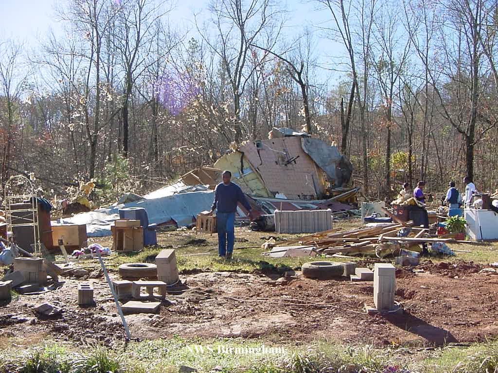
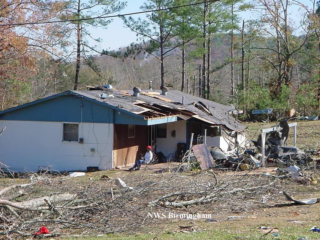
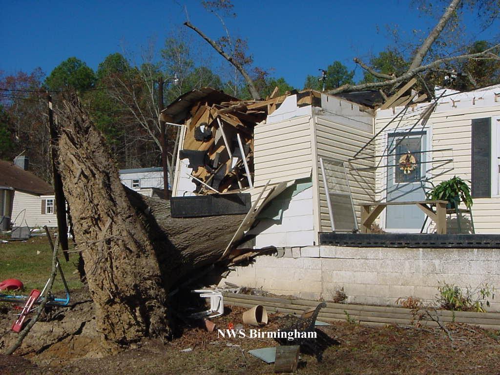
National Weather Service Meteorologists rated it an F2 on the Fujita Scale. An F2 contains winds 113 to 157 mph. The tornado began at 3:42 PM CST near the intersection of Forest Glen Road and Odens Mill Road in the Oak Grove community. It traveled northeast crossing US 280 and ended at 3:45 PM CST near Shirtee Creek in the Odena community. The Red Cross and the local Emergency Management Agency estimate that 15 people were injured, two critically. Forty to 50 homes were damaged with 7 of the homes sustaining significant damage. Ten mobile homes were totally destroyed. Several outbuildings and sheds were destroyed and numerous trees were blown down or uprooted. 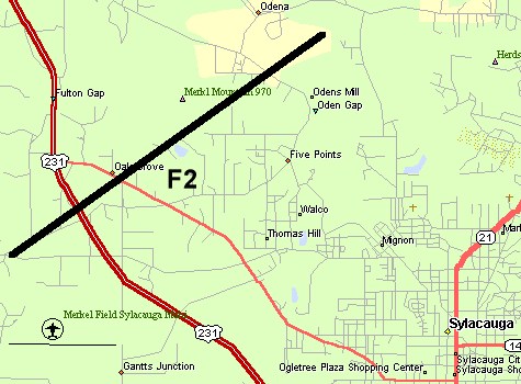 The tornado path was 3.1 miles long and 400 yards wide at its widest point. A Tornado Watch was issued at 1:53 PM CST which included Talladega County. Click on the map to view a larger image showing the approximate path of the tornado. The tornado path was 3.1 miles long and 400 yards wide at its widest point. A Tornado Watch was issued at 1:53 PM CST which included Talladega County. Click on the map to view a larger image showing the approximate path of the tornado.A Severe Thunderstorm Warning was issued for Talladega County at 3:24 PM valid until 4:15 PM CST and a Tornado Warning was in effect for Talladega County from 3:45 PM until 4:30 PM CST. Click on images for a larger display. |
|
Current Hazards
National Outlooks
Tropical
Local Storm Reports
Public Information Statement
Graphical Hazardous Weather Outlook
Current Conditions
Regional Weather Roundup
Rivers and Lakes
Drought Monitor
Forecasts
Forecast Discussion
Air Quality
Fire Weather
Aviation Weather
Graphical Forecasts
Climate and Past Weather
Past Events
Storm Data
Tornado Database
Daily Rainfall Plots
Tropical Cyclone Reports
Monthly Climate
Annual Climate
Warnings and Other Products
Tornado Warnings
Severe Thunderstorm Warnings
Flash Flood Warnings
Winter Weather Warnings
Special Weather Statements
Non-Precipitation Warnings
Flood/River Flood Warnings
Productos en Español
Conciencia y Preparación
Previsión de 7 Días
Weather Safety
NOAA Weather Radio
Severe Weather Preparedness
Severe Safety Rules
Tornado Safety Rules
Severe Safety w/ ASL
Awareness Weeks
Severe Weather
Hurricane Preparedness
Summer Safety Campaign
Winter Weather
US Dept of Commerce
National Oceanic and Atmospheric Administration
National Weather Service
NWS Birmingham, Alabama
465 Weathervane Road
Calera, AL 35040
205-664-3010
Comments? Questions? Please Contact Us.