|
Event Summary
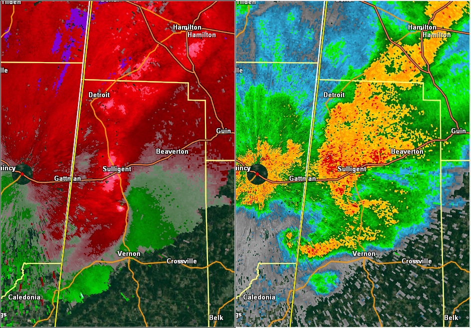
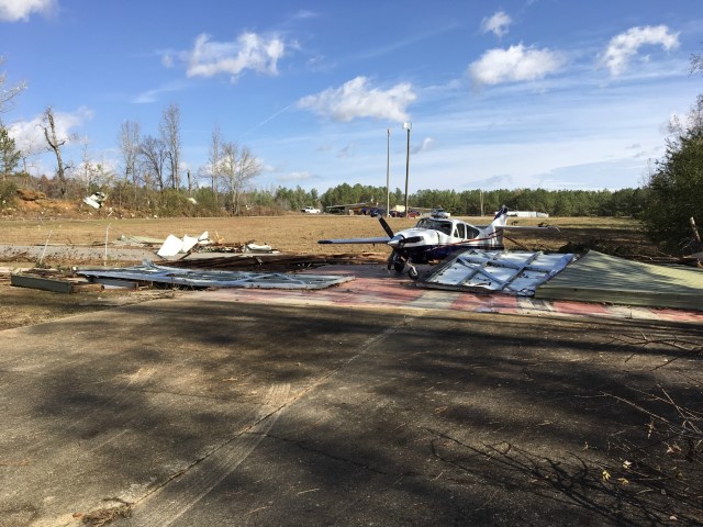
National Weather Service meteorologists surveyed damage in Central Lamar County and determined that the damage was consistent with an EF-1 tornado. The tornado touched down about 3 miles west southwest of the Lamar County Airport, near the intersection of Buck Jackson Road and Morris Road. There were several trees with large branches removed and a few trees that were snapped off. The tornado moved northeastward and crossed County Road 25 and Country Club Road. Several trees were snapped or uprooted and a few mobile homes suffered minor damage. The tornado then hit the Lamar County Airport at US Highway 17. Two hangers were destroyed, three planes were destroyed, several outbuildings were destroyed, one restaurant sustained roof damage, several mobile homes sustained minor damage and one home was destroyed. The tornado continued northeastward and produced more tree damage and minor mobile home damage on Pitts Road and Bluebird Road. Additional damage was located on Taylor Springs Road where several trees were uprooted and snapped off, a few homes sustained roof damage, and a few mobile homes were damaged. The tornado continued to snap off trees until it lifted near the intersection of County Road 49 and Garrison Road. The tornado was 9.69 miles long and was 600 yards wide at its widest point. The tornado was rated an EF-1 with maximum winds around 105 mph.
|