|
Event Summary
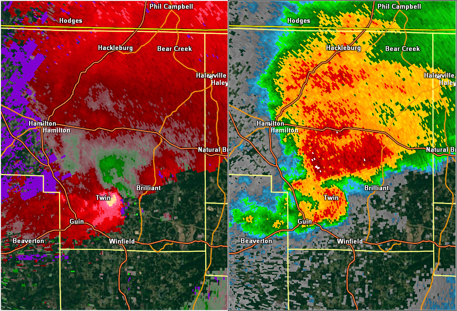
National Weather Service meteorologists surveyed damage in southern Marion County near Twin and determined that the damage was consistent with an EF-0 tornado.
The tornado touched down about 3 miles north of Gu-Win, or just southwest of the Twin Community on County Road 250. The tornado damage was light and mainly consisted of tree and tree branch damage northeastward across County Road 3, Alabama Highway 253 and up to Interstate 22. The tornado proceeded northeastward and crossed County Road 95, County Road 36 and Vinston Road. More tree and tree branch damage was done on this part of the path. The tornado the passed Piney Grove Road, Alabama Highway 129 and lifted near County Road 170. More light tree damage occurred and a few outbuildings sustained damage in this area. The tornado was 10.6 miles long and was 150 yards wide at its widest point. The tornado was rated an EF-0 with maximum winds around 75 mph.
|