|
Event Summary
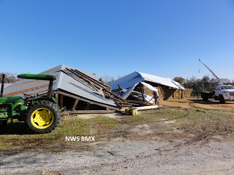
A National Weather Service Damage Assessment Team has surveyed the storm damage in Elmore County. It has been determined the damage was the result of a tornado. The tornado has been rated an EF-0 on the Enhanced Fujita Scale. Damage estimates were consistent with winds around 80 mph.
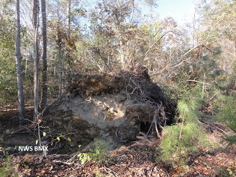
The tornado touched down west of US 231 north of Wetumpka. Some homes suffered shingle damage along River Falls Road. The tornado moved northeastward and as it approached US Highway 231, a roof of a large hay barn collapsed. The tornado then crossed County Road 209 near Fortner Road. Several trees were uprooted in this vicinity. The tornado finally lifted near the intersection of Balm Road and Mt Zion Road. The tornado damage path was 6.7 miles long and was 100 yards wide at its widest point.
|