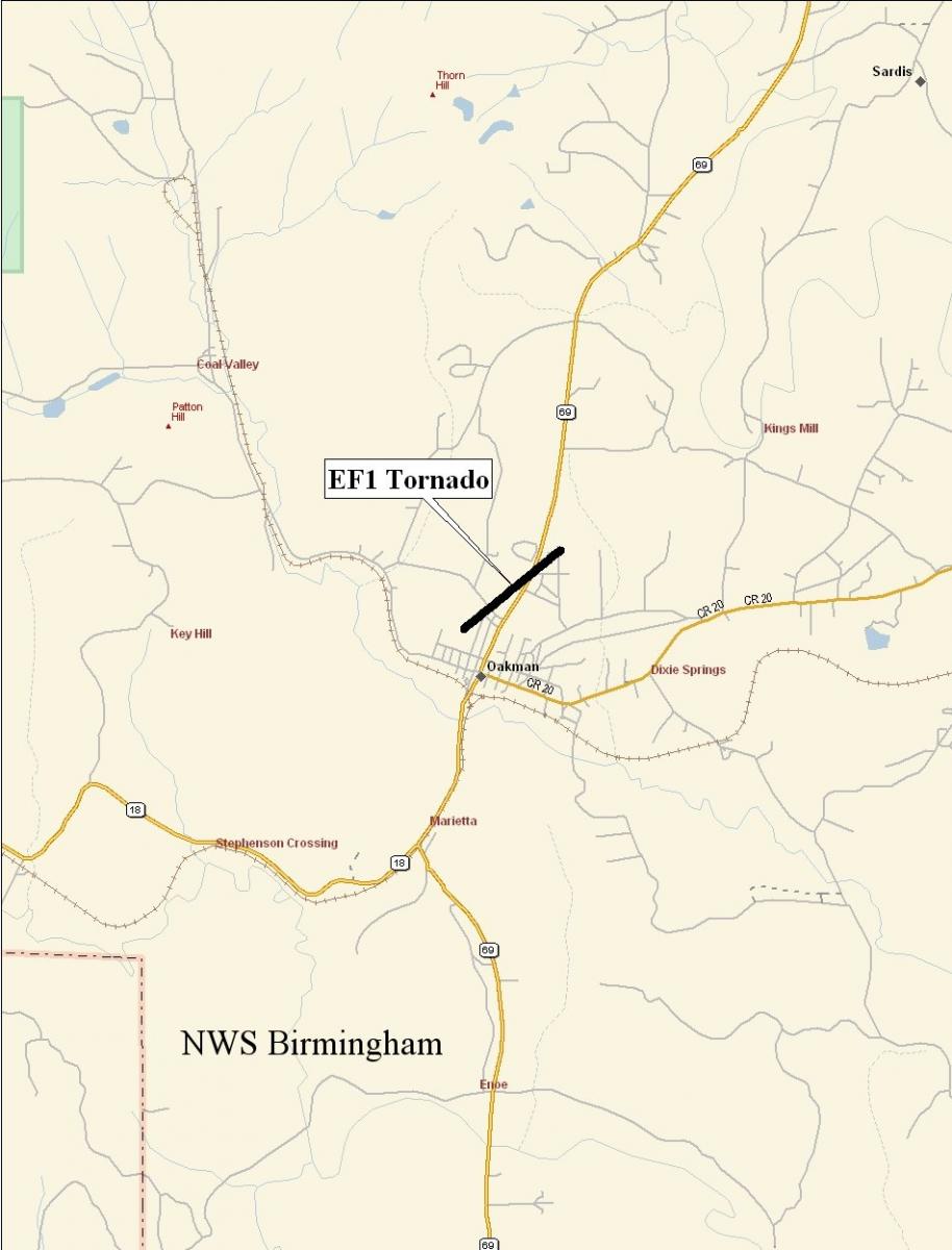
Oakman Tornado - Walker County - December 10th, 2008
|
Rating:
(Click for EF Scale) |
EF-1
|
|
Estimated Maximum Wind:
|
80-90 mph
|
|
Injuries/Fatalities:
|
None
|
|
Damage Path Length:
|
0.75 miles
|
|
Maximum Path Width:
|
400 yards
|
|
Approximate Start Point:
|
33.7176/-87.3904 at 1243 AM
|
|
Approximate End Point:
|
34.1963/-87.7222 at 1245 AM
|
|
KML/KMZ File :
|
|
A National Weather Service Damage Assessment Team has surveyed the storm damage in Walker County near Oakman. It has been determined the damage was the result of a tornado. The tornado has been rated an EF-1 on the Enhanced Fujita Scale. Damage estimates were consistent with maximum winds between 80 & 90 mph.
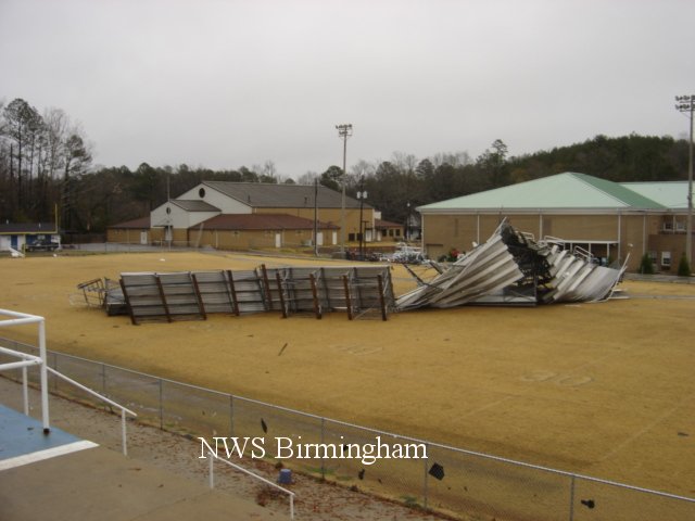
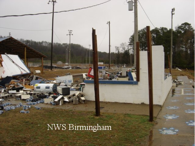
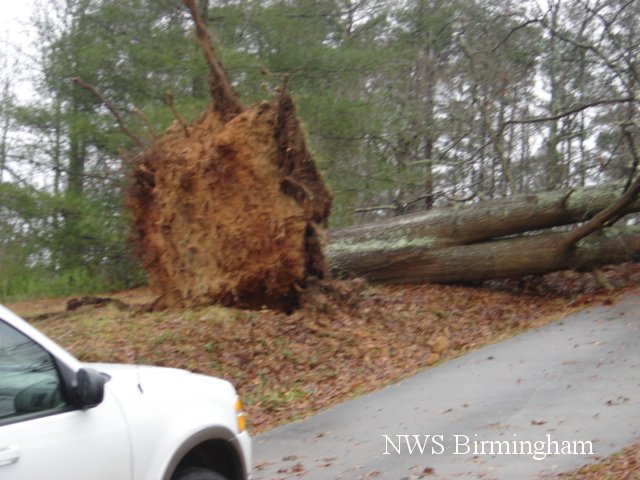
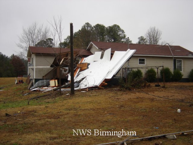
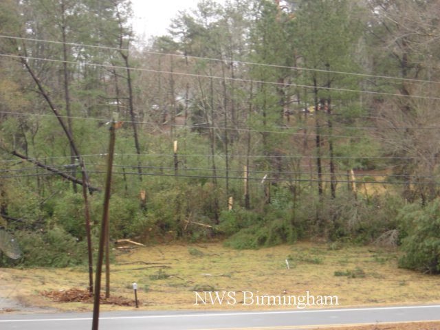
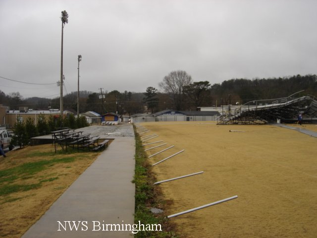
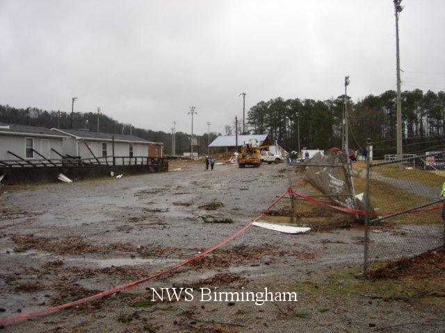
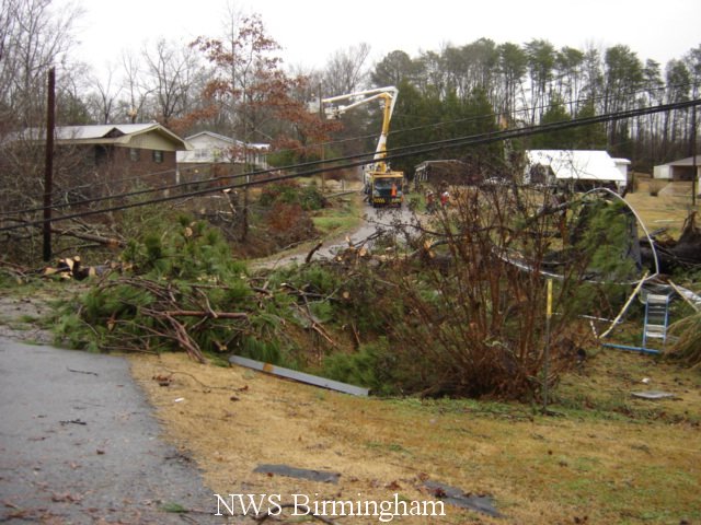
The tornado touched down just west of Jackson Street on the north side of Oakman. The tornado traveled northeastward and crossed School Street and State Highway 69. The tornado lifted on Watts Street just east of State Highway 69. Metal bleachers were twisted and thrown at the Oakman School athletic field. Several houses suffered significant roof damage along State Highway 69. Approximately 150 trees were either uprooted or snapped off. Little structural damage occurred at the school, but water damage was sustained.
|
|
||||||||||||||||||||||