NWS Birmingham, Alabama
Weather Forecast Office
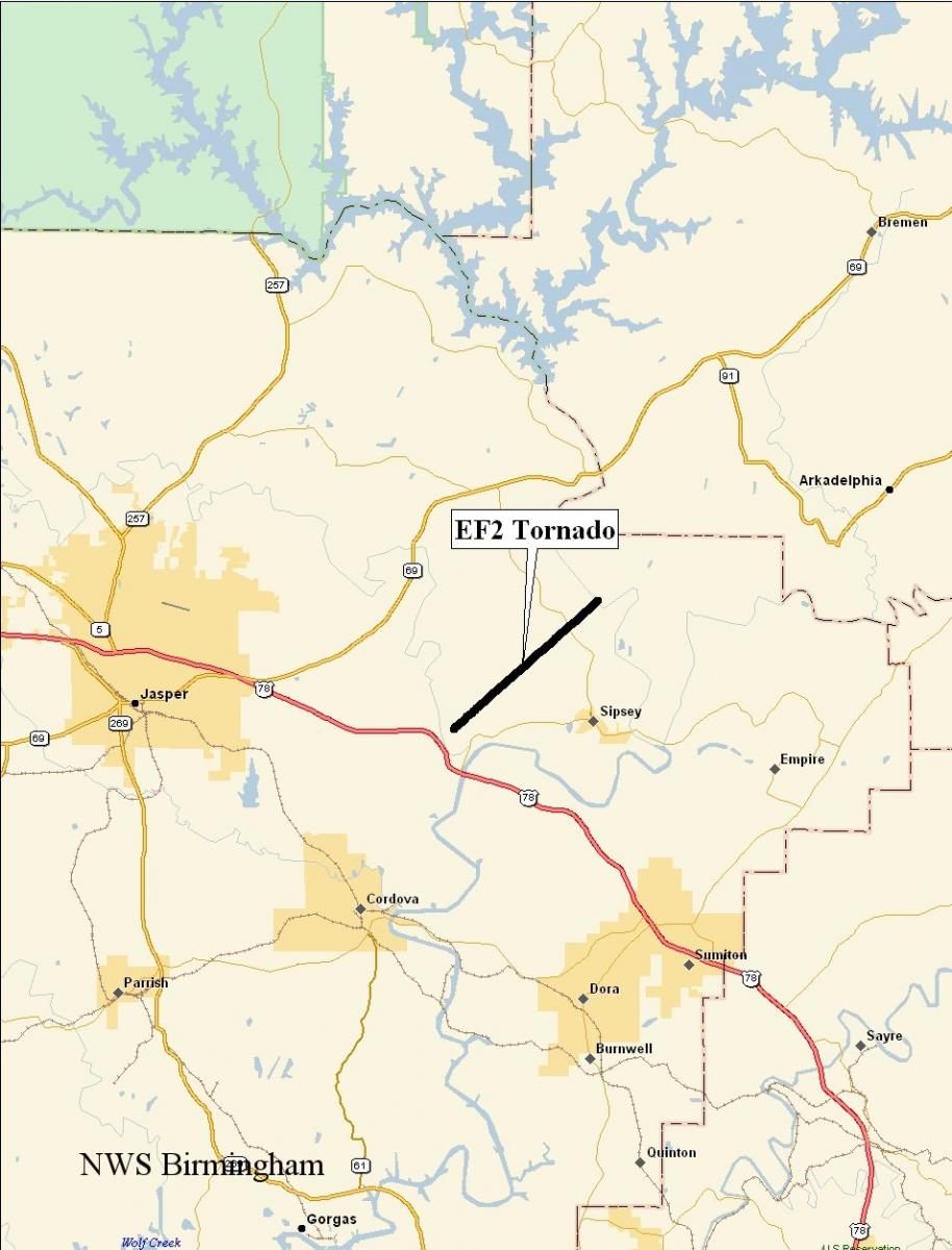
Sipsey Tornado - Walker County - December 10th, 2008
|
Rating:
(Click for EF Scale) |
EF-2
|
|
Estimated Maximum Wind:
|
Around 130 mph
|
|
Injuries/Fatalities:
|
None
|
|
Damage Path Length:
|
4.6 miles
|
|
Maximum Path Width:
|
400 yards
|
|
Approximate Start Point:
|
33.8221/-87.1446 at 101AM
|
|
Approximate End Point:
|
33.8667/87.0838 at 107AM
|
|
KML/KMZ File :
|
|
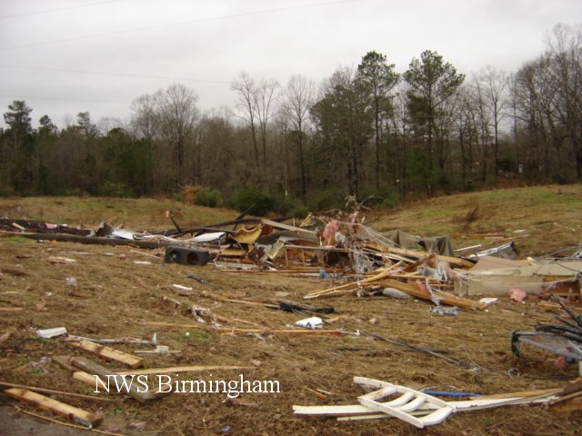
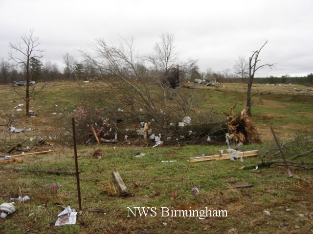
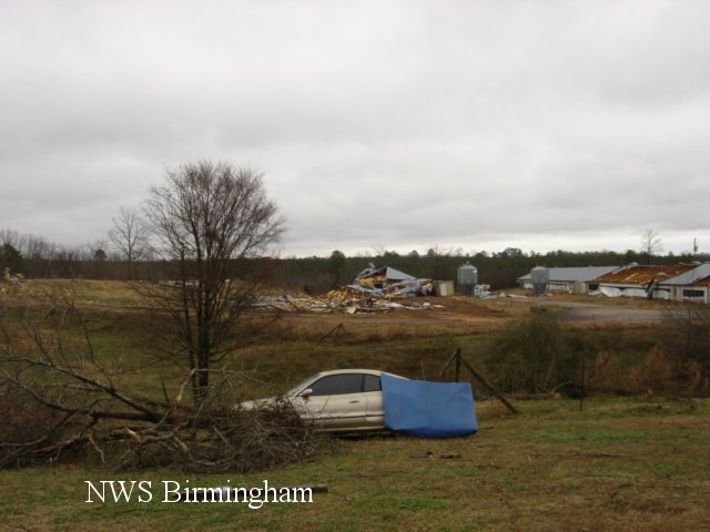
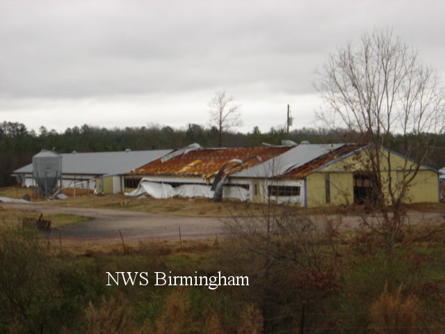
A National Weather Service Damage Assessment Team has surveyed the storm damage in Walker County near Sipsey. It has been determined the damage was the result of a tornado. The tornado has been rated an EF-2 on the Enhanced Fujita Scale. Damage estimates were consistent with winds around 130 mph.
The tornado touched down near the intersection of Snow Drive and Old Pineywoods Road, just north of US Highway 78. The tornado traveled northeastward and crossed County Road 77 and lifted shortly thereafter. One mobile home was totally destroyed and rolled approximately 50 feet. At least two additional mobile homes suffered significant damage. Two chicken houses were damaged. A few hundred trees were either snapped off or were uprooted along the path.
|
|
||||||||||||||
Current Hazards
National Outlooks
Tropical
Local Storm Reports
Public Information Statement
Graphical Hazardous Weather Outlook
Current Conditions
Regional Weather Roundup
Rivers and Lakes
Drought Monitor
Forecasts
Fire Weather
Aviation Weather
Graphical Forecasts
Forecast Discussion
Air Quality
Climate and Past Weather
Past Events
Storm Data
Tornado Database
Daily Rainfall Plots
Tropical Cyclone Reports
Monthly Climate
Annual Climate
Warnings and Other Products
Tornado Warnings
Severe Thunderstorm Warnings
Flash Flood Warnings
Winter Weather Warnings
Special Weather Statements
Non-Precipitation Warnings
Flood/River Flood Warnings
Productos en Español
Conciencia y Preparación
Previsión de 7 Días
Weather Safety
NOAA Weather Radio
Severe Weather Preparedness
Severe Safety Rules
Tornado Safety Rules
Severe Safety w/ ASL
Awareness Weeks
Severe Weather
Hurricane Preparedness
Summer Safety Campaign
Winter Weather
US Dept of Commerce
National Oceanic and Atmospheric Administration
National Weather Service
NWS Birmingham, Alabama
465 Weathervane Road
Calera, AL 35040
205-664-3010
Comments? Questions? Please Contact Us.