|
Tornado Damage on December 10th, 2012
|
|
Birmingham (Jefferson) EF-1 Tornado
|
|
|
EF-1
|
|
Estimated Maximum Wind:
|
90 mph
|
|
Injuries/Fatalities:
|
None |
|
Damage Path Length:
|
1.05 miles
|
|
Maximum Path Width:
|
250 yards
|
|
Approximate Start Point/Time:
|
33.5359/-86.8436 at 443 am
|
|
Approximate End Point/Time:
|
33.5420/-86.8268 at 445 am
|
|
|
National Weather Service meteorologists surveyed damage just northwest of downtown Birmingham. It has been determined that the damage was consistent with a tornado. Maximum winds were estimated up to 90 mph. The tornado touched down just west of 3rd Place West or just to the east of the Birmingham Farmers Market. From there, it moved to the northeast across a light industrial warehouse area, striking a large metal building. Several overhead doors at the loading dock were blown in, which then blew out about 25 percent of the roof off the building. Debris from this structure was found up to a mile away. The tornado continued northeastward through a residential area, causing damage to 29 homes, 2 of which had major damage and one of which lost its roof entirely. A church and two other businesses were damaged near the intersection of Finley Blvd and 16th Street. The tornado lifted near the intersection of 24th Court North and 18th Street North, just west of Interstate 65.
|
|
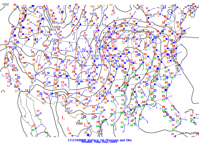
Surface analysis at 6pm Sunday, Dec 9
|
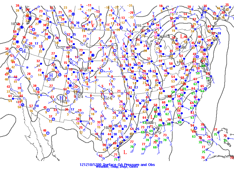
Surface analysis at 6am Monday, Dec 10
|
|
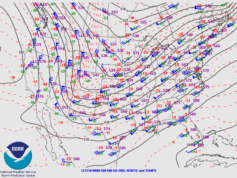
500mb analysis at 6pm Sunday, Dec 9
|
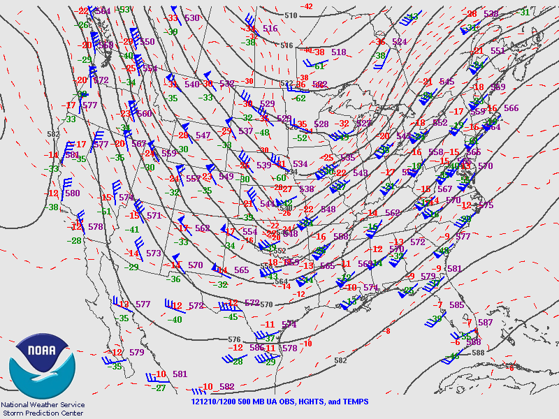
500mb analysis at 6am Monday, Dec 10
|
|
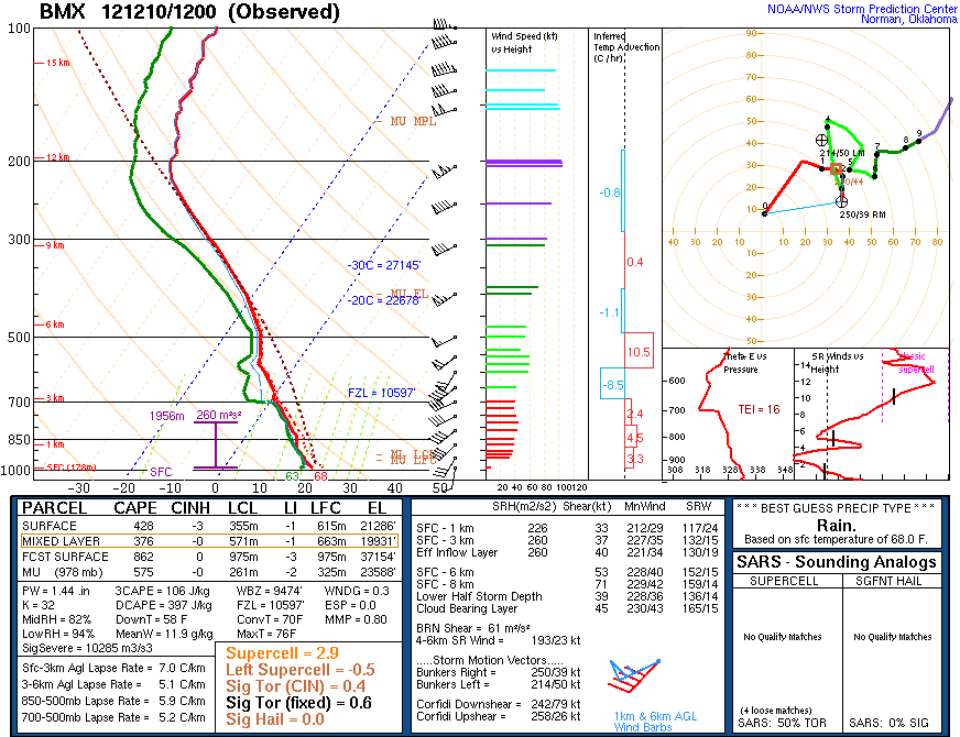
BMX upper air sounding from 6am Monday, Dec 10
|
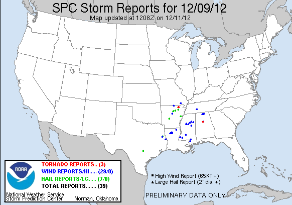
Storm Reports
|
|
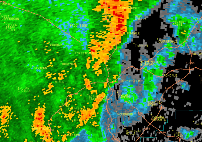
0.5 degree reflectivity from KBMX at or just before tornado touchdown. The reflectivity does not give any true clues to strength of this storm.
|

0.5 degree SRM velocity from KBMX at or just before tornado touchdown. Notice how the rotation is extremely weak.
|
|
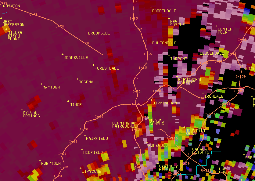
0.5 degree correlation coefficient (CC) of Dual Pol from KBMX. There are 3 images in this loop. Notice the "explosion" of CC just east of I-65 on the last two images. This is called a Tornadic Debris Signature or TDS.
|
|
Storm Damage Images - Click to Enlarge
|
|
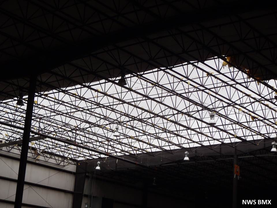
Roof damage to warehouse
|
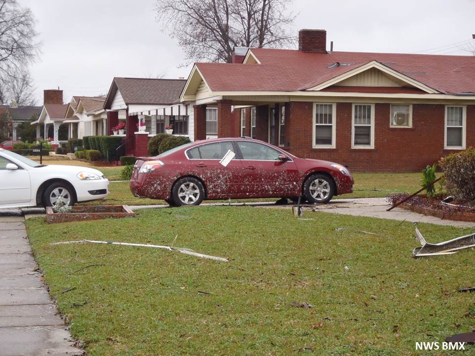
Debris splatter on vehicle and house
|
|
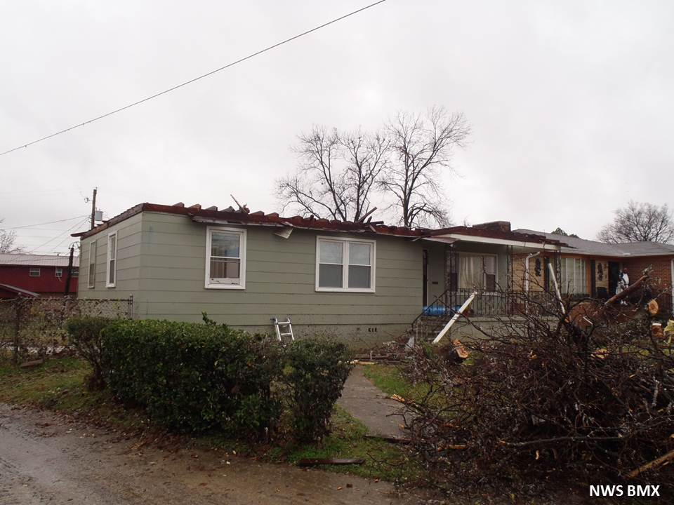
Roof damage to a home
|

Tree damage and home damage
|
|


