National Weather Service United States Department of Commerce


Tornadoes of December 10, 2023

Overview
 

A storm system moved through Alabama late on December 9th and into the early morning hours of December 10th. Widespread wind damage was reported in the Birmingham metro area, along with four brief tornadoes, two in Jefferson County, one in Barbour County, and one in Lee County.

 
Interactive Damage Map


**The data below are considered PRELIMINARY.**

Location/Clickable Detailed Summary Link
Damage Rating/Estimated Maximum Wind Speeds
Injuries/Fatalities
Damage Path Length/Width
Starting Point/Time
Ending Point/Time
Straight-line Winds
(Jefferson County)
Thunderstorm Wind
60-70 mph

 
None 13.5 miles
3.60 miles
Oxmoor Valley
33.4179/-86.8650
12:04 am CST
2 ESE Irondale
33.5236/-86.6698
12:22 am CST
Homewood Tornado
(Jefferson County)
EF-1
100 mph

 
None 3.02 miles
600 yards
2 SW Homewood
33.4434/-86.8370
12:09 am CST
Samford University
33.4682/-86.7951
12:12 am CST
Brookwood Village Tornado
(Jefferson County)
EF-1
90 mph

 
None 1.78 miles
200 yards
Samford University
33.4685/-86.7849
12:13 am CST
1 S Mountain Brook
33.4772/-86.7559
12:15 am CST
Barbour/Henry Tornado
(Barbour/Henry Counties)
EF-0
75 mph
None 8.01 miles
200 yards
1 NW Clopton
31.6234/-85.4420
1:19 am CST
3 W Lawrenceville
31.6688/-85.3172
1:37 am CST
County Road 29 Tornado
(Lee County)
EF-0
70 mph

 
None 2.43 miles
400 yards
3 NNE Society Hill
32.4649/-85.4258
4:36 am CST
3 NW Marvyn
32.4744/-85.3857
4:39 am CST
 
Jefferson County Straight-line Winds
 

Jefferson County Straight-line Winds
  December 10, 2023


Event Summary

Thunderstorm Wind
Estimated Maximum Wind:
60-70 mph
Injuries/Fatalities:
None
Damage Path Length:
13.50 miles
Maximum Path Width:
3.60 miles
Approximate Start Point/Time:
Oxmoor Valley
33.4179/-86.8650
at 12:04 am CST
Approximate End Point/Time:
Samford University
33.5236/-86.6698
at 12:22 am CST


A large area of straight-line wind damage impacted the southern Birmingham suburbs just after midnight on December 10. Damage was first noted in the Oxmoor Valley and Bluff Park areas, with a concentrated area of heavier softwood tree damage along Shades Creek from Cammack Road to the Huntington Parc neighborhood. Widespread wind damage was observed through parts of northern Hoover, Vestavia Hills, Homewood, and Cahaba Heights. More damage was observed in much of Mountain Brook, including in Cherokee Village near Brookwood Mall and areas northwest of Mountain Brook High School along Spring Valley Road and Old Leeds Road. Many streets in these areas had hundreds of trees down, many of which were on homes. Further northeast, more tree and home damage was observed in the neighborhood along Nottingham Lane and along Overton Road east of Interstate 459 up to Grants Mill Road. The observed swath of wind damage was roughly 13.5 miles long and 3.6 miles wide at the widest point, lasting roughly 18 minutes from Oxmoor Valley to near Grants Mill Road. Wind speeds were estimated at 60 to 70 mph. 

Track Map


Radar Image
Reflectivity of the line segment that produced the damaging winds.
Images are from KBMX at 12:06 am CST.


Damage Photo
 Tree Damage
Damage Photo
 Tree Damage
Damage Photo
 Tree Damage
Damage Photo
 Tree Damage
 
Homewood EF-1
 

Homewood EF-1 Tornado (Jefferson County)
  December 10, 2023


Event Summary

EF-1
Estimated Maximum Wind:
100 mph
Injuries/Fatalities:
None
Damage Path Length:
3.02 miles
Maximum Path Width:
600 yards
Approximate Start Point/Time:
2 SW Homewood
33.4434/-86.8370
at 12:09 am CST
Approximate End Point/Time:
Samford University
33.4682/-86.7951
at 12:12 am CST


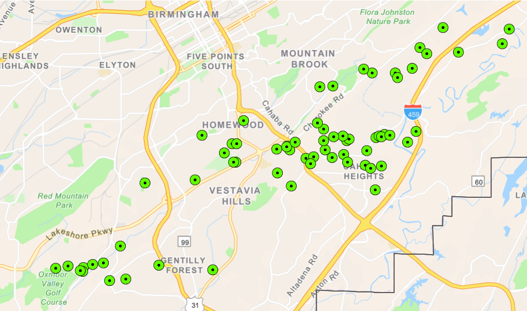
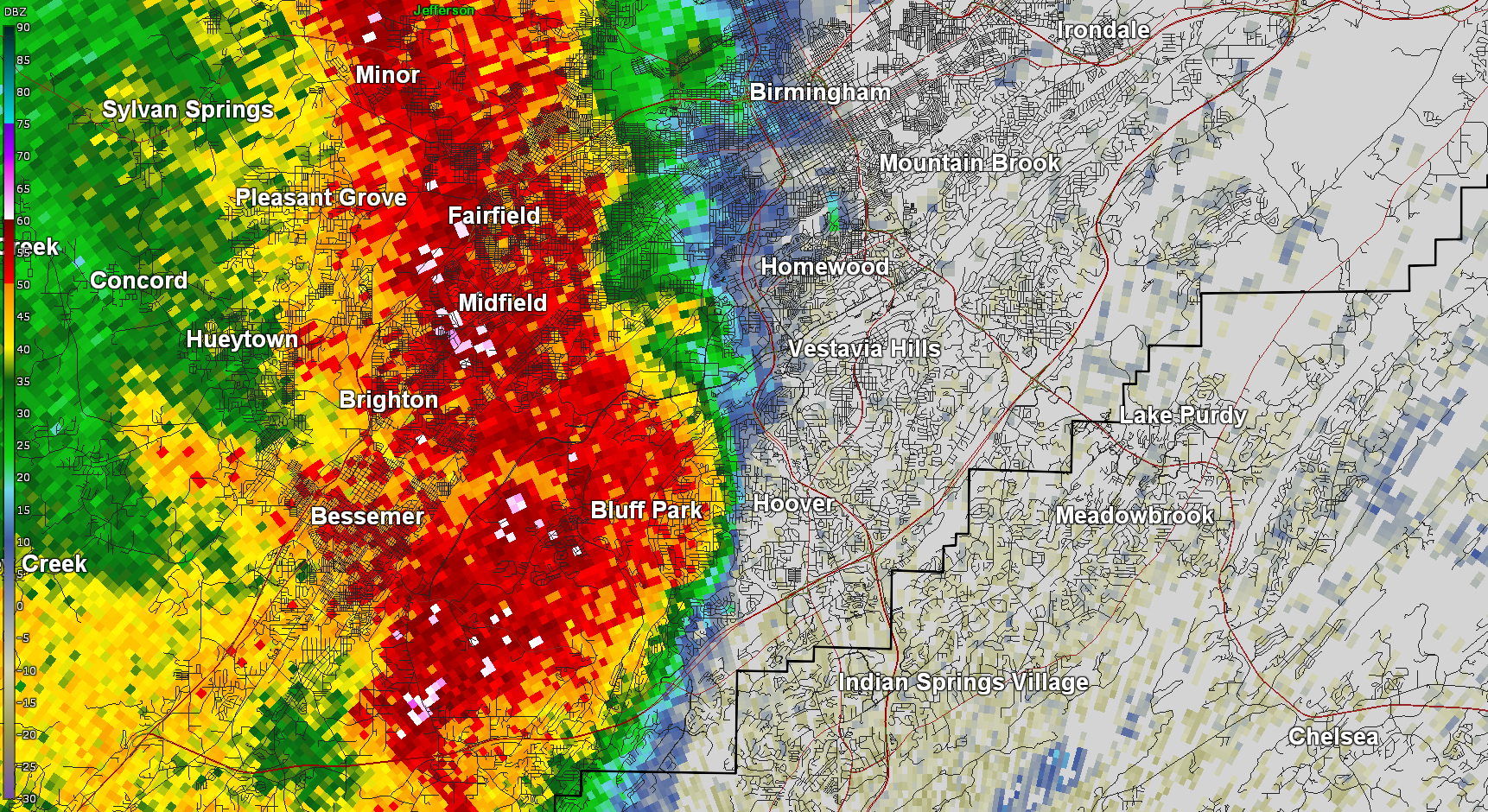
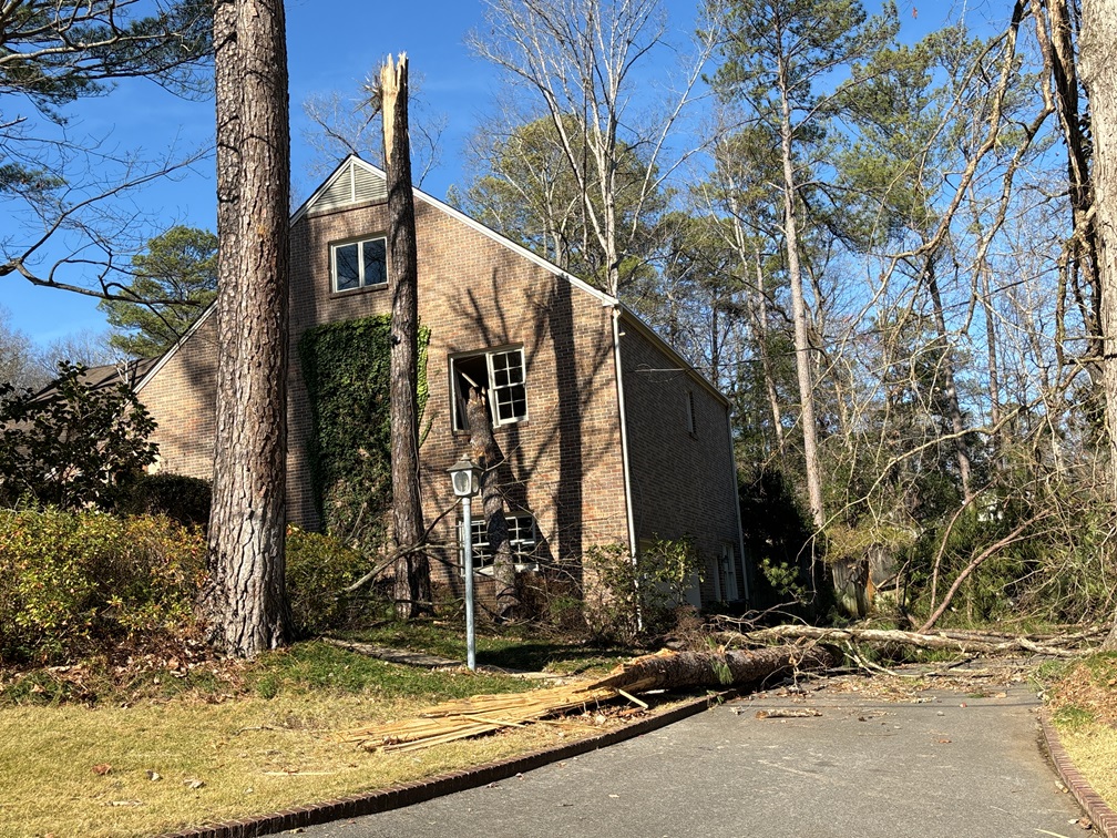
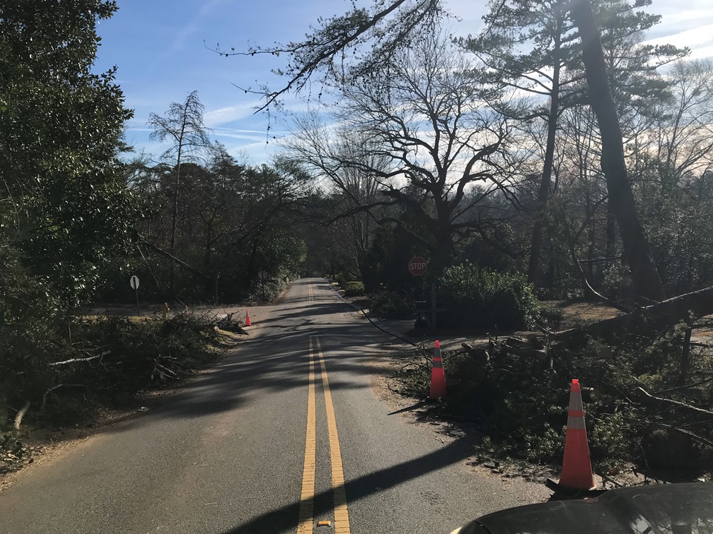
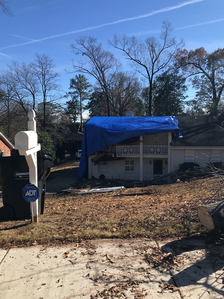
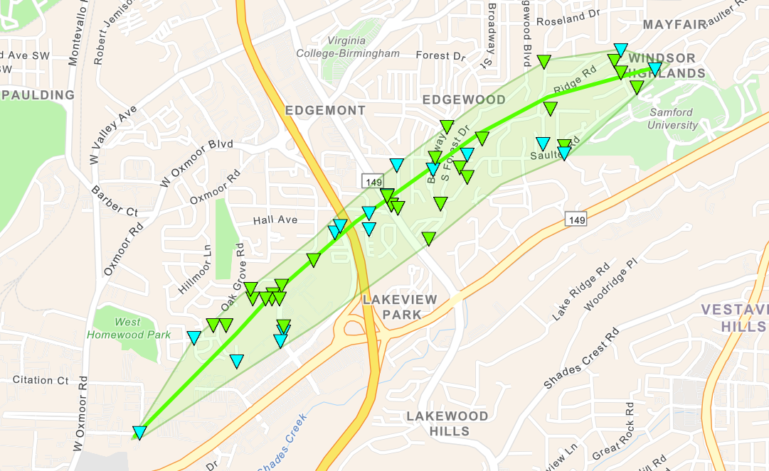
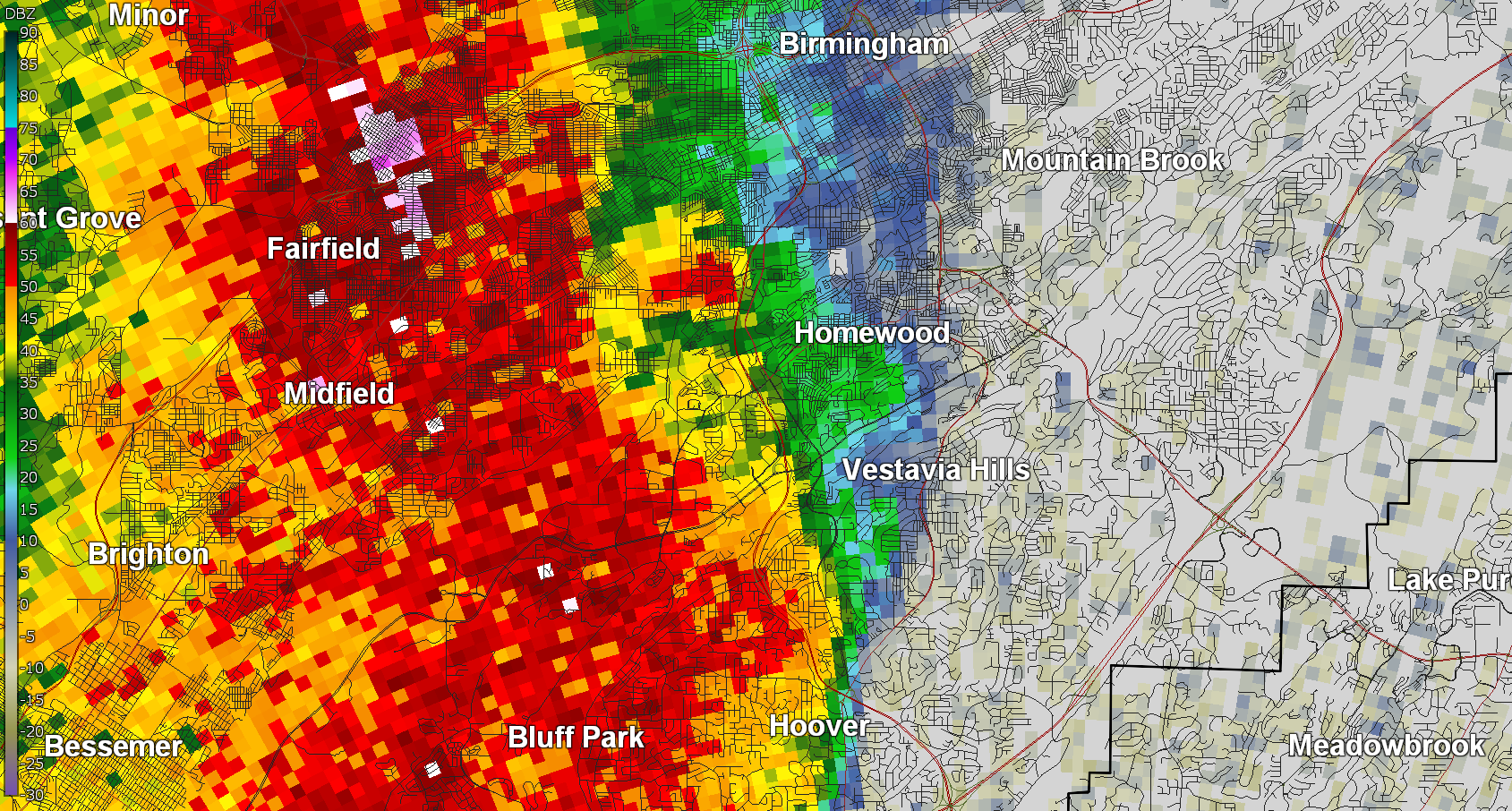
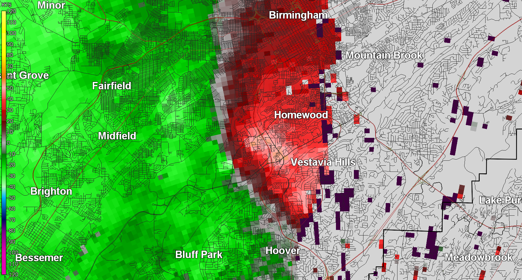
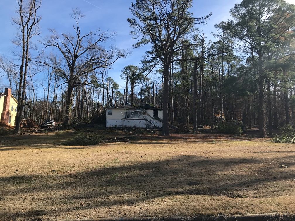
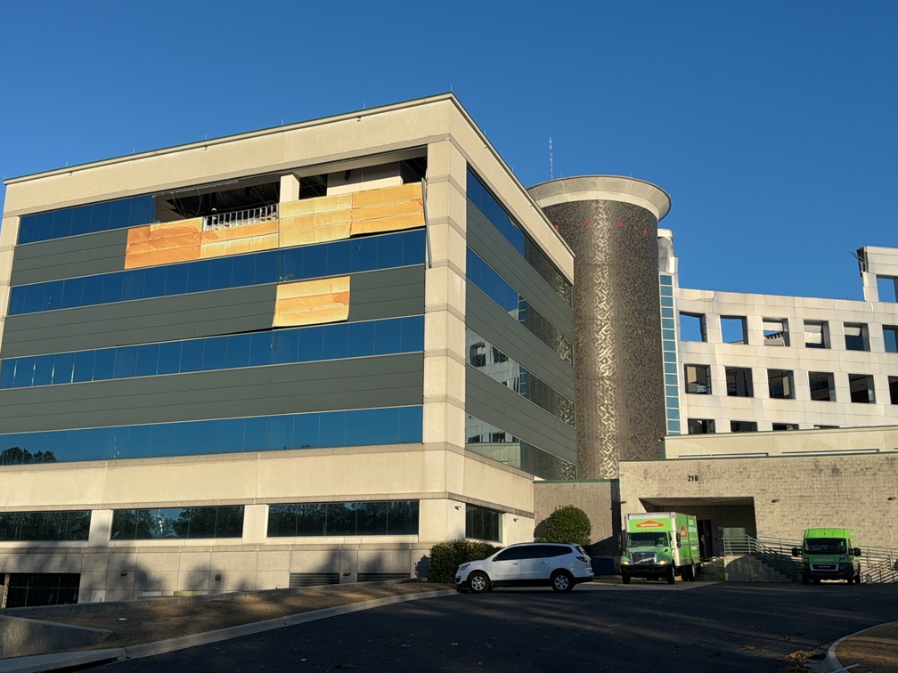
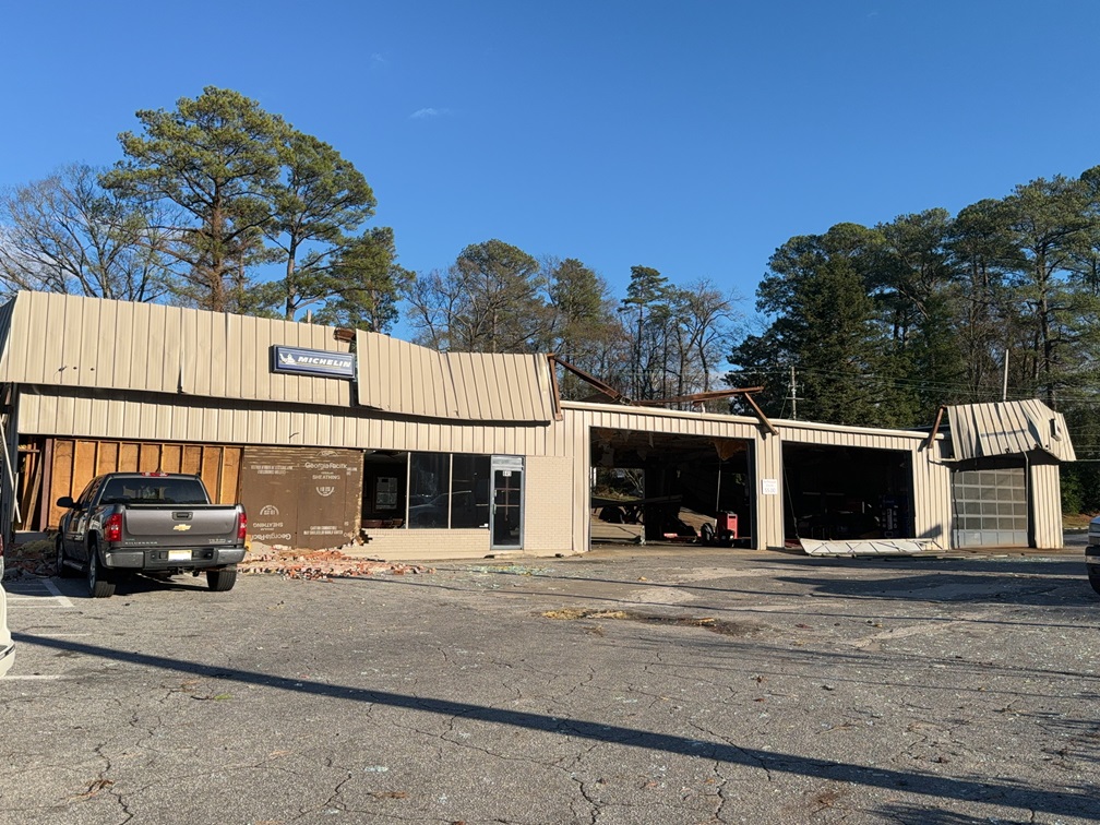
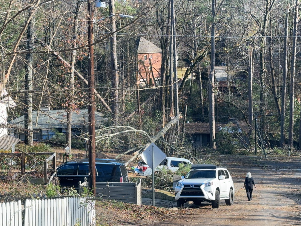
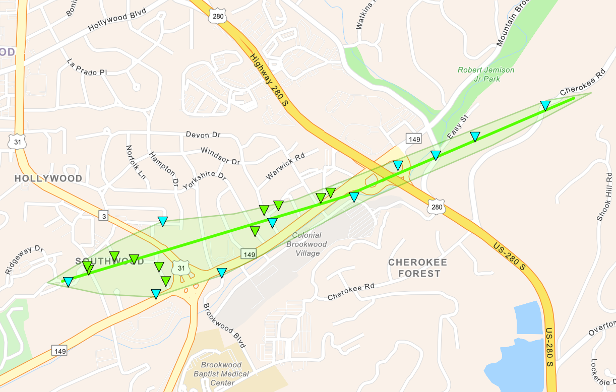
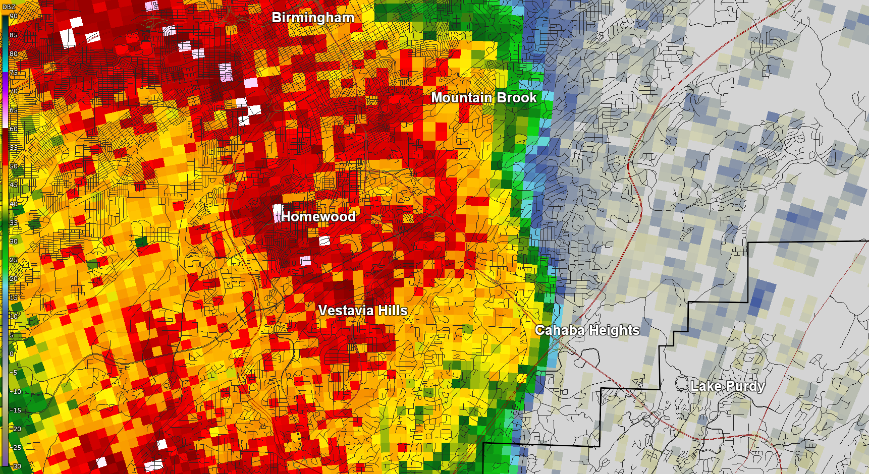
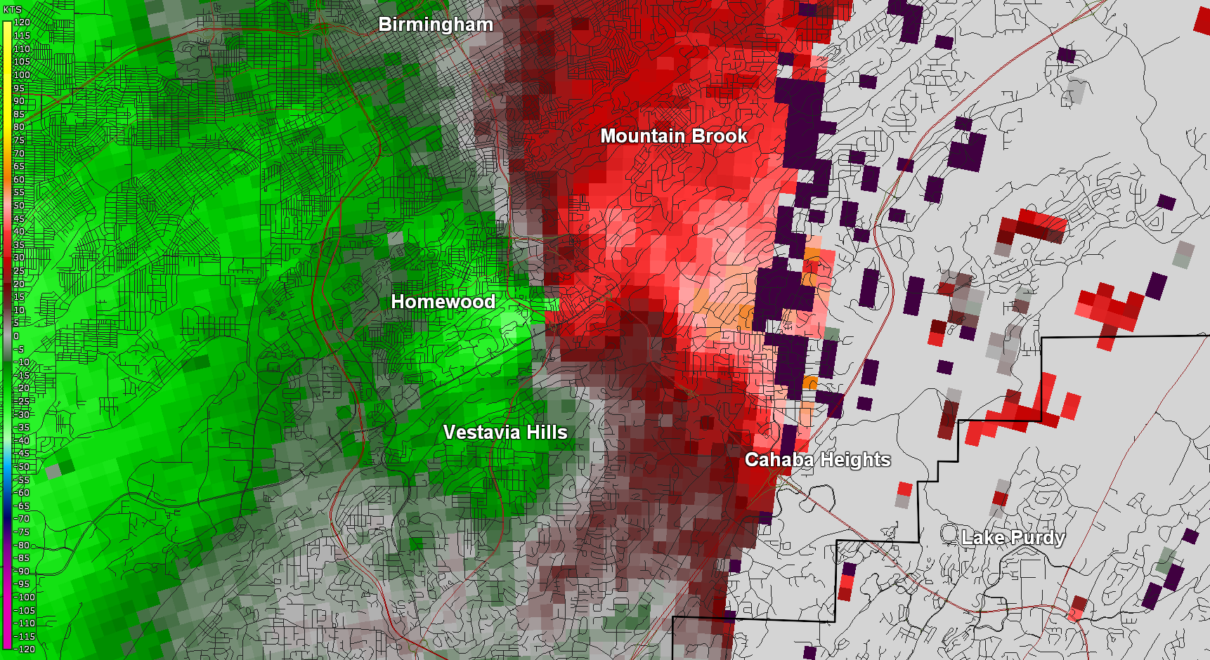
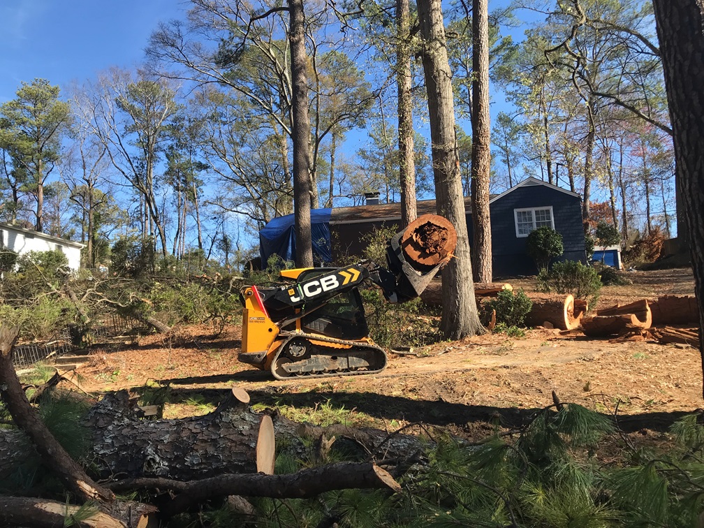
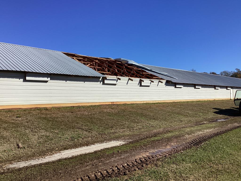
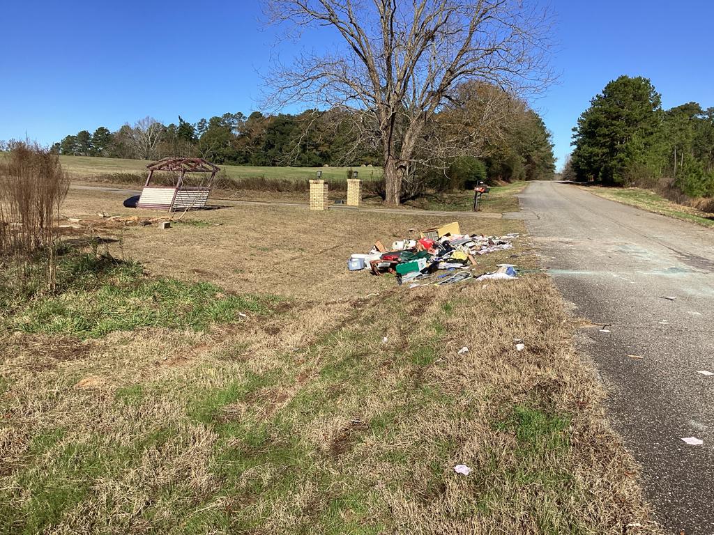
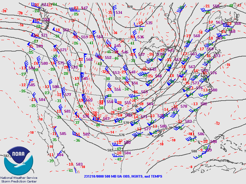
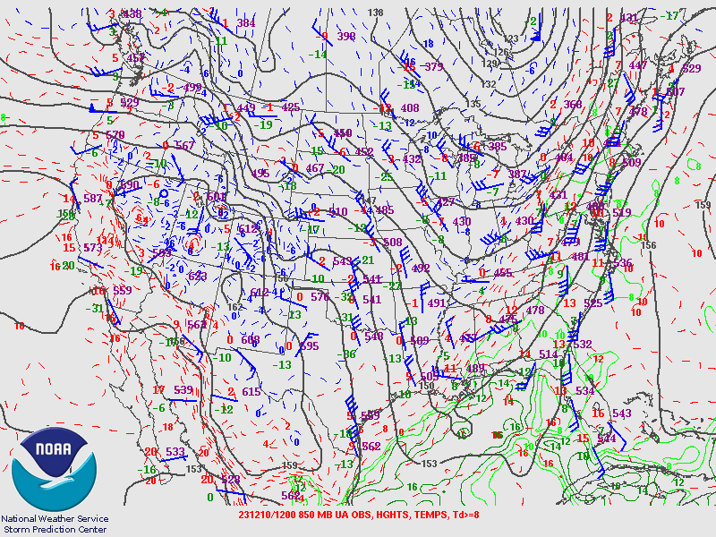
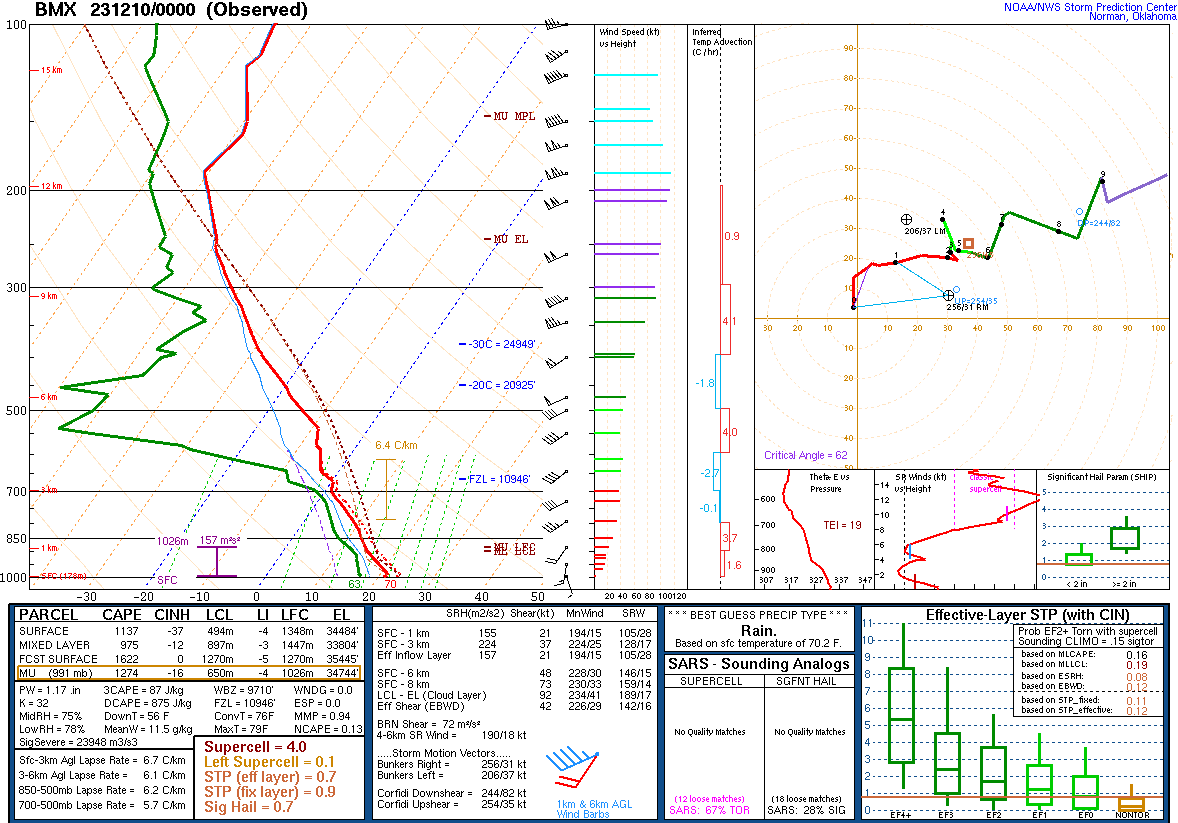
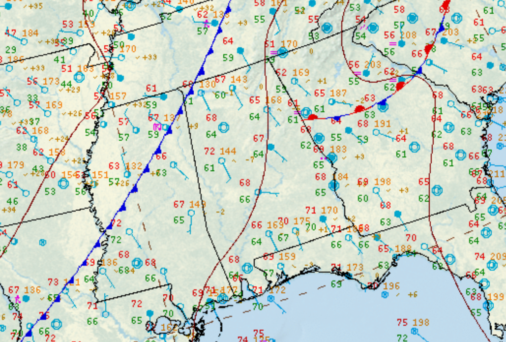
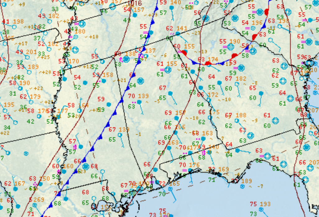
A tornado first touched down just north of Lakeshore Parkway along Snow Drive. Here the damage was very light with large tree branches broken. The tornado tracked northeast, skirting John Carroll High School before producing significant tree damage along Oak Grove Road. One home was heavily damaged by falling trees, with lesser damage to others, and a large stand of mostly pine trees were snapped or uprooted east of Oak Grove Road. The tornado widened and intensified as it approached Wildwood Parkway. A strip mall there sustained very minor damage. However, a large office complex on the north end of Wildwood Parkway sustained substantial damage. A large number of windows were blown out of a 5-story professional building with many windows and debris blown back westward. A large load bearing beam was also pulled from the roof structure. The tornado is estimated to have reached its maximum intensity here at EF-1 / 100 mph. The tornado continued to move northeast, felling numerous trees south of Kent Drive. Along State Farm Parkway, a couple hotels sustained roof damage, a large hotel sign was blown out, and a vehicle was flipped before it crossed Interstate 65. The tornado reached its maximum width of approximately 600 yards as it crossed Green Spring Avenue. Significant structural damage was noted to an auto repair shop with the roof blown off. Several additional businesses and an apartment complex in this area also sustained minor roof damage. Power poles were snapped in this area as well. Further northeast, the tornado tracked through a densely populated residential area. Here the primary damage was caused by snapping and felling of trees. Many large and mature trees fell through homes in this area, causing moderate to severe damage. The most concentrated area of damage was along and north of Saulter Road and surrounding streets. It is estimated that over three dozen homes in this area sustained at least moderate damage from falling trees. The tornado began to weaken as it tracked on the north side of the Samford University campus with a few trees down in this area. The tornado dissipated near the Windsor Highlands Community along the north edge of the Samford Campus.

Track Map


Radar Image
Radar Image
Reflectivity (top) and velocity (bottom) of the tornado.
Images are from KBMX at 12:09 am CST.


Damage Photo
 Tree Damage
Damage Photo
 Structure Damage
Damage Photo
 Structure Damage
Damage Photo
 Tree Damage
 
Brookwood Village EF-1
 

Brookwood Village EF-1 Tornado (Jefferson County)
  December 10, 2023


Event Summary

EF-1
Estimated Maximum Wind:
90 mph
Injuries/Fatalities:
None
Damage Path Length:
1.78 miles
Maximum Path Width:
200 yards
Approximate Start Point/Time:
Samford University
33.4685/-86.7849
at 12:13 am CST
Approximate End Point/Time:
1 SW Mountain Brook
33.4772/-86.7559
at 12:15 am CST


An EF-1 tornado touched down just west of US Highway 31 in the Southwood community, just east of Lakeshore Foundation. Numerous softwood trees were knocked down across Old Montgomery Highway and Ashley Road, with some on homes. The tornado tracked east, nearly paralleling Lakeshore Drive/Shades Creek Parkway. At this point the tornado was near its maximum EF-1 intensity and also its widest point of 200 yards. Several houses on the north side of Shades Creek Parkway along Yorkshire Drive, Devon Drive, and Windsor Drive were damaged by falling trees. Power poles were snapped as well. The north facing side of Brookwood Mall also sustained minor structural damage. The very narrow tornado passed through the interchange of US Highway 280 and Shades Creek Parkway, with tree and power line damage noted around the interchange. The tornado moved northeastward across Cahaba Road and up a ridge, with a defined area of tree damage consisting of uproots and snapped limbs and tree tops. The last observable damage occurred at the top of the ridge along Cherokee Road. 

Track Map


Radar Image
Radar Image
Reflectivity (top) and velocity (bottom) of the tornado.
Images are from KBMX at 12:13 am CST.


Damage Photo
 Tree Damage
Damage Photo
 Tree Damage
 
Barbour/Henry EF-0
 

Barbour/Henry EF-0 Tornado (Barbour & Henry Counties)
  December 10, 2023


Event Summary

EF-0
Estimated Maximum Wind:
75 mph
Injuries/Fatalities:
None
Damage Path Length:
8.01 miles
Maximum Path Width:
200 yards
Approximate Start Point/Time:
1 NW Clopton
31.6234/-85.4420
at 1:19 am CST
Approximate End Point/Time:
3 W Lawrenceville
31.6688/-85.3172
at 1:37 am CST


The tornado began in rural southwestern Barbour County just west of Lury Walker Road with a single tree uprooted along the road bank and a few branches off of trees. The entire tornado track mainly consisted of sporadic very minor tree damage, yet the path remained discernible and consistent with the associated tornado debris signature (TDS). The tornado crossed Alabama Highway 10 and entered Henry County just north of and parallel to County Rd (CR) 54, before crossing CR 54 just before CR 216. The tornado reached its maximum width of approximately 200 yards wide as well as its maximum intensity, with relatively more widespread tree damage, as well as superficial damage to several manufactured homes. The tornado continued northeastward through forested land before crossing CR 75 and CR 235. It continued across the East Fork of the Choctawhatchee River before crossing CR 29. As the tornado crossed CR 235, it struck a chicken farm with surgical precision, slicing across all 6 chicken barns like a can opener, causing primarily narrow minor damage to each barn. The tornado continued to the northeast and dissipated before crossing CR 54 yet another time.

Track Map


Radar Image
Reflectivity (left) and velocity (right) of the tornado.
Images are from KEOX at 1:22 am CST.


Damage Photo
 Chicken House Damaged
Damage Photo
 Debris
 
County Road 29 EF-0
 

County Road 29 EF-0 Tornado (Lee County)
  December 10, 2023


Event Summary

EF-0
Estimated Maximum Wind:
70 mph
Injuries/Fatalities:
None
Damage Path Length:
2.43 miles
Maximum Path Width:
400 yards
Approximate Start Point/Time:
3 NNE Society Hill
32.4649/-85.4258
at 4:36 am CST
Approximate End Point/Time:
3 NW Marvyn
32.4744/-85.3857
at 4:39 am CST


The tornado initially touched down along County Road 30 where several trees were uprooted and a single family residence sustained minor damage. The tornado continued east-northeast crossing County Road 29 where additional trees were uprooted and a home had roof damage. It was also noted that a car window was blown out. The tornado then crossed County Road 11 just before lifting north of County Road 39. Additional soft and hard wood trees were damaged and uprooted along these two roads. It should be noted that this damage was adjacent to the EF4 tornado that impacted Lee County in 2019.

Track Map


Radar Image
Reflectivity (left) and velocity (right) as the tornado formed.
Images are from KMXX at 4:37 am CST.


Damage Photo
 Tree Damage
 
Outlooks & Reports
 

Local Day 3 Outlook
Local Day 3 Outlook
Dec 7 at 415 am

Local Day 2 Outlook
Local Day 2 Outlook
Dec 8 at 1230 pm

Local Day 1 Outlook
Local Day 1 Outlook
Dec 9 at 10 am

Storm Reports
Storm Reports
December 9


Surface & Upper Air Charts
 

250mb Analysis
250mb Analysis
Dec 9 at 6 pm

500mb Analysis
500mb Analysis
Dec 9 at 6 pm

850mb Analysis
850mb Analysis
Dec 9 at 6 pm

250mb Analysis
250mb Analysis
Dec 10 at 6 am

500mb Analysis
500mb Analysis
Dec 10 at 6 am

850mb Analysis
850mb Analysis
Dec 10 at 6 am

KBMX Sounding
KBMX Sounding
Dec 9 at 6 pm

Surface Chart
Surface Analysis
Dec 9 at 6 pm

Surface Analysis
Surface Analysis
Dec 9 at 9 pm

Surface Analysis
Surface Analysis
Dec 10 at 12 am

Surface Analysis
Surface Analysis
Dec 10 at 3 am

Surface Analysis
Surface Analysis
Dec 10 at 6 am