|
Event Summary
|
|
EF-0
|
|
Estimated Maximum Wind:
|
70 mph
|
|
Injuries/Fatalities:
|
None |
|
Damage Path Length:
|
3.12 miles
|
|
Maximum Path Width:
|
200 yards
|
|
Approximate Start Point/Time:
|
2 ENE Gary Springs
32.9800/-87.0507
at 949 pm
|
|
Approximate End Point/Time:
|
2 SSE Six Mile
32.9858/-86.9977
at 955 pm
|
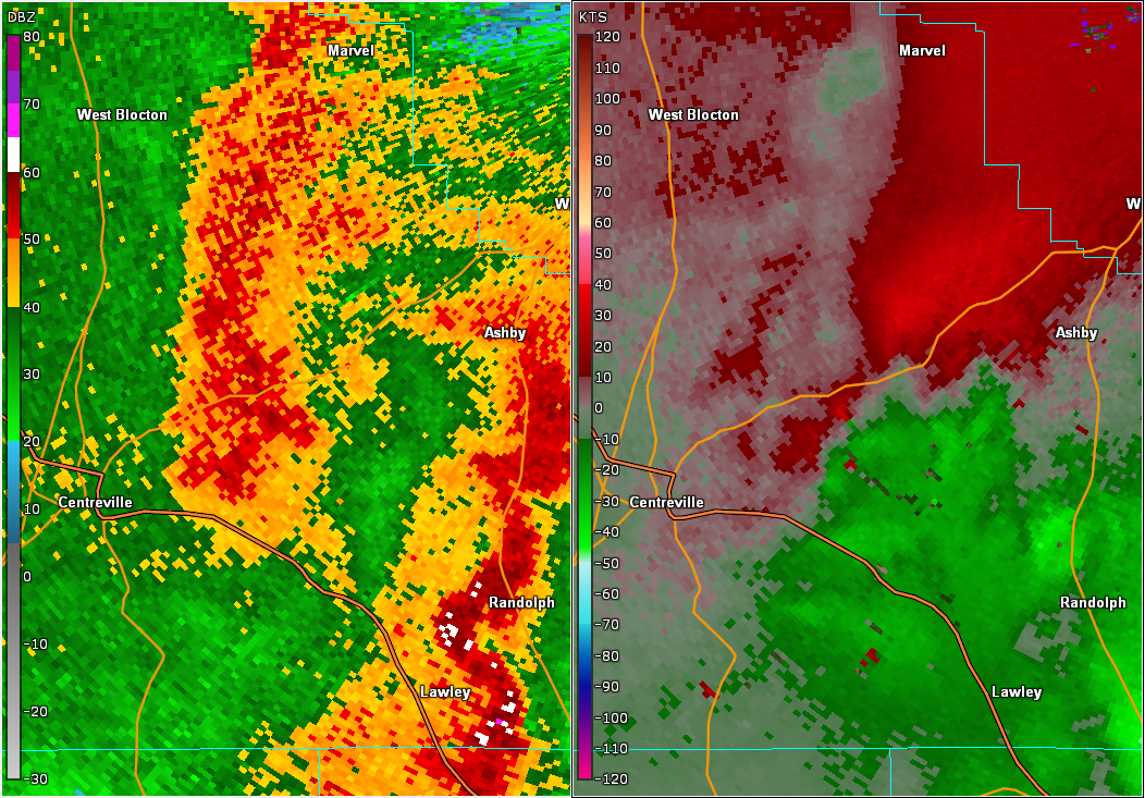
NWS Meteorologists surveyed damage in east central Bibb County northeast of Centreville and determined it was the result of a tornado.
The tornado began northeast of Centreville in an inaccessible area east of Gary Springs Loop Road, where a well-defined tornado debris signature was observed by the KBMX radar. The tornado tracked eastward and crossed Pine Tree Road and Tucker Road, where a few trees and limbs were downed. Maximum winds were estimated at 70 mph.
|