|
Event Summary
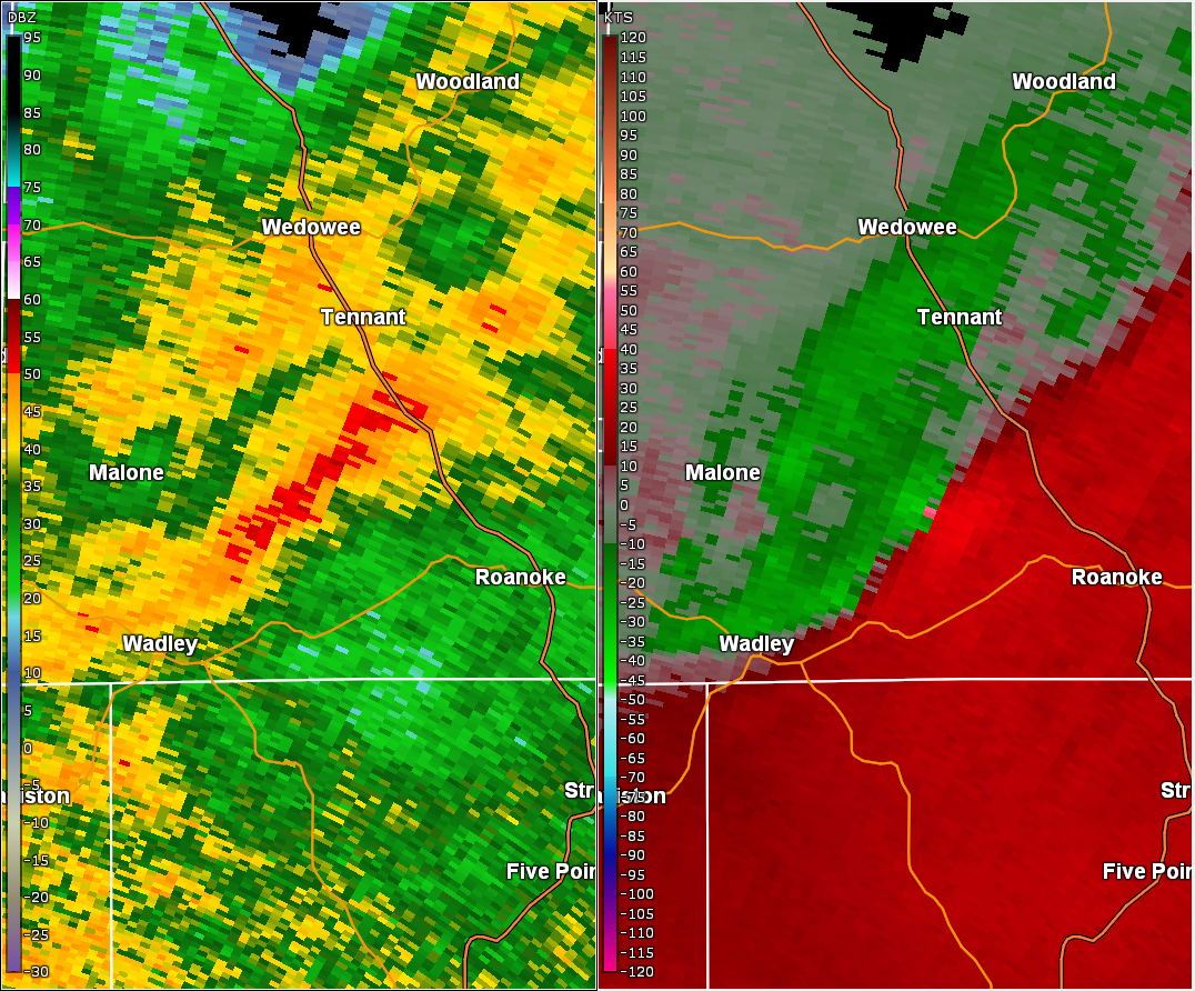
NWS Meteorologists surveyed damage near Roanoke in Randolph County and determined it was the result of a tornado.
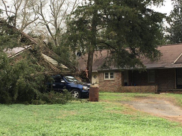
A brief EF-0 tornado moved along an eastward track just north of County Road 22 in southern Randolph County. Several metal roof panels were blown off a barn on County Road 865, with a few instances of snapped tree branches and snapped, slender pine trees noted downstream. A split tree within the city limits of Roanoke fell onto an SUV. Tree damage from the December 8th snowstorm turned out to be more prominent than the tornado damage. Special thanks to the Randolph County EMA for their assistance in this survey.
|