National Weather Service United States Department of Commerce

Demopolis (Marengo) EF-1 Tornado
December 25th, 2012

 
EF-1
Estimated Maximum Wind:
100 mph
Injuries/Fatalities:
None
Damage Path Length:
5.9 miles
Maximum Path Width:
500 yards
Approximate Start Point/Time:
32.4762/-87.8228 at 550 pm
Approximate End Point/Time:
32.5140/-87.7324 at 559 pm
 

National Weather Service meteorologists have surveyed the damage near Demopolis in Marengo County and determined that it was the result of an EF-1 tornado. The tornado touched down west of US Hwy 43 near Marengo Farms Road. The tornado tracked northeastward across US Highway 43 where it caused minor tree damage in Memorial Gardens Cemetery, Old Springhill Road and Reed Drive. The tornado continued northeastward and produced damage along Sunset Road where the strongest winds occurred. This is where 2 mobile homes were completely destroyed and multiple others that sustained minor to moderate damage. Also one church on US Hwy 80 had partial roof damage. The tornado then crossed US Hwy 80 and lifted just before crossing into Hale County. Hundreds of trees were either snapped off or were uprooted along the path.

The National Weather Service would like to thank the Marengo County Emergency Management Agency for their assistance with the storm survey


Radar Data 

Radar Image
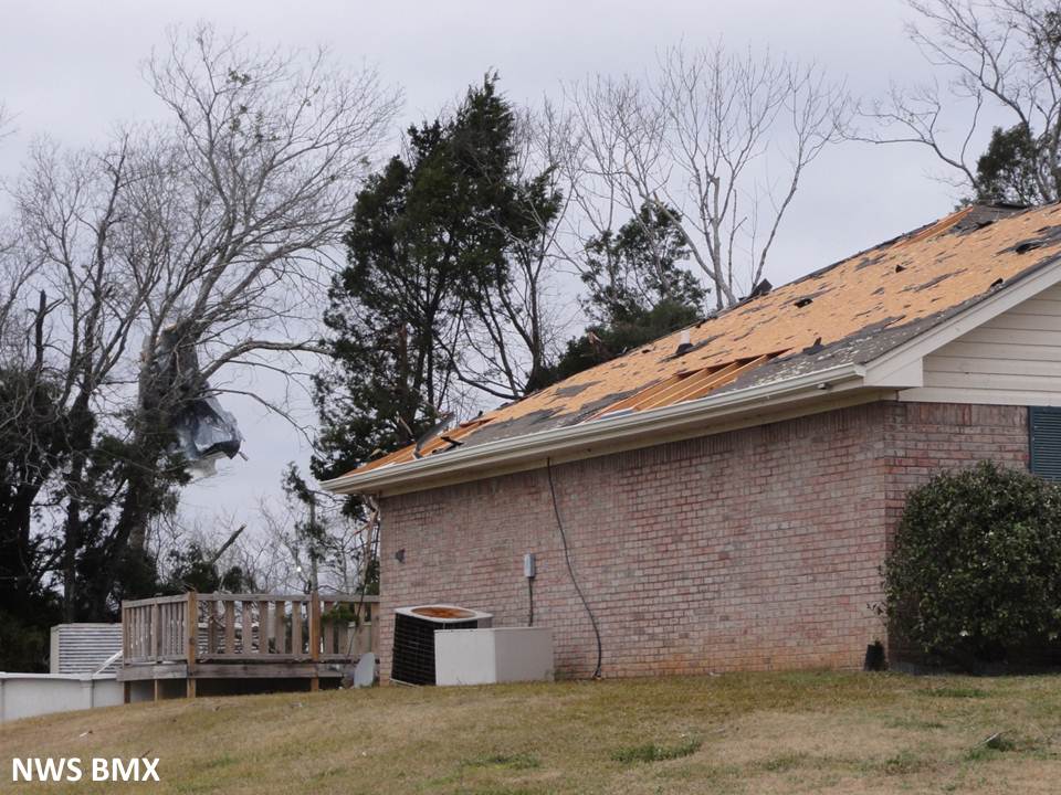
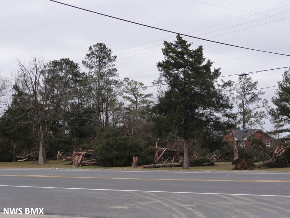
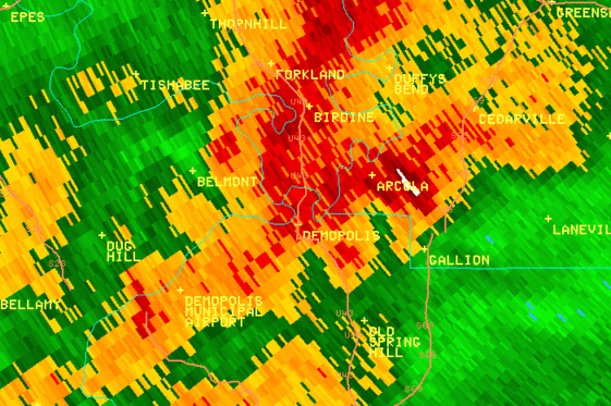
This is an image of the 0.5 degree reflectivity data from KBMX at 555 pm. In this area, the radar coverage does not allow for radar data below
5000 ft. What you are looking at here is the mesocyclone of the storm. Click to enlarge.

Radar Image
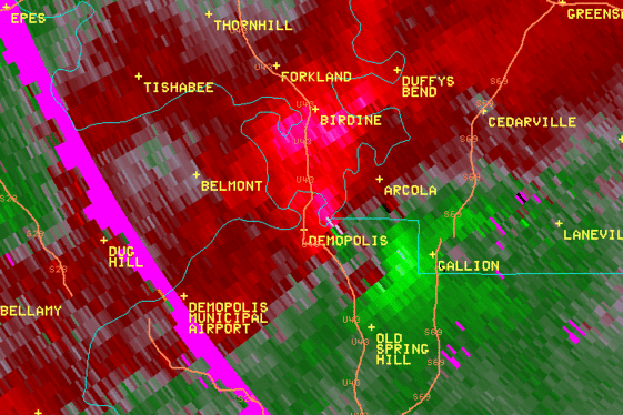
This is an image of the 0.5 degree SRM data from KBMX at 555 pm. In this area, the radar coverage does not allow for radar data below
5000 ft. What you are looking at here is the mesocyclone of the storm. Click to enlarge.

 
Damage Pictures 

Damage
Tossed mobile home

Damage
Failed mobile home anchor

Damage
Flipped mobile home

Damage
Rolled mobile home

Damage
Minor roof damage to brick home

Damage
Extensive soft wood tree damage