|
Currently on an experimental basis, the National Weather Service in Birmingham will be offering GIS data from storm surveys following severe weather events that unfold across Central Alabama. These data offer survey information from tornado tracks that are found by damage assessment teams in the field. The links below contain information for all tornadoes that have been surveyed across Central Alabama. Most information was produced and extracted from the National Weather Service Damage Assessment Toolkit, which has been developed by National Weather Service Meteorologists to modernize storm survey information into a geospatial format for the general public and GIS analysts. The information can be passed along to decision makers and the emergency management community after storm surveys have been completed. The Damage Assessment Toolkit will continue to be devloped, improved, and implemented throughout the agency.
ESRI Shapefiles: 
All Survey Shapefiles - Zipped folder contains line, path, survey point, and select estimated damage swath shapefiles of all tornado tracks that occurred in the Birmingham County Warning Area. Attribute information includes: Tornado Name, EF-Scale, Peak Wind, Start Time, Beginning and Ending Latitudes and Longitudes, End Time, and maximum width in yards. Shapefile projections are in Universal Transverse Mercator Zone 16N.
Attention GIS Analysts Using ArcGIS: Please view the metadata within ArcCatalog to view a complete description of shapefile information.
Google Earth KMZ Files: 
Tornado Survey Information KMZ - Google Earth KMZ contains all the detailed storm survey information gathered for the 4 tornadoes in the Birmingham County Warning Area. In select locations, damage photographs taken by assessment teams can also be viewed. Be advised that this information is still deemed as experimental. The information was extracted from the National Weather Service Damage Assessment Toolkit.
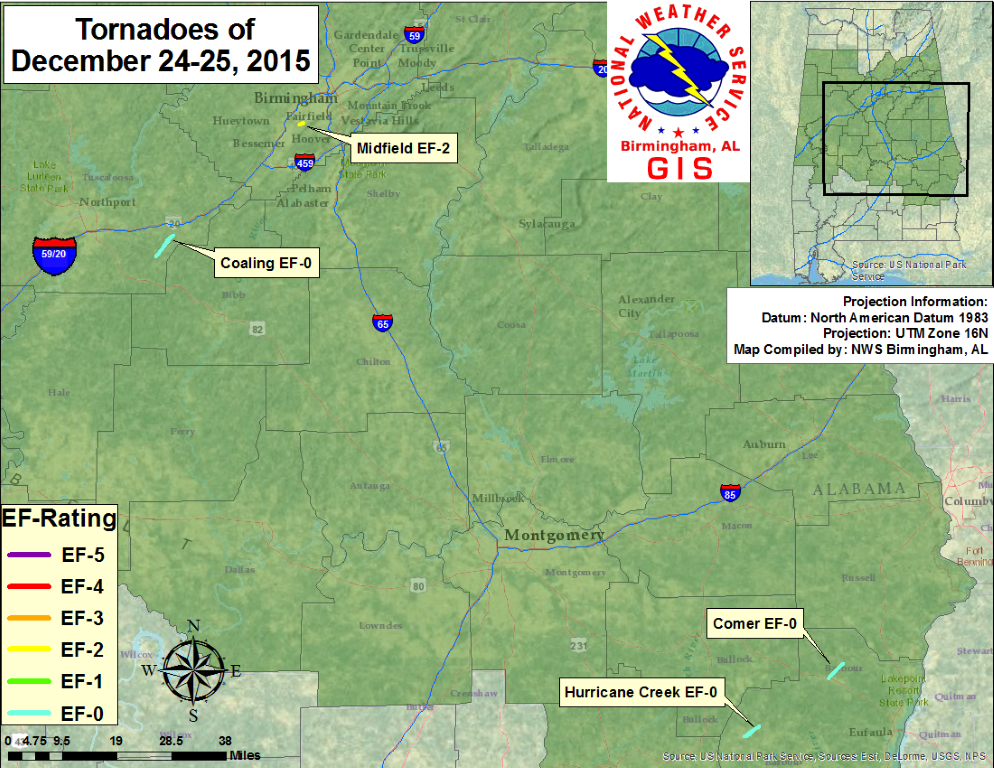
4 tornadoes have been confirmed from December 24-25, 2015 in the Birmingham County Warning Area.
|

