National Weather Service United States Department of Commerce


Historic Flooding of December 23-25, 2015
Overview Surface/Upper Air Photos
Tornadoes Rainfall Totals Videos & Other Links
 

Overview

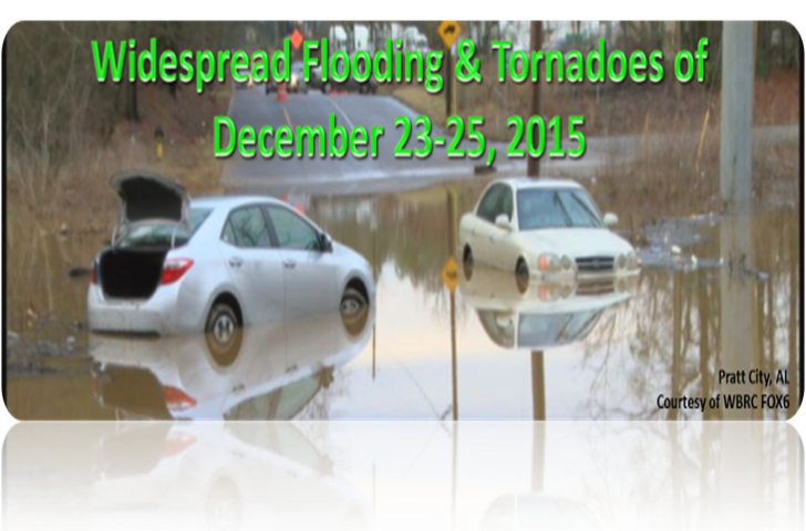
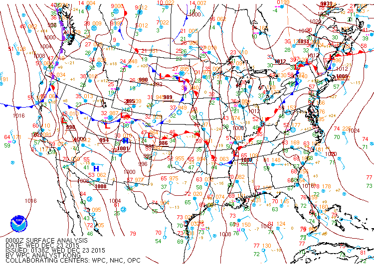
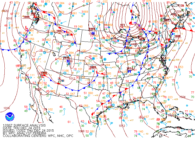
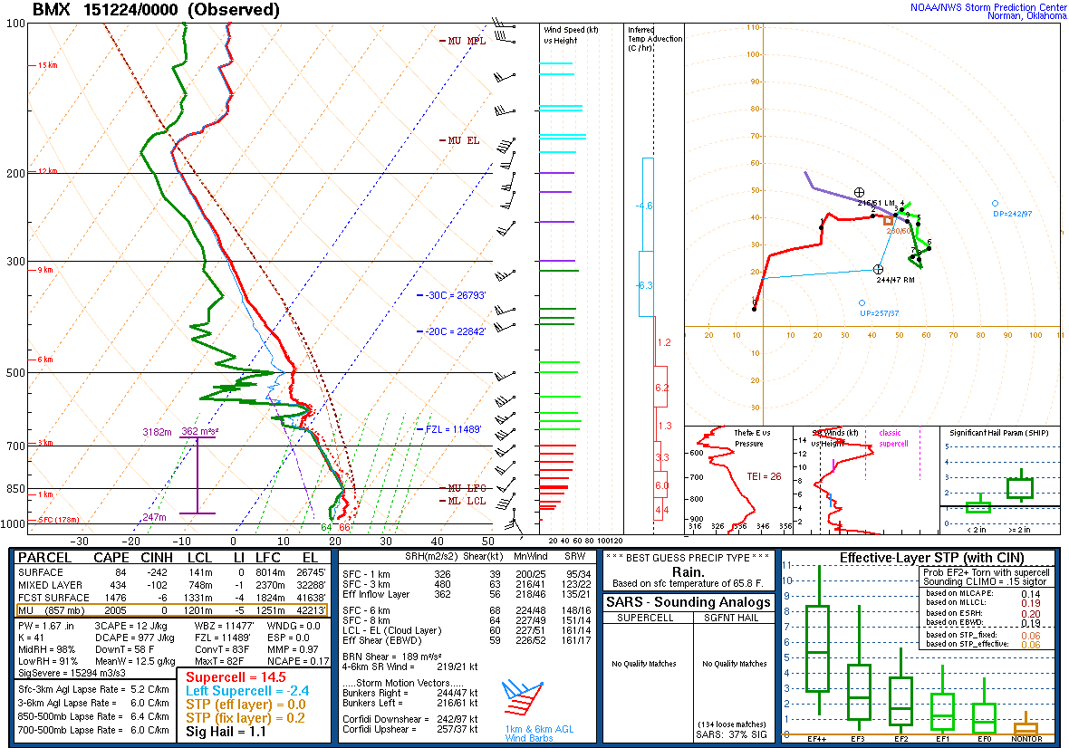
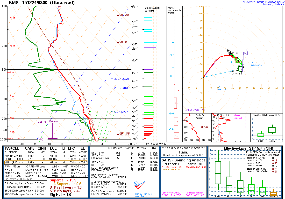
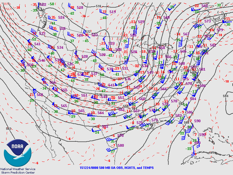
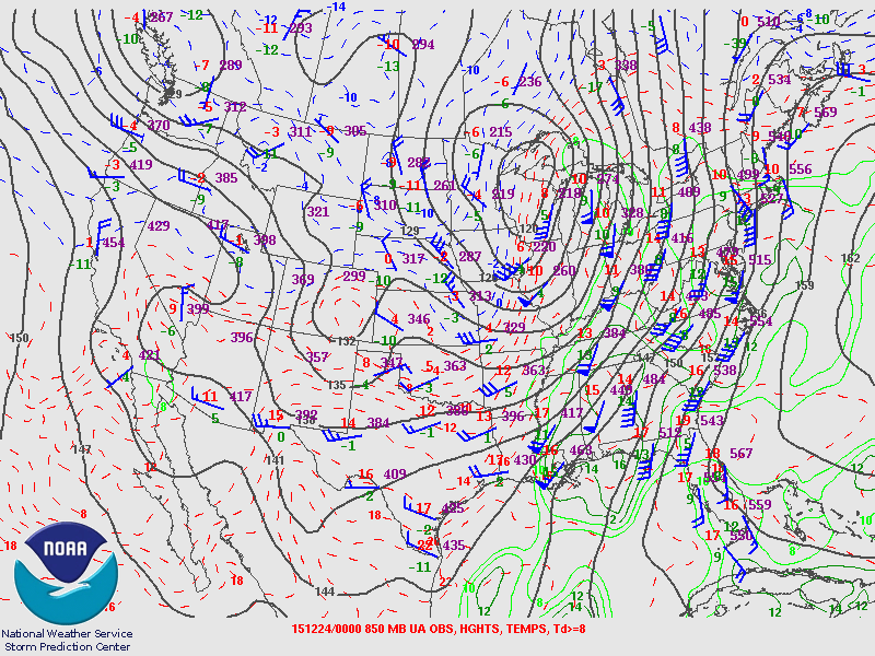
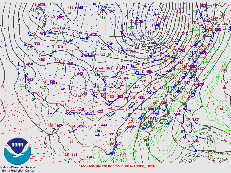
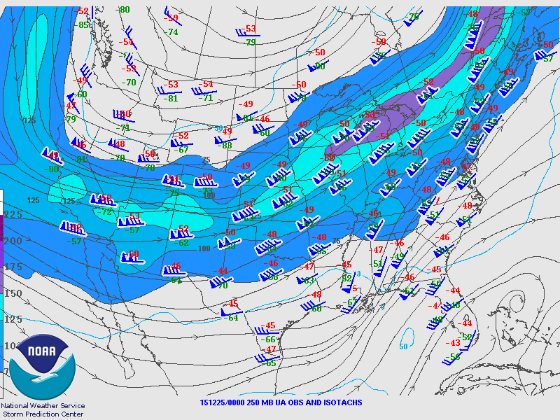
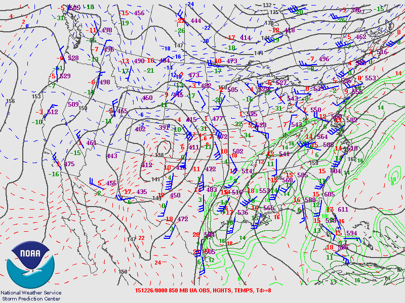
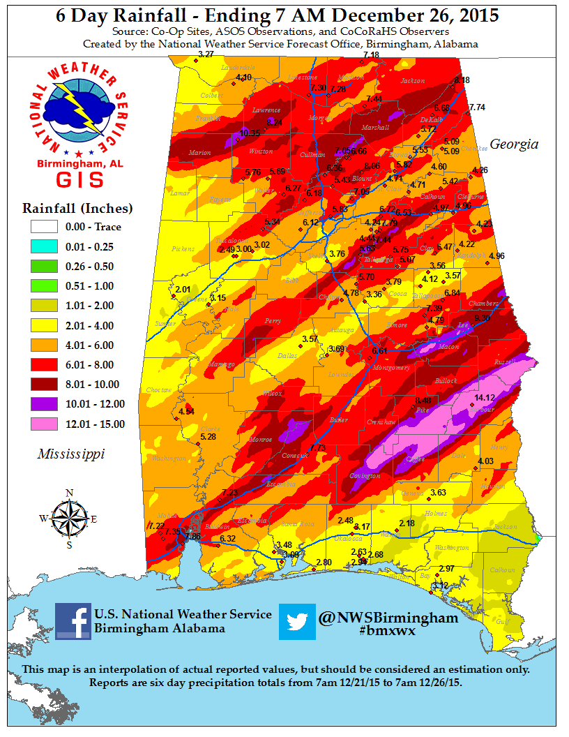
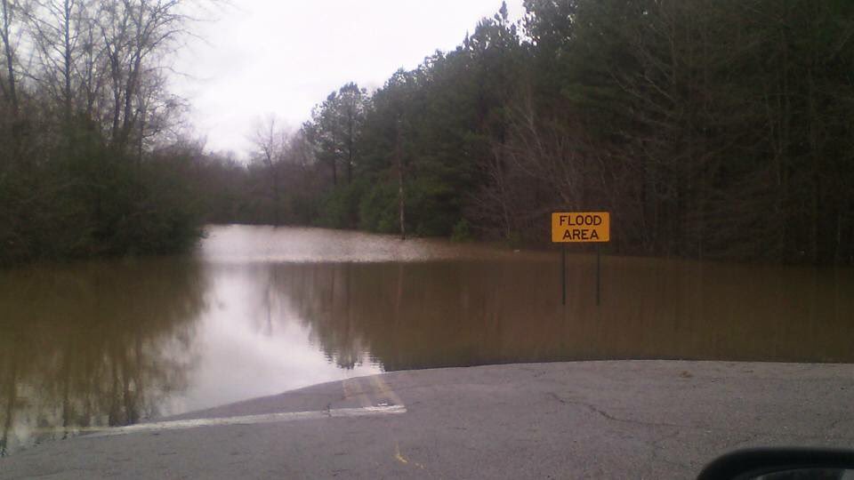
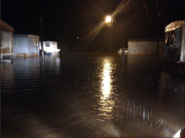
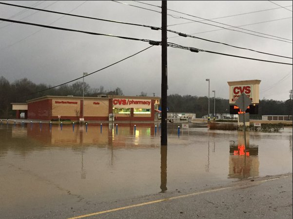
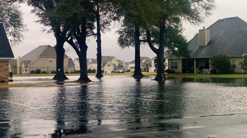
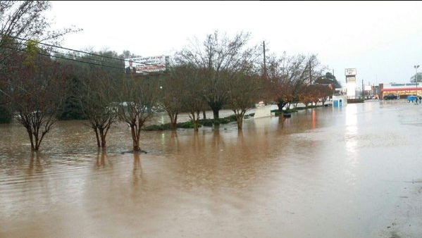
Beginning Monday, December 21st, an evolving and days-long, large-scale pattern featured a broad 500mb trough across the western U.S. and a western Atlantic surface ridge. This setup placed Alabama within a steady fetch of deep-layer moisture and warm surface air, which included near-record to record high temperatures and persistent wind shear. A surface boundary pushed southward into Central Alabama by Thursday, December 24th. Several bands of moderate to heavy rainfall and embedded storms developed south of this boundary and led to widespread flash flooding across the southeast sections of Central Alabama. From December 23rd to December 24th, many locations received 6-10 inches of rain, with localized higher amounts.

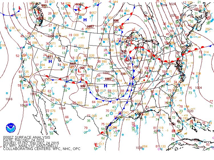
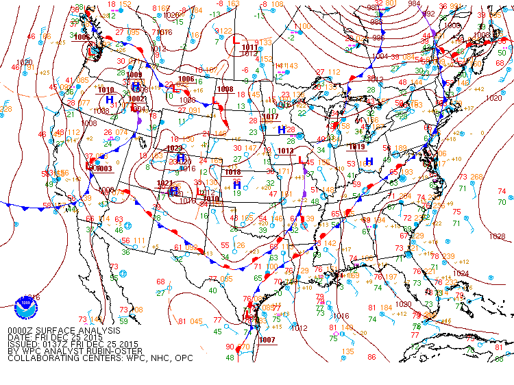
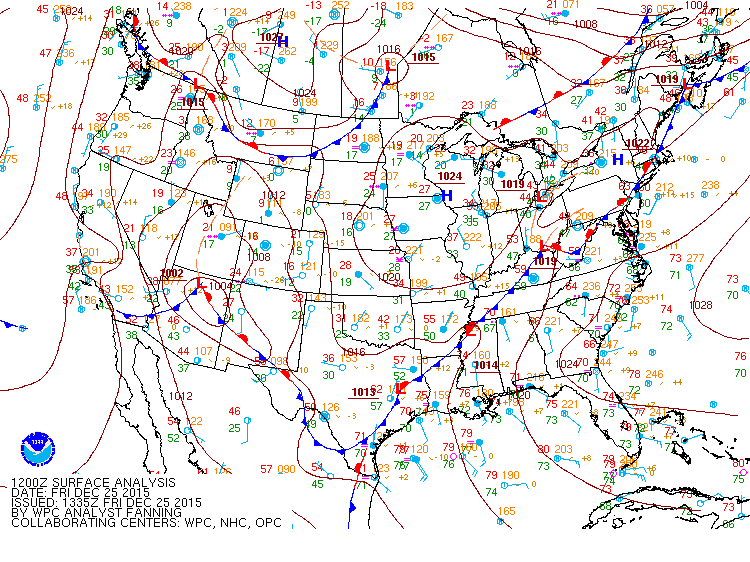
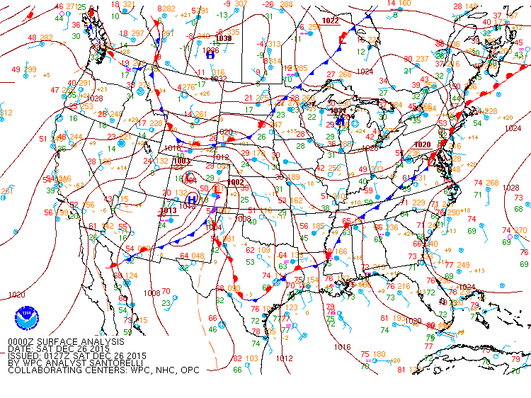
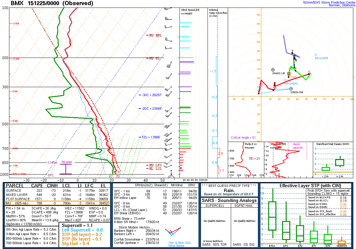
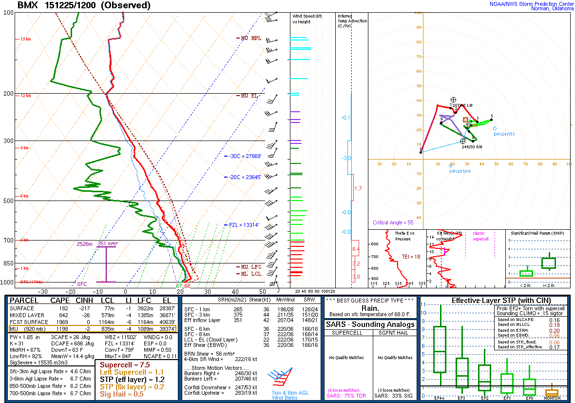
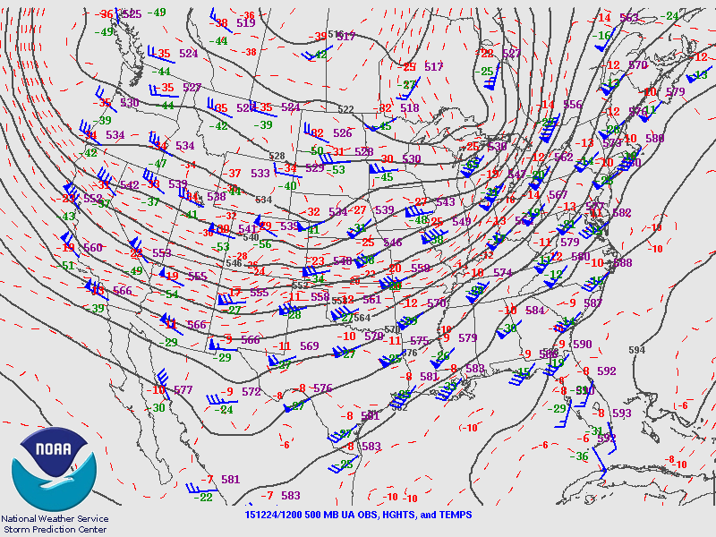
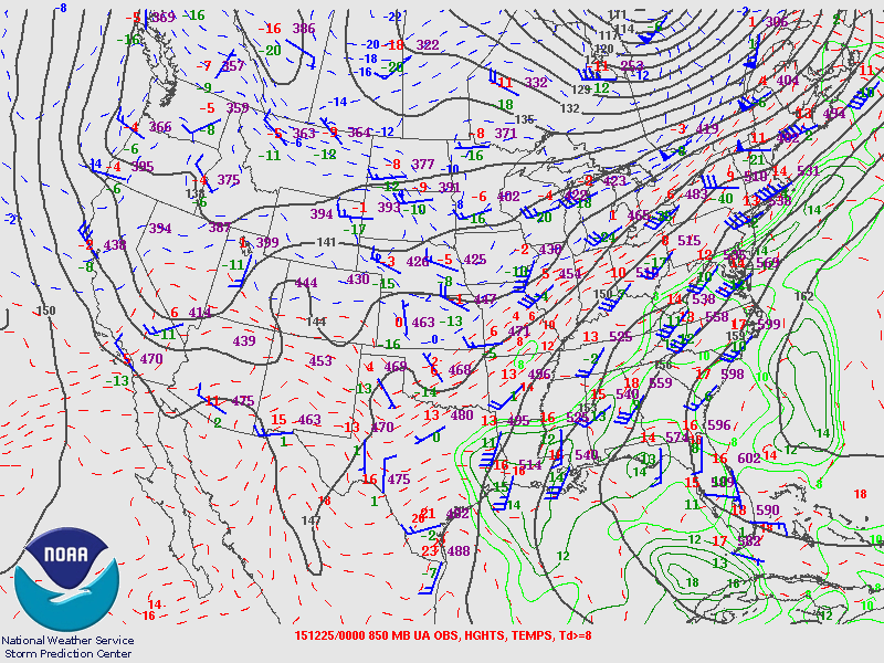
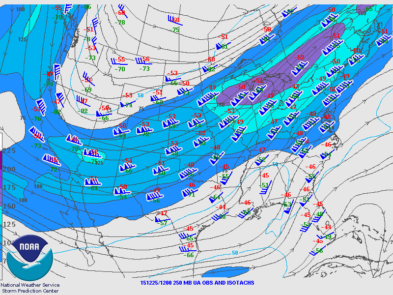
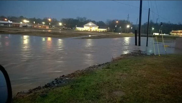
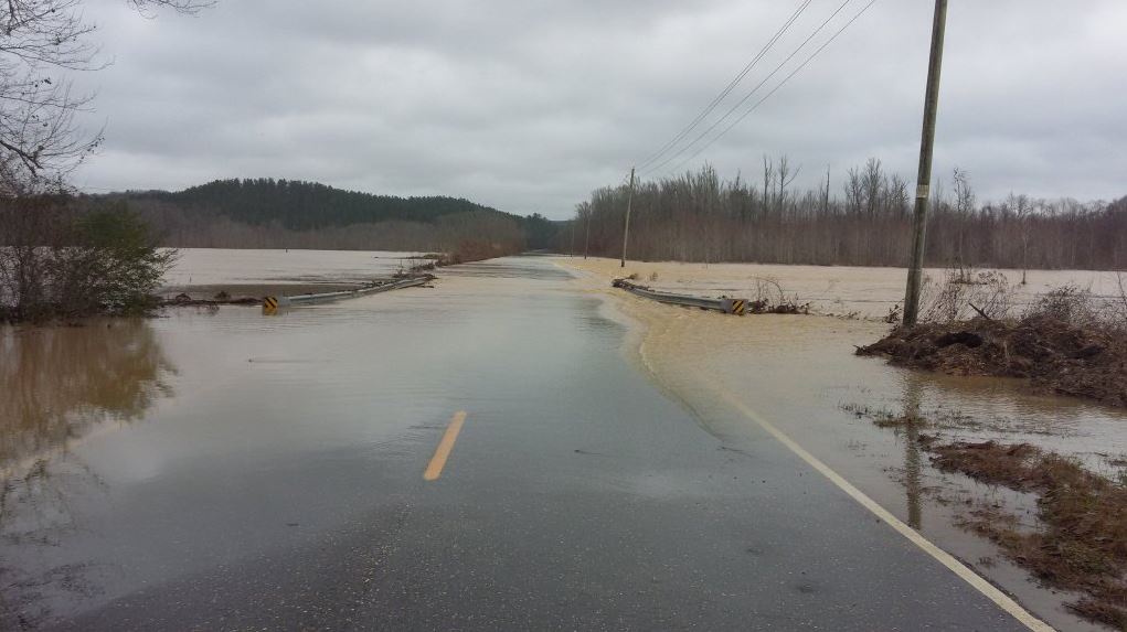
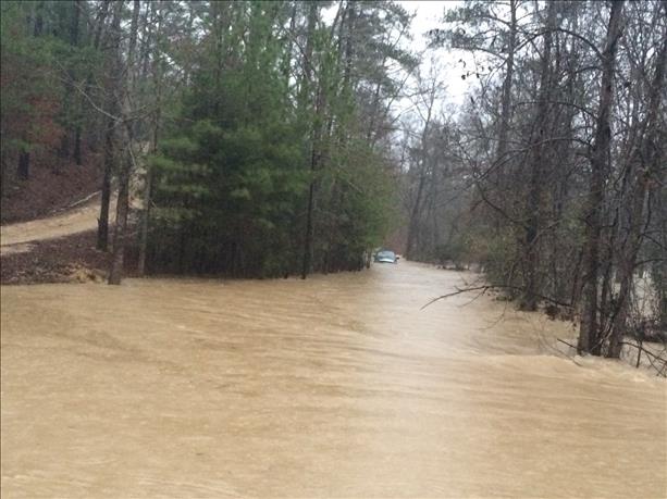
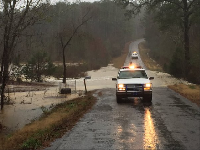
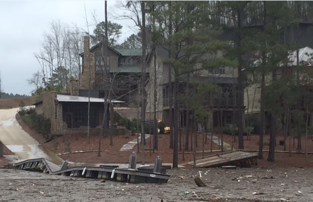
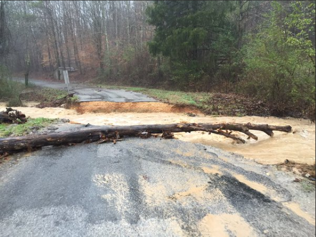
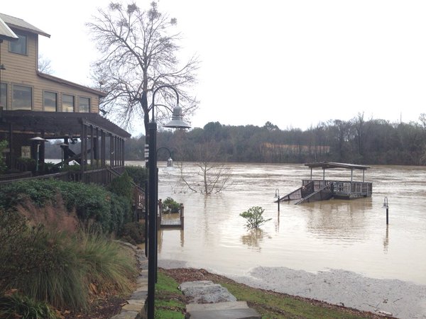
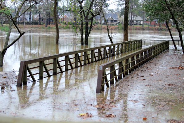
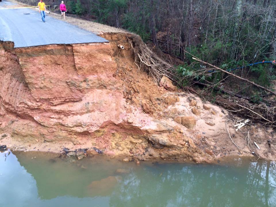
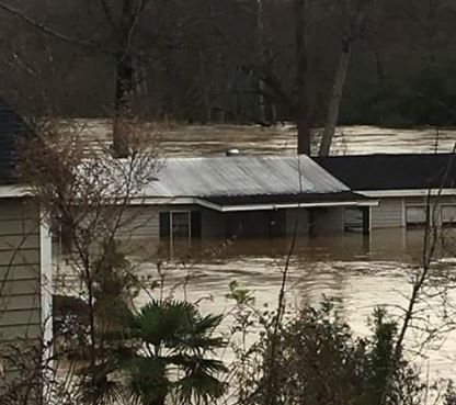
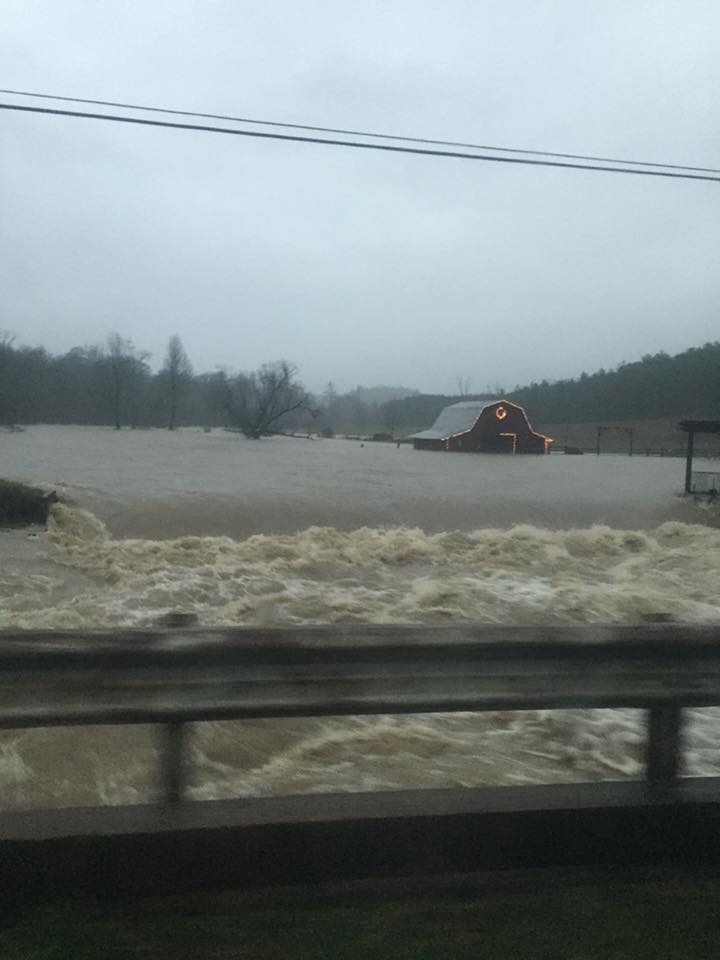
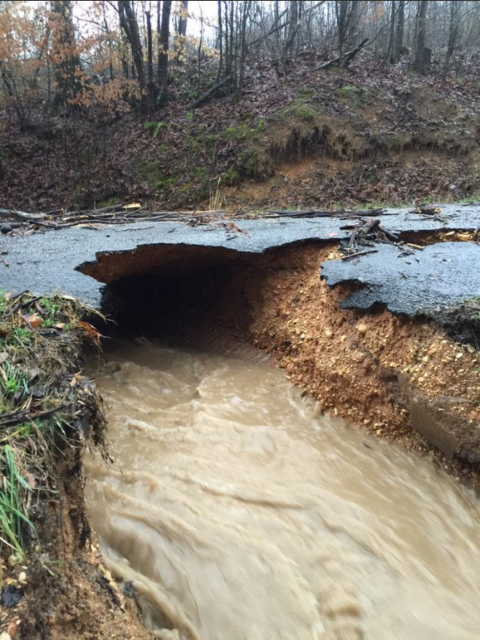
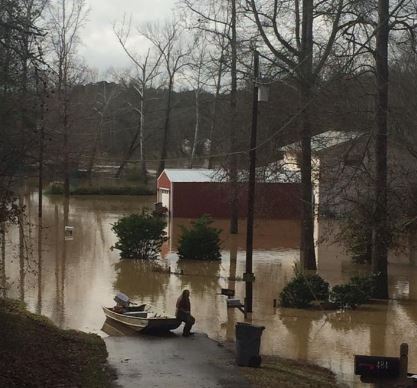
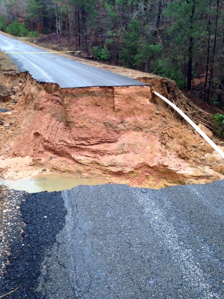
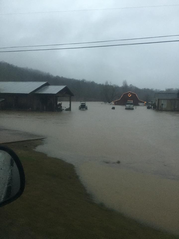
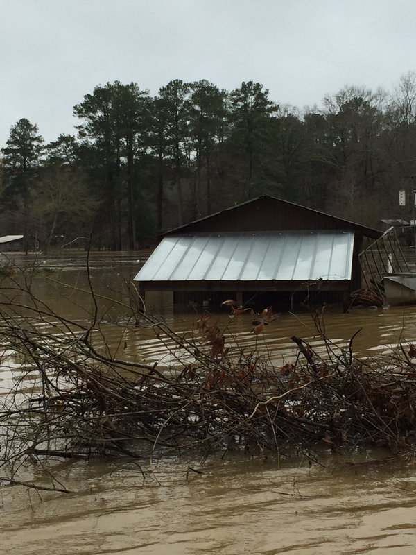
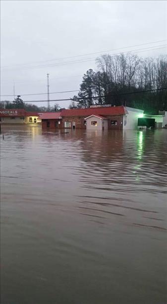
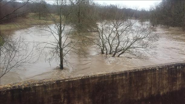
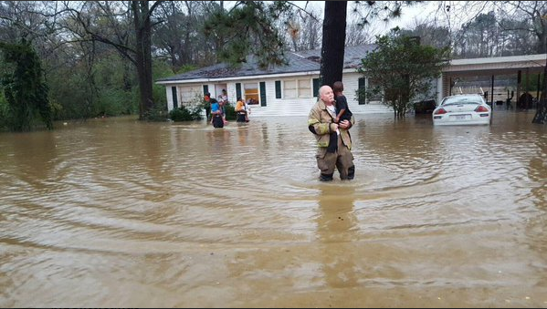
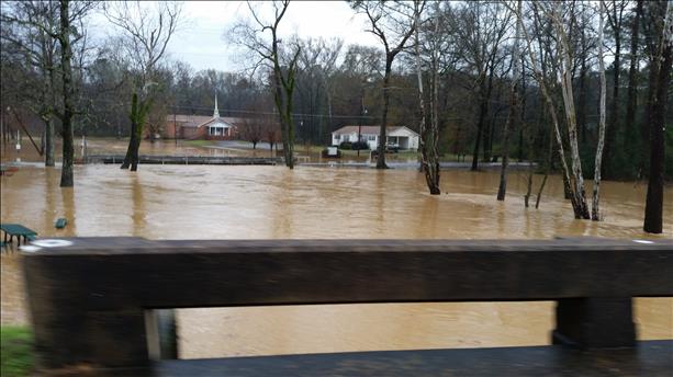
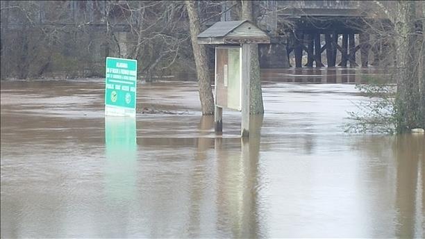
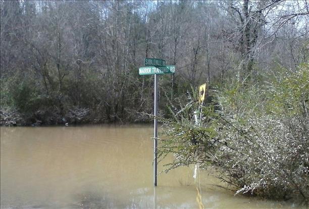
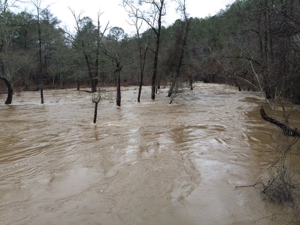
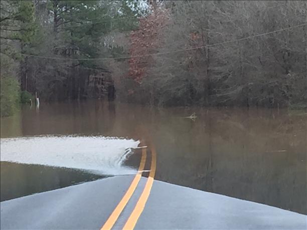
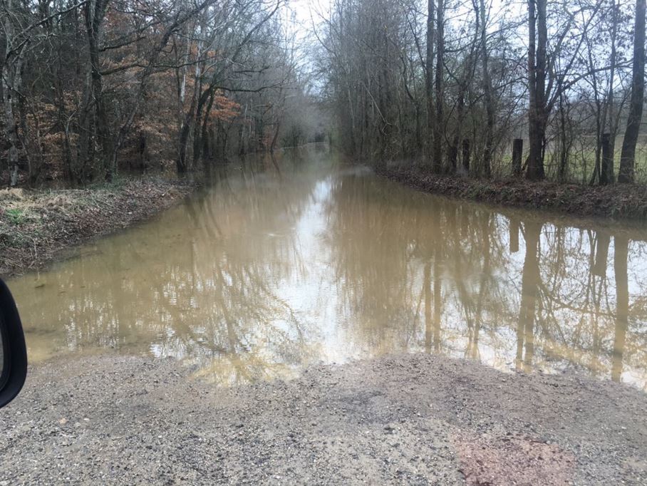
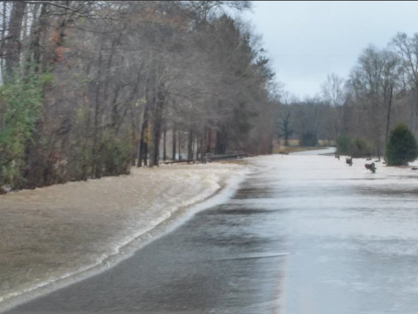
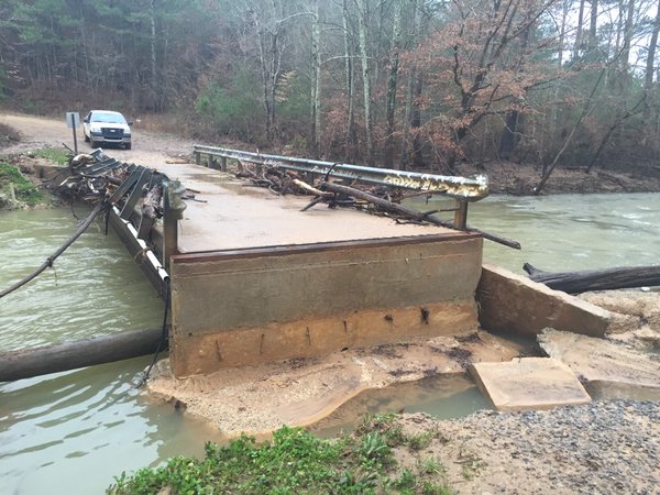
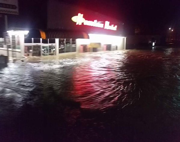
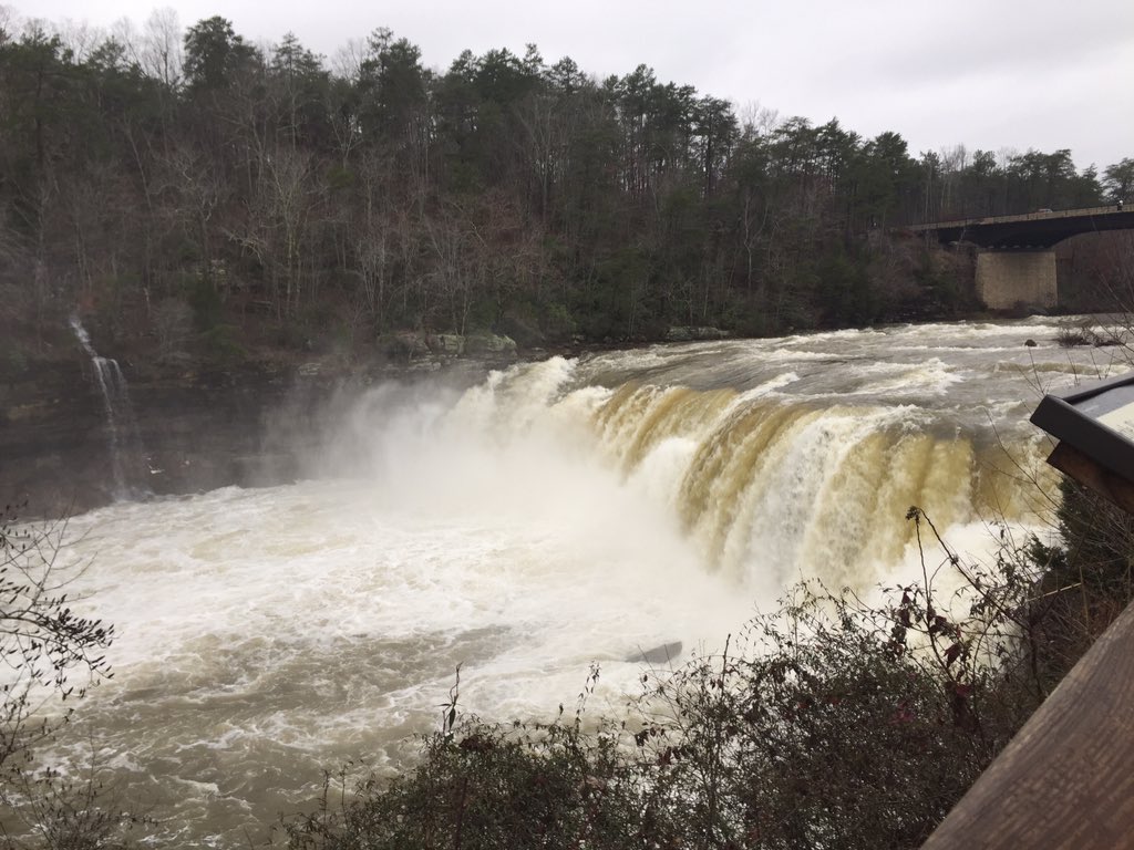
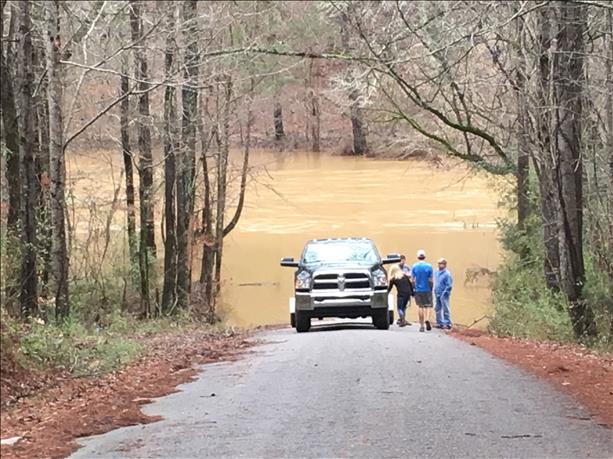
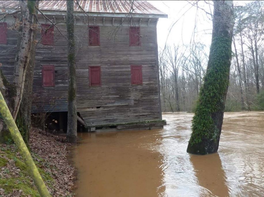
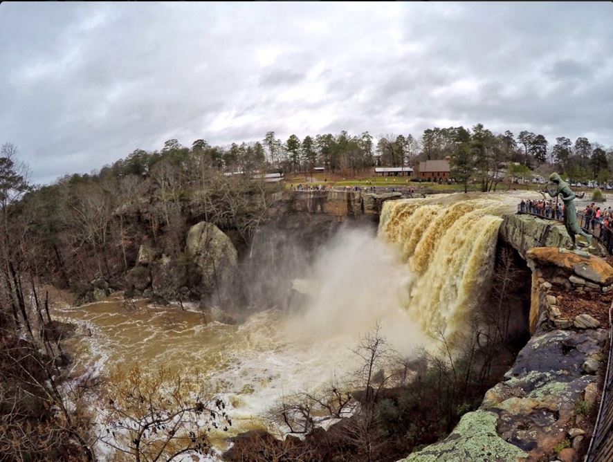
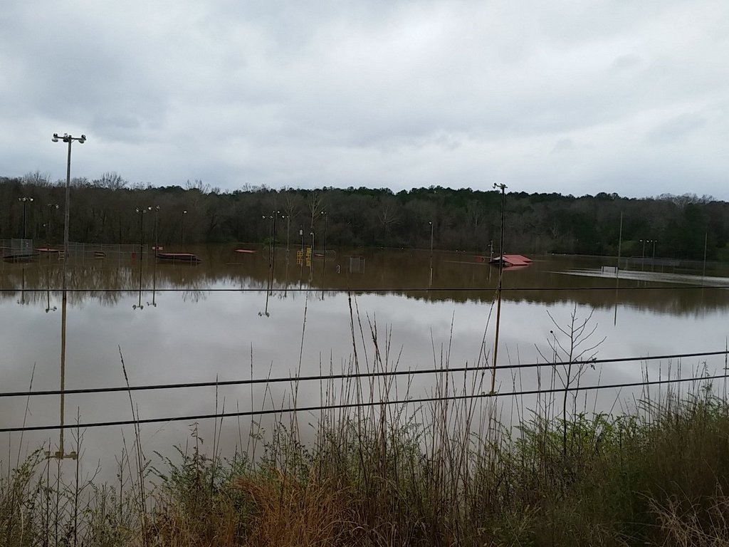
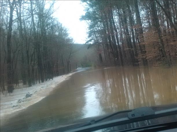
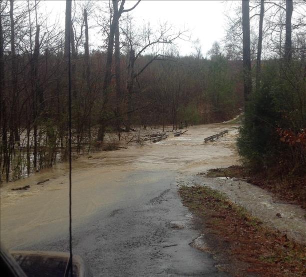
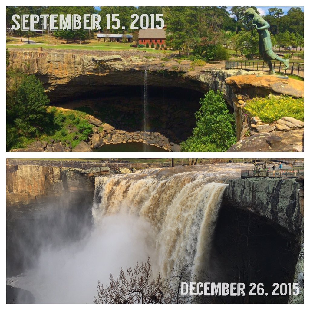
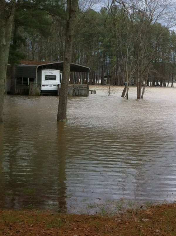
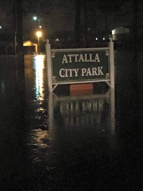
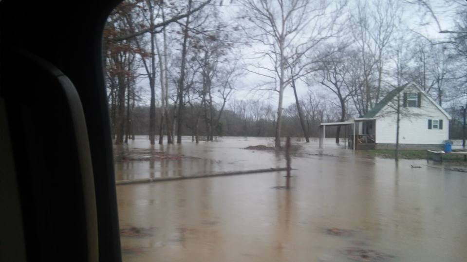
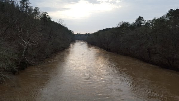
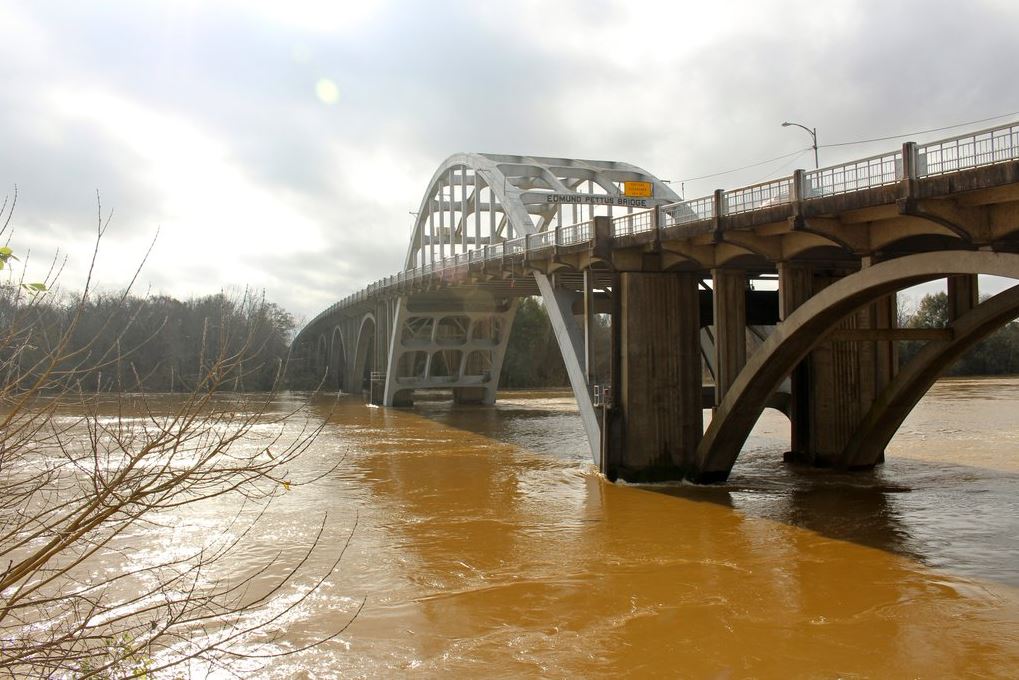
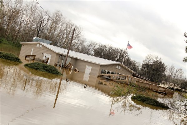
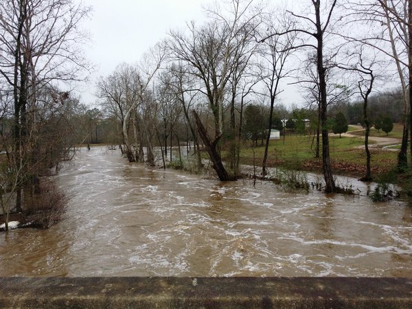
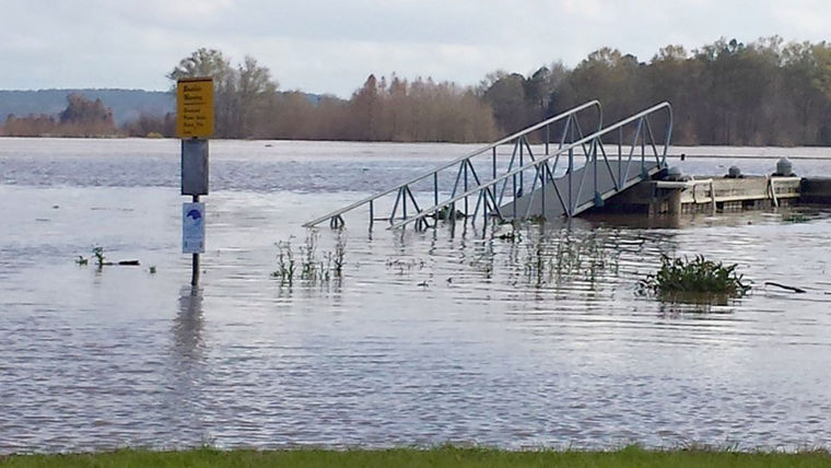
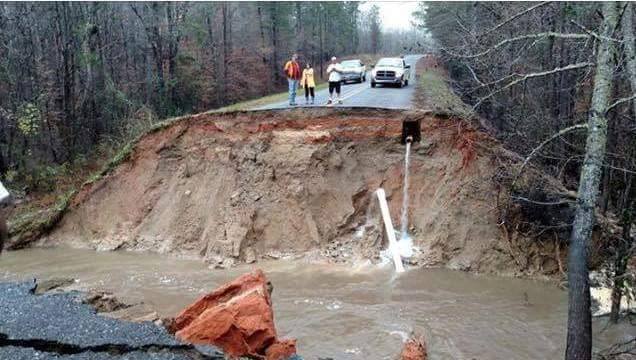
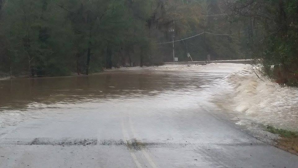
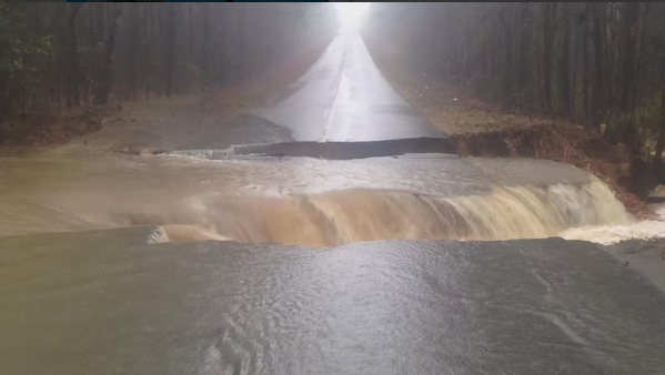
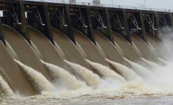
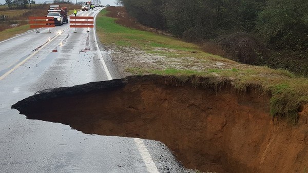
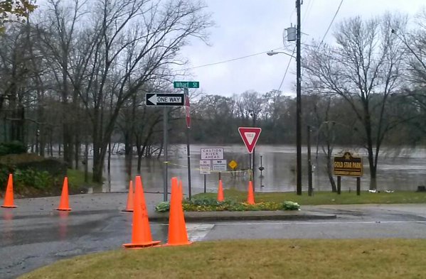
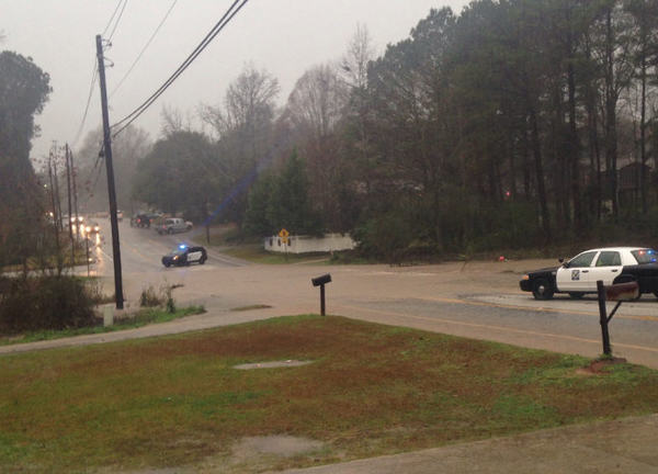
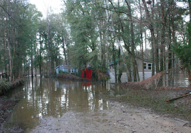
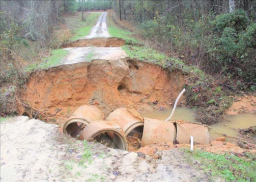
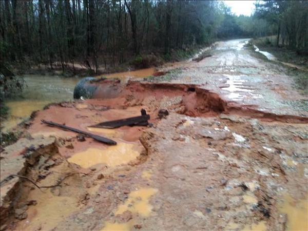
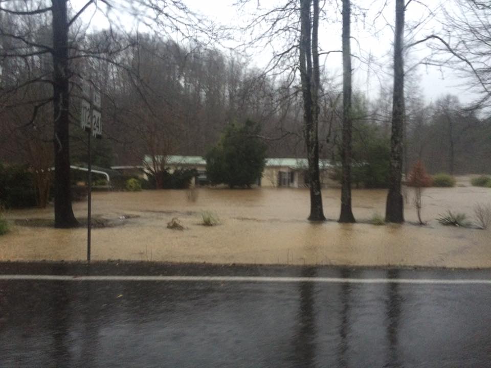
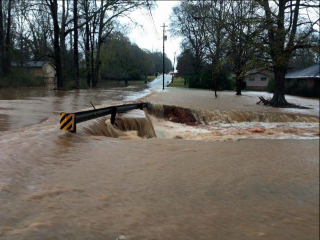
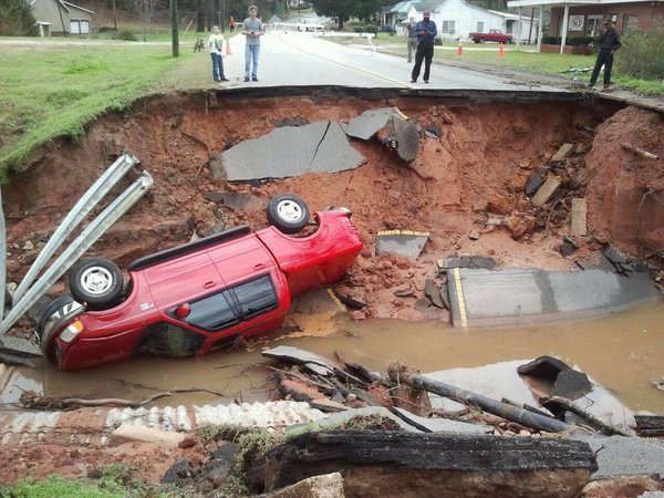
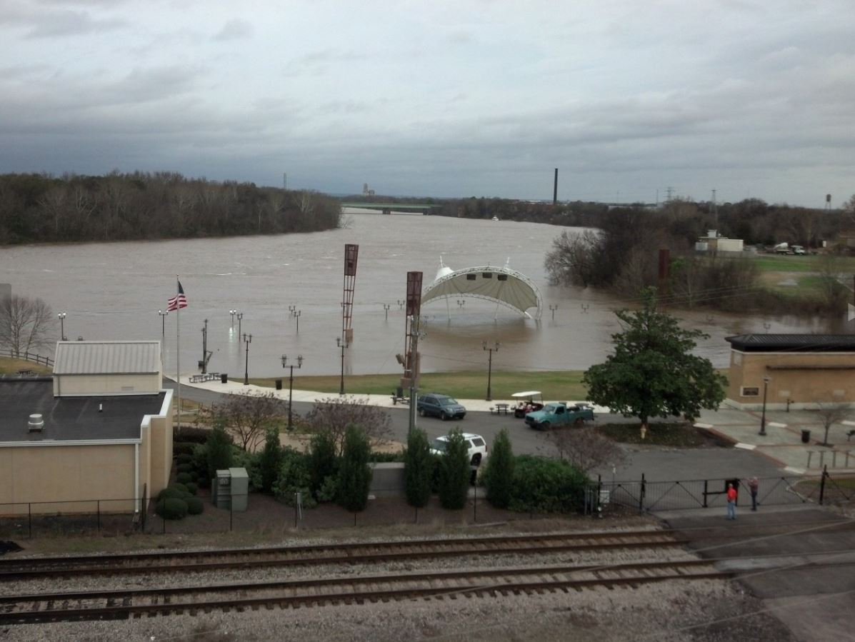
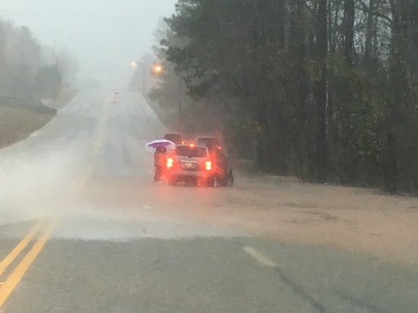
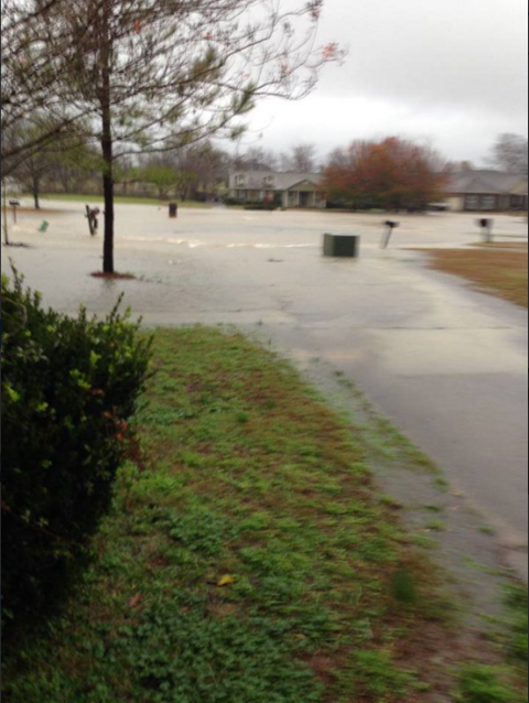
The surface boundary lifted back to the north late on Thursday, December 24th, and stalled over north Alabama on Christmas Day. With storm motions parallel to the boundary, a band of heavy rain moved over the same areas for several hours. Rainfall totals of 4-8 inches occurred over a large area. This resulted in widespread and significant flooding for locations in the northern third of Alabama. Farther south, rain rates within heavy thunderstorms, plus slow storm motions, resulted in flash flooding as well. The excessive runoff caused by the heavy rainfall led to flooding along almost every main stem river in Central Alabama, as well as numerous small creeks and streams.

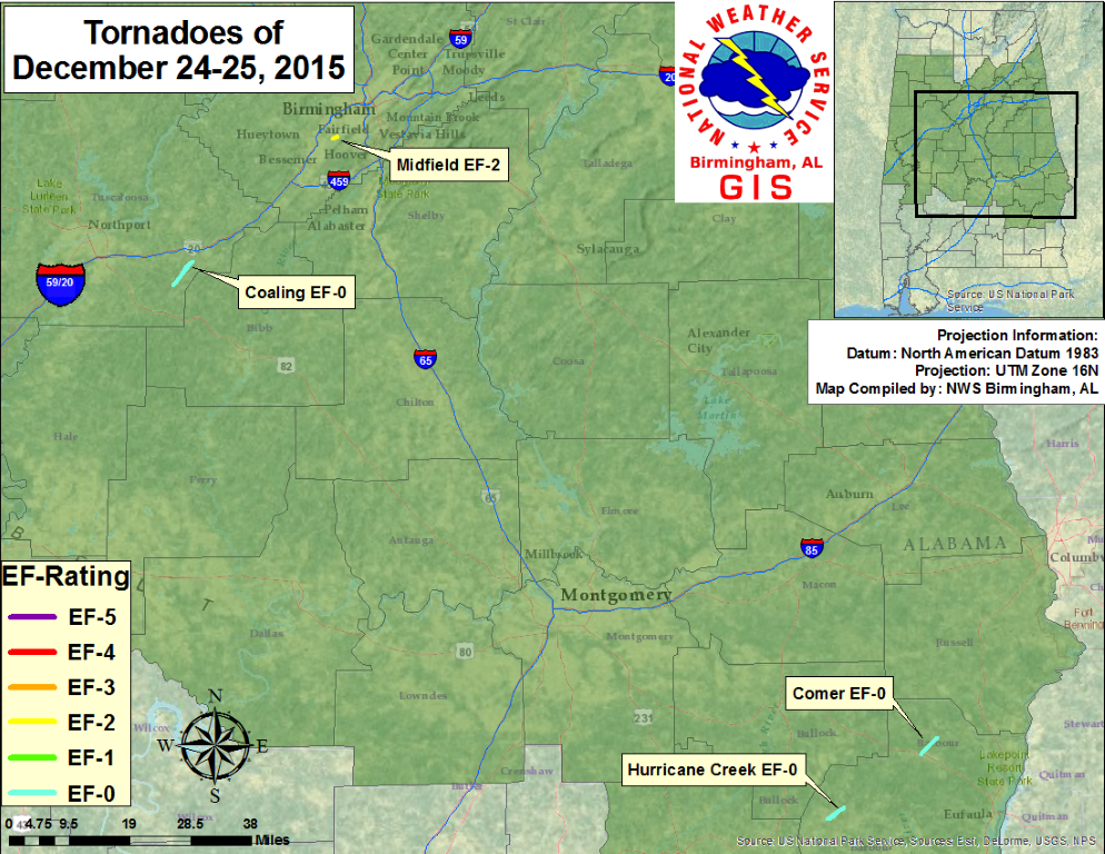
In addition to the flooding, the combination of instability and shear was conducive for a limited risk of severe thunderstorms south of the boundary during the period of December 23-25.  A couple of weak tornadoes touched down in Barbour County on the morning of December 24th. Two additional tornadoes touched down along the I-20 corridor in the late afternoon hours of December 25th...one in Tuscaloosa County and one in Jefferson County. Thunderstorm wind damage was also confirmed in Bibb County on Christmas Day.

 
Tornadoes
 December 24th, 2015 Tornadoes
Location/Clickable Detailed Summary Link
Damage Rating/Estimated Maximum Wind Speeds
Injuries/Fatalities
Damage Path Length/Width
Starting Point/Time
Ending Point/Time
Comer Tornado
(Barbour County)
EF-0
70 mph
None
3.6 miles
100 yards
32.0270/-85.3390
341 am
32.0636/-85.2953
348 am
Hurricane Creek Tornado
(Barbour County)
EF-0
70 mph
None
3.2 miles
125 yards
31.8829/-85.5918
434 am

31.9082/-85.5469
440 am

 December 25th, 2015 Tornadoes
Location/Clickable Detailed Summary Link
Damage Rating/Estimated Maximum Wind Speeds
Injuries/Fatalities
Damage Path Length/Width
Starting Point/Time
Ending Point/Time
Coaling Tornado
(Tuscaloosa County)
EF-0
75 mph
None
5.00 miles
185 yards
33.1063/-87.3473
329 pm
33.1624/-87.2933
342 pm
Midfield Tornado
(Jefferson County)
EF-2
130 mph
2 Injuries
0.92 miles
280 yards
33.4433/-86.9137
455 pm

33.4454/-86.8987
459 pm


Pertinent Geographic Information Systems (GIS) Data from this Event


Surface/Upper Air

Surface Charts

Surface Chart at 6pm Dec 22nd

6pm Dec 22nd

Surface Chart at 6am Dec 23rd

6am Dec 23rd

Surface Chart at 6pm Dec 23rd

6pm Dec 23rd

Surface Analysis at 6am Dec 24th

6am Dec 24th

Surface Analysis at 6pm Dec 24th

6pm Dec 24th

Surface Chart at 6am Dec 25th

6am Dec 25th

Surface Chart at 6pm Dec 25th

6pm Dec 25th


KBMX Upper Air Soundings

KBMX Sounding at 6pm Dec 23rd

6pm Dec 23rd

KBMX Sounding at 9pm Dec 23rd

9pm Dec 23rd

KBMX Sounding at 6pm Dec 24th

6pm Dec 24th

KBMX Sounding at 6am Dec 25th

6am Dec 25th


Upper Air Charts

250mb Chart at 6am Dec 23rd

250mb Chart at 6am Dec 23rd

500mb Chart at 6am Dec 23rd

500mb Chart at 6am Dec 23rd

850mb Chart at 6am Dec 23rd

850mb Chart at 6am Dec 23rd

250mb Chart at 6pm Dec 23rd

250mb Chart at 6pm Dec 23rd

500mb Chart at 6pm Dec 23rd

500mb Chart at 6pm Dec 23rd

850mb Chart at 6pm Dec 23rd

850mb Chart at 6pm Dec 23rd

250mb Chart at 6am Dec 24th

250mb Chart at 6am Dec 24th

500mb Chart at 6am Dec 24th

500mb Chart at 6am Dec 24th

850mb Chart at 6am Dec 24th

850mb Chart at 6am Dec 24th

250mb Chart at 6pm Dec 24th

250mb Chart at 6pm Dec 24th

500mb Chart at 6pm Dec 24th

500mb Chart at 6pm Dec 24th

850mb Chart at 6pm Dec 24th

850mb Chart at 6pm Dec 24th

250mb Chart at 6am Dec 25th

250mb Chart at 6am Dec 25th

500mb Chart at 6am Dec 25th

500mb Chart at 6am Dec 25th

850mb Chart at 6am Dec 25th

850mb Chart at 6am Dec 25th

250mb Chart at 6pm Dec 25th

250mb Chart at 6pm Dec 25th

500mb Chart at 6pm Dec 25th

500mb Chart at 6pm Dec 25th

850mb Chart at 6pm Dec 25th

850mb Chart at 6pm Dec 25th

 
Rainfall Totals
 
Preliminary Snowfall Totals

For an interactive map, click here.

 
Flooding Photos (River & Flash Flood)
 

Northwest Flooding

Macedonia
Courtesy of @WalkerCoALWX

Guin
Courtesy of Derick Stidham

Pratt City
Courtesy of WBRC Fox 6

North Lamar County
Courtesy of @jkhankins

Black Warrior River - Tuscaloosa
Courtesy of Michael Shaw

Hamilton
Courtesy of WBRC viewer

Haleyville
Courtesy of Karl Stern

Crooked Creek - Smith Lake
Courtesy of Samuel Dodd

Hackleburg
Courtesy of Tyler Norton

Black Warrior River - Tuscaloosa
Courtesy of Jennifer Parker

Tuscaloosa River Walk
Courtesy of Chris Miller

Winston County
Courtesy of Hal Jones

Sipsey
Courtesy of Crystal Willingham

Hamilton
Courtesy of Donielle Taylor

Hackleburg
Courtesy of Tyler Norton

Black Warrior River - Walker Co
Courtesy of Ashley Kornegay

Smith Laek Duncan Bridge
Courtesy of @WalkerCoALWX

Black Pond - Winston Co
Courtesy of Patrick Rice

Hamilton
Courtesy of Donielle Taylor

Black Warrior River - Birmingport
Courtesy of Clay Burton

Haleyville
Courtesy of Kim Hulsey

Curry
Courtesy of WBRC viewer


Northeast Flooding

Locust Fork
Courtesy of WBRC viewer

Noccalula Falls
Courtesy of Pat Bentley

Irondale
Courtesy of WBRC Fox 6

Wilsonville
Courtesy of Jason ingram

Eastaboga
Courtesy of WBRC viewer

Coosa River - Childersburg
Courtesy of WBRC viewer

Trafford
Courtesy of WBRC viewer

Shades Creek
Courtesy of @DStignani

Ashville
Courtesy of WBRC viewer

Cold Branch - Blount County
Courtesy of @Lindsey_Arlene1

Columbiana
Courtesy of Lance Brown

Blount Springs
Courtesy of Allen Armstrong

Blountsville
Courtesy of Christian Mejia

Columbiana
Courtesy of Jane McDaniel

Oneonta
Courtesy of Jeff Griffin

Little River Canyon Falls
Courtesy of Dana Grimes Brewis

Nectar
Courtesy of WBRC viewer

Clear Creek - Logan Martin
Courtesy of WBRC viewer

Lakeside Landing - Logan Martin
Courtesy of Pam Owens Knight

Kymulga Grist Mill
Courtesy of @ATLBravesAddict

Noccalula Falls
Courtesy of Jake Evans

Ohatchee
Courtesy of @MastaBlastya

Springville
Courtesy of WBRC viewer

Summit (Blountsville)
Courtesy of WBRC viewer

Noccalula Falls
Courtesy of Joey Amberson

Cedar Bluff
Courtesy of Mitzi Eaker

Attalla
Courtesy of WBRC viewer


Southwest Flooding

Selma
Courtesy of Justin Averette

Lake Mitchell Dam
Courtesy of Charla Harris

Moundville
Courtesy of Temekia Beard

Cahaba River - West Blocton
Courtesy of Dave Jones

Selma
Courtesy of Justin Averette

Selma
Courtesy of Justin Averette

Yellow Leaf Creek - Chilton Co
Courtesy of Michael Ray


Southeast Flooding

Lakepoint State Park - Eufaula
Courtesy of Eufaula Tribune

Eclectic
Courtesy of anonymous

Fort Mitchell
Courtesy of Candy Muncy Poole

Bear Creek (Barbour Co)
Courtesy of David Logan

Macon County
Courtesy of Adam Broach

Lay Dam
Courtesy of Michael Ray

Lanett
Courtesy of East AL Skywarn

Tanyard (Bullock Co)
Courtesy of Bullock Co EMA

Gold Star Park - Wetumpka
Courtesy of WAKA

Auburn
Courtesy of Auburn Plainsman

Auburn
Courtesy of WSFA

Bear Creek (Barbour Co)
Courtesy of Bear Creek Police Dept

Eufaula
Courtesy of Eufaula Tribune

Bullock County
Courtesy of Leslie Adams

Brundidge
Courtesy of WSFA viewer

Bear Creek
Courtesy of Shane Whitten

Lanett
Courtesy of Shawn Reynolds

Lanett
Courtesy of Valerie Gray

Montgomery
Courtesy of al.com

Auburn
Courtesy of Cheryl Gainer McCall

Pike Road (Montgomery)
Courtesy of WAKA viewer

Montgomery
Courtesy of WSFA viewer


Videos

Aerial View of Flooding in Blount County. Courtesy of Corey Scogin.

Aerial View of Midfield Tornado Damage. Courtesy of Kevin Henderson.


Other Links

NWS Huntsville
NWS Jackson, MS
NWS Nashville