NWS Birmingham, Alabama
Weather Forecast Office
Choccolocco Tornado - Calhoun County
August 25th, 2008
|
Rating:
(Click for EF Scale) |
EF-1
|
|
Estimated Maximum Wind:
|
90 - 100 MPH
|
|
Injuries/Fatalities:
|
None
|
|
Damage Path Length:
|
1.1 Miles
|
|
Maximum Path Width:
|
250 Yards
|
|
Approximate Start Point:
|
33.68/-85.69 at 12:19 PM
|
|
Approximate End Point:
|
33.70/-85.70 at 12:20 PM
|
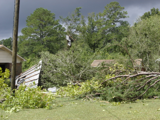
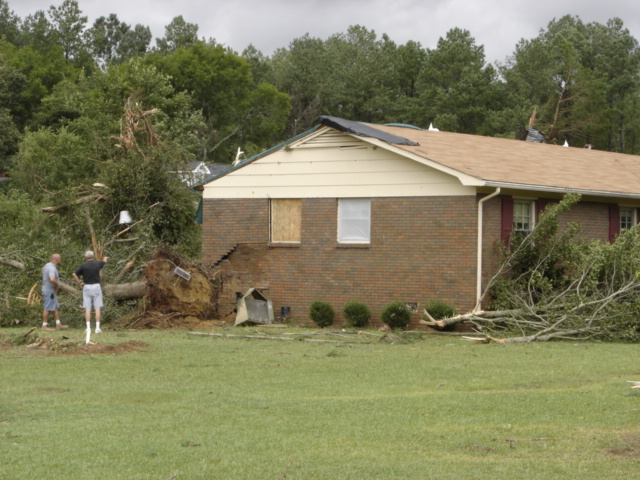
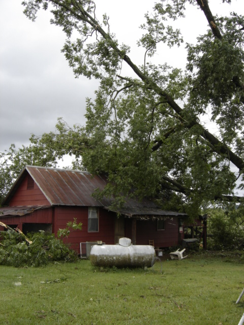
A National Weather Service damage assessment team surveyed the storm damage in Calhoun County. It was determined that the damage was the result of a tornado. The tornado was rated an EF-1 on the Enhanced Fujita scale. Damage estimates were consistent with winds between 90 and 100 MPH. The total tornado damage path was 1.1 miles long and was 250 yards wide at its widest point.
The tornado touched down on Cross Creek Road, just east of Choccolocco Road and then moved north-northwestward, roughly parallel to Choccolocco Road. It lifted near the intersection of Choccolocco Road and Cobb Road. One auto shop was destroyed, and two houses sustained moderate damage. Additionally, one home suffered light damage, and 50 to 100 trees were snapped off or were uprooted along the path.
Damage Photos
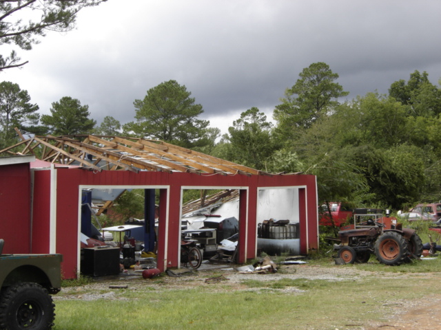
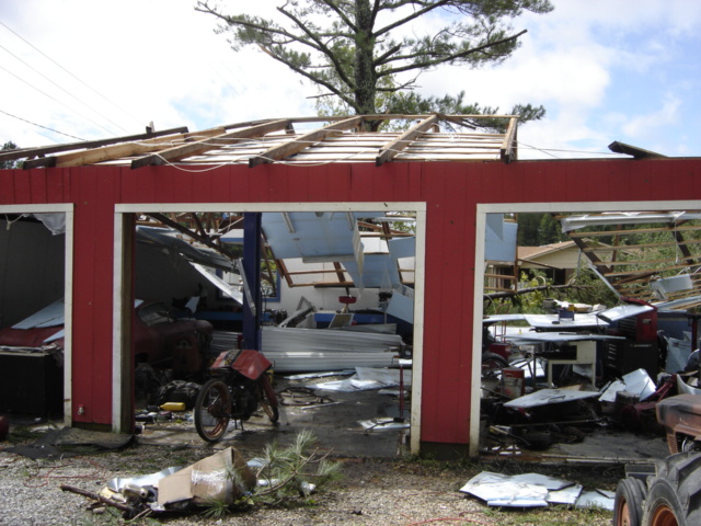
Structure Damage Structure Damage Tree & Structure Damage
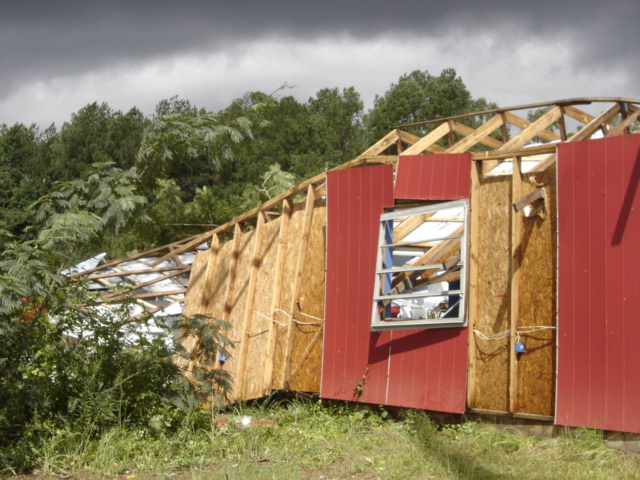
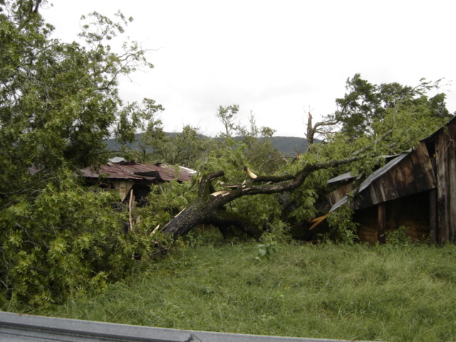
Structure Damage Home Damage Tree Damage
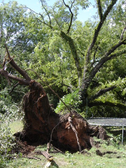
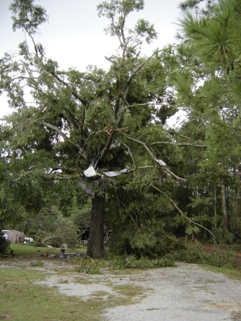
Tree Uprooted Tree Damage Tree Damage
Current Hazards
National Outlooks
Tropical
Local Storm Reports
Public Information Statement
Graphical Hazardous Weather Outlook
Current Conditions
Regional Weather Roundup
Rivers and Lakes
Drought Monitor
Forecasts
Graphical Forecasts
Forecast Discussion
Air Quality
Fire Weather
Aviation Weather
Climate and Past Weather
Past Events
Storm Data
Tornado Database
Daily Rainfall Plots
Tropical Cyclone Reports
Monthly Climate
Annual Climate
Warnings and Other Products
Tornado Warnings
Severe Thunderstorm Warnings
Flash Flood Warnings
Winter Weather Warnings
Special Weather Statements
Non-Precipitation Warnings
Flood/River Flood Warnings
Productos en Español
Conciencia y Preparación
Previsión de 7 Días
Weather Safety
NOAA Weather Radio
Severe Weather Preparedness
Severe Safety Rules
Tornado Safety Rules
Severe Safety w/ ASL
Awareness Weeks
Severe Weather
Hurricane Preparedness
Summer Safety Campaign
Winter Weather
US Dept of Commerce
National Oceanic and Atmospheric Administration
National Weather Service
NWS Birmingham, Alabama
465 Weathervane Road
Calera, AL 35040
205-664-3010
Comments? Questions? Please Contact Us.

