Needmore Tornado - Pike County
August 25th, 2008
|
Rating:
(Click for EF Scale) |
EF-0
|
|
Estimated Maximum Wind:
|
75 MPH
|
|
Injuries/Fatalities:
|
None
|
|
Damage Path Length:
|
0.45 of a Mile
|
|
Maximum Path Width:
|
75 Yards
|
|
Approximate Start Point:
|
31.85/-85.95 at 8:18 AM
|
|
Approximate End Point:
|
31.86/-85.95 at 8:19 AM
|
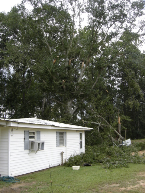
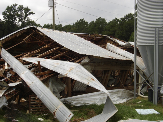
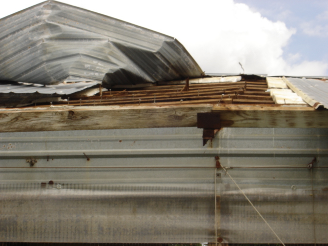
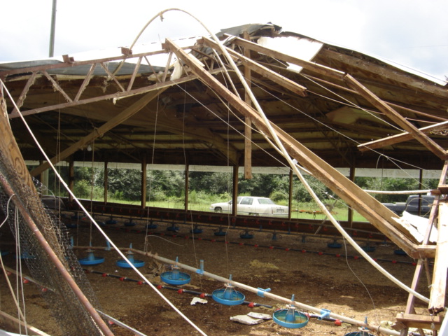
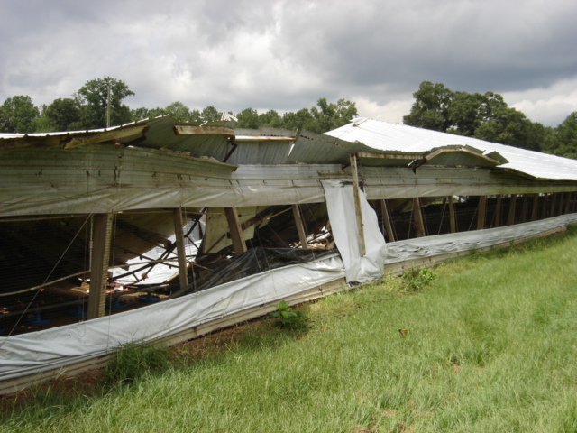
A National Weather Service damage assessment team has surveyed the storm damage in Pike County. It was determined the damage was the result of a tornado. The tornado was rated an EF-0 on the Enhanced Fujita scale. Damage estimates were consistent with winds around 75 MPH. The total tornado damage path was 0.5 of a mile long and was 75 yards wide at its widest point.
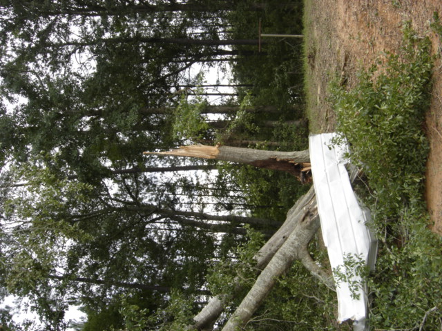
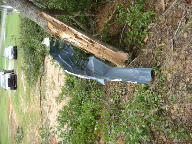
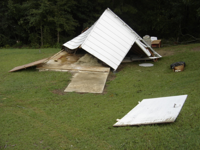
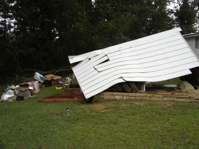
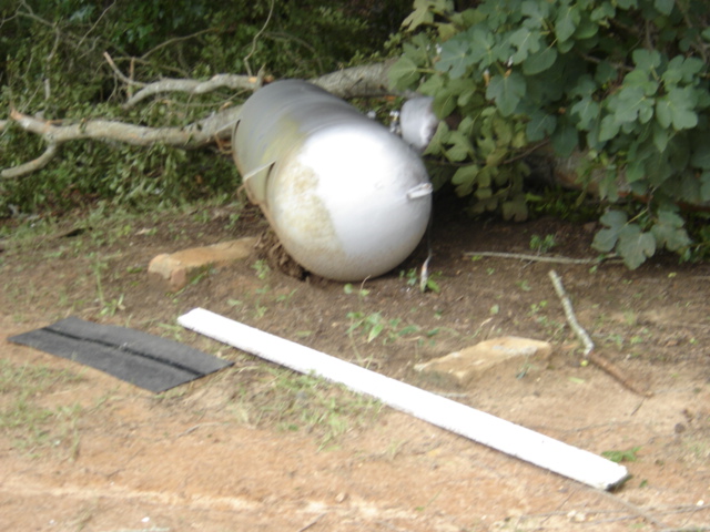
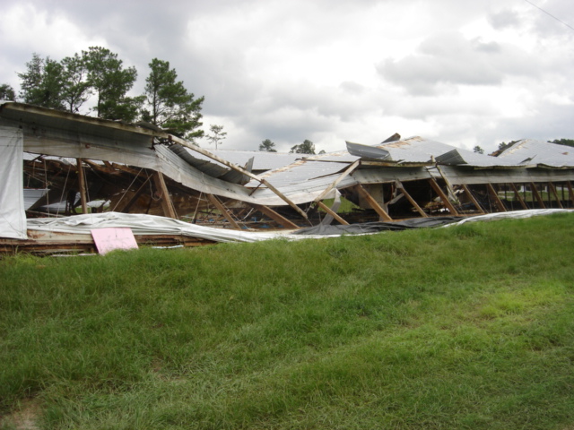
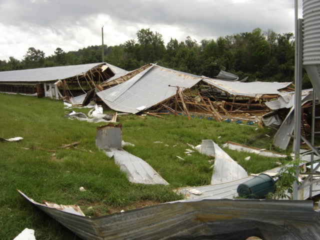
The tornado touched down near the intersection of Needmore Road and Pike County Road 7749. The tornado then moved north-northeastward, roughly parallel to Needmore Road. Two chicken houses suffered extensive damage. Minor damage occurred to a roof of a home. An outbuilding was destroyed. An awning of a barn housing a tractor was destroyed with building supports tossed around 100 feet. Approximately two dozen hardwood trees were snapped off aloft or lost their limbs. Insulation from a home was found 6 to 8 miles north of the home.
Damage Photos
|
Damage Tree Snapped Damage
Damage Damage Damage
Chicken House Damage Chicken House Damage Chicken House Damage
Chicken House Damage Chicken House Damage Chicken House Damage |