
Scattered thunderstorms with severe gusts, hail and a tornado risk are possible near a cold front from the Ohio Valley to the Mid-Atlantic tonight. Tropical Storm Bertha is expected to bring tropical storm conditions to portions of the Gulf Coast from the panhandle of Florida into Louisiana through Wednesday. Read More >
Overview:
On March 13th, 2019 an extremely powerful low pressure system developed over southern Colorado, setting a record for the lowest pressure ever recorded over Colorado, at Lamar, of 970.4 mb. The system officially met the criteria of a "Bomb Cyclone", in which barometric pressure readings dropped in excess of 24 mb (0.71 in Hg) over a 24-hour period.
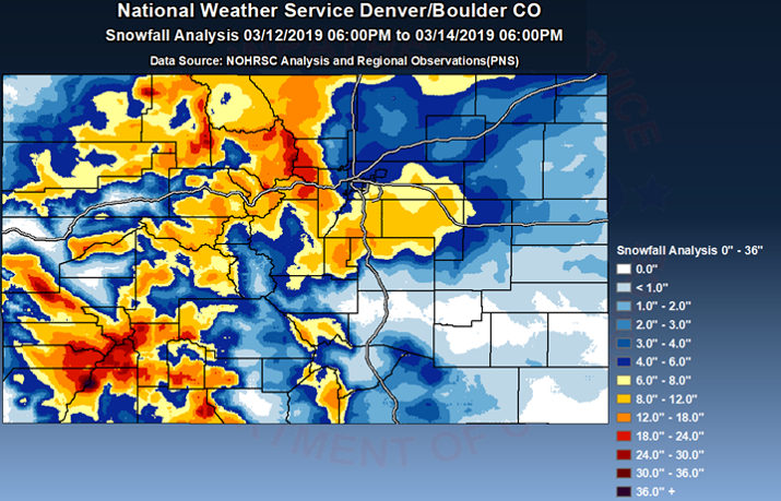
This storm created widespread blizzard conditions across northeast Colorado, Palmer Divide and over El Paso County. Wind gusts from 60 to 80 mph, with locally up to 100 mph. In addition, 1 to 3 feet of snow fell across the mountains with up to 52" at Wolf Creek Pass.
Impacts:
Total Snowfall
 |
Peak Wind Gusts
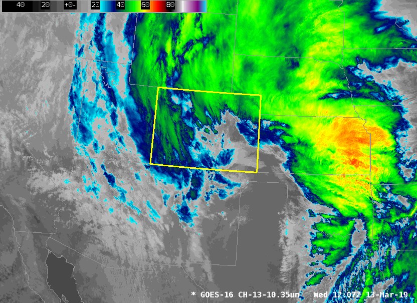
Satellite Imagery of the Storm (courtesy of NWS Pueblo)
 |
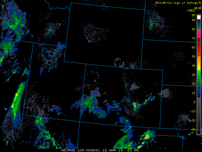
Radar Imagery of the Storm (courtesy of NWS Pueblo)
 |
Photos
Abandoned Cars in Arapahoe County (Courtesy of Arapahoe County Sheriff)
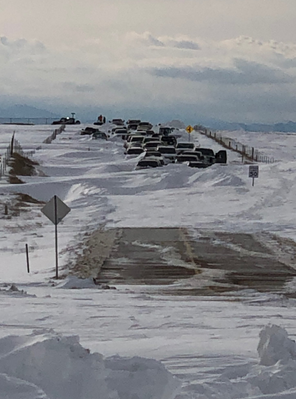 |
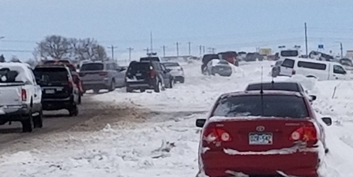
Abandoned Cars on Woodmen Road in El Paso County (Courtesy of KOAA)
 |
For more information about "Bomb Cyclones" NWS Pueblo has an excellent write up at https://www.weather.gov/pub/Bombogenesis_20190313

