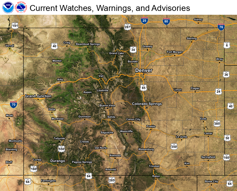
Flash flooding threatens areas from the Tennessee Valley to the Carolinas as storms repeat along a stalled front. Monsoonal storms may trigger flooding in the Southwest. Dangerous heat expands across the Desert Southwest, Plains, mid-Mississippi Valley and Southern Tier. Critical fire weather for interior Pacific Northwest. Cooler, drier air brings brief relief to the Great Lakes and Northeast. Read More >
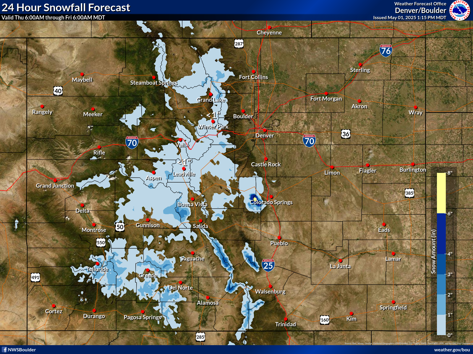
Snowfall Forecast 0-24 Hours |
|||||||||||||||||||||||||||||
|
|
|||||||||||||||||||||||||||||
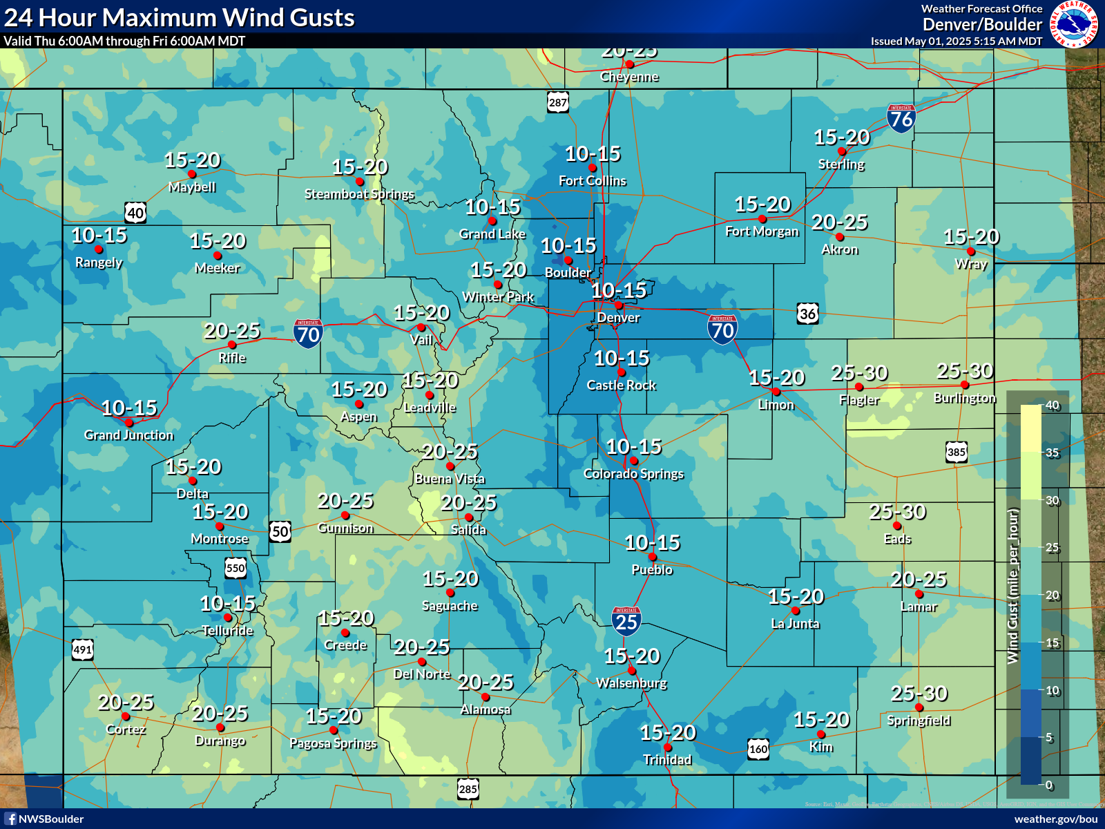
| Day 2 | Day 3 | Days 4-8 |
 |
 |
 |
| (Click or Tap for Larger Images & Details) | ||
| Day 2 | Day 3 |
 |
 |
|---|---|
| (Click or Tap for Larger Images & Details) | |
| Day 2 | Days 3-8 |
 |
 |
|---|---|
| (Click or Tap for Larger Images & Details) | |
|
If you have any questions, please call us anytime 24/7/365 to speak to a forecaster. If you are in north central or northeast Colorado, call NWS Boulder at (303) 494-4479. If you are in south central or southeast Colorado, call NWS Pueblo at (719) 948-3838. If you are in western Colorado, call NWS Grand Junction at (970) 256-9463. For your local forecast, please visit weather.gov/denver and enter your zip code on the left side of the page. |