
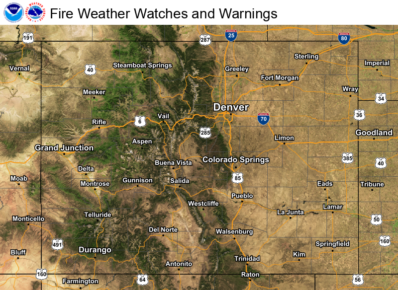
Dangerous heat expands across the Desert Southwest, Plains, Mississippi Valley and Midwest. Critical fire weather for portions of the Intermountain West. Risk for severe thunderstorms and flash flooding across the Upper Midwest/Great Lakes, Ohio Valley, and portions of the mid-Atlantic. Active monsoonal moisture fuels thunderstorms over the Southwest. Hurricane Fausto in the Pacific, should weaken Read More >
Denver/Boulder, CO
Weather Forecast Office
| Fire Weather Outlooks | ||
| Today | Tomorrow | Days 3-8 |
 Day 1 discussion |
 Day 2 discussion |
 Day 3-8 discussion |
| (Click or Tap for Larger Images & Details) | ||
| North Central/Northeast Colorado (NWS Boulder) |
South Central/Southeast Colorado (NWS Pueblo) |
Western Colorado (NWS Grand Junction) |
  |
||
  |
||
| 24-48 Hours (Click or Tap for Larger Images) 48-66 Hours | ||
  |
|
  |
|
| Tomorrow (Click or Tap for Larger Images) Day 3 |
  |
|
  |
|
| 24-48 Hours (Click or Tap for Larger Images) 48-66 Hours |
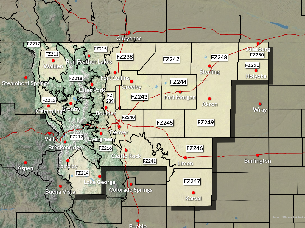
FIRE WEATHER ZONES IN BOU CWA
|
If you have any questions, please call us anytime 24/7/365 to speak to a fire weather forecaster. If you are in north central or northeast Colorado, call NWS Boulder at (303) 494-3877. To request a spot forecast, CLICK HERE. |
US Dept of Commerce
National Oceanic and Atmospheric Administration
National Weather Service
Denver/Boulder, CO
325 Broadway
Boulder, CO 80305-3328
303-494-3210 for a recording call 303-494-4221
Comments? Questions? Please Contact Us.

