Overview
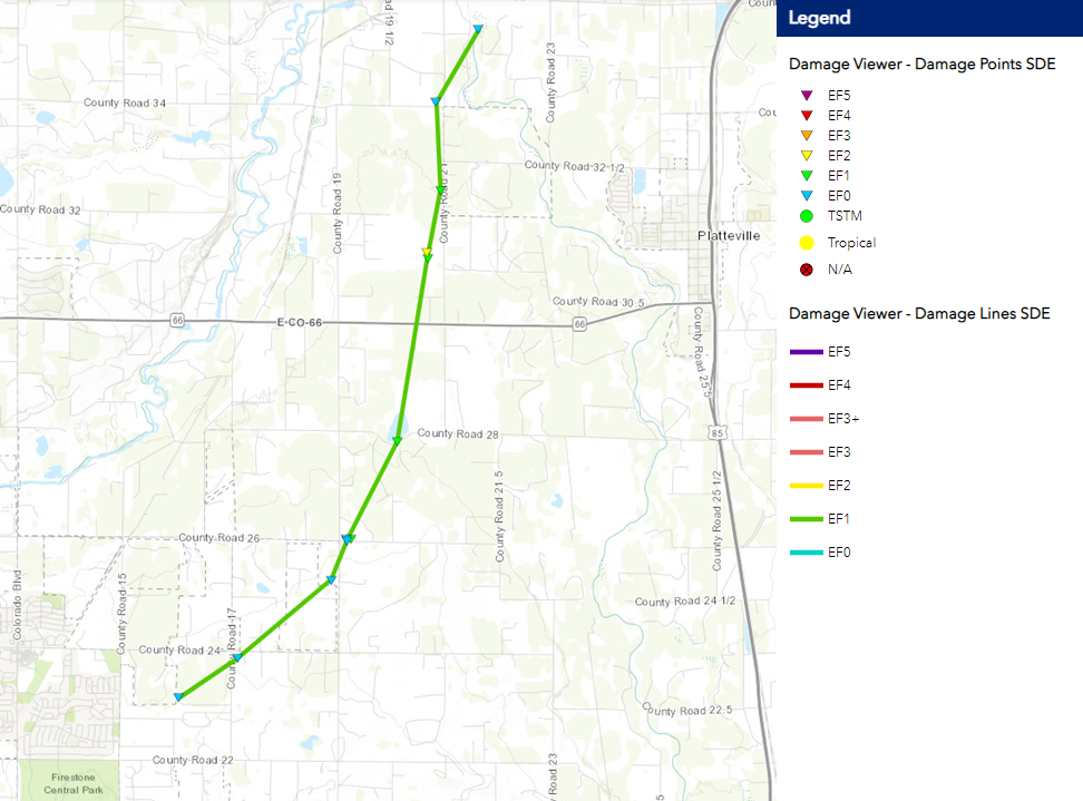
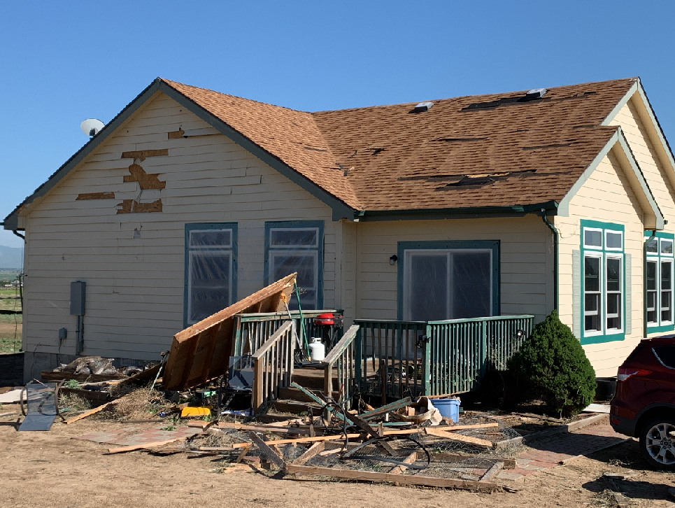
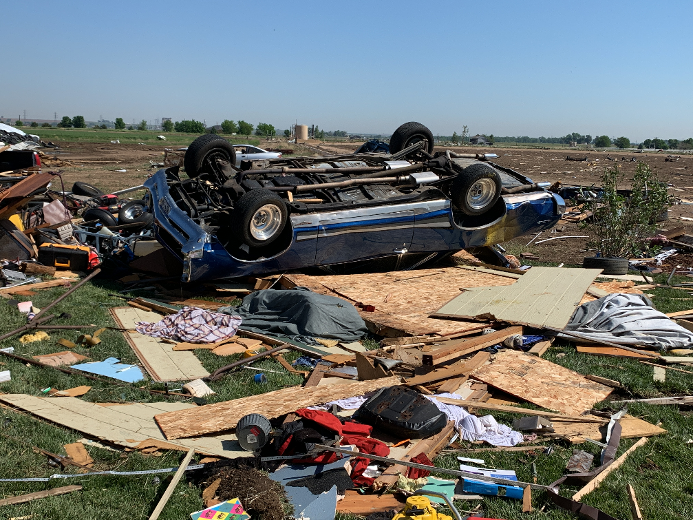
On June 7, 2021 a landspout tornado developed in southwest Weld County CO on June 7 2021, 2 miles northeast of Firestone. The tornado traveled north-northeast, and ended 3 miles northwest of Platteville. The tornado reached a peak intensity of EF-2 on the Enhanced Fujita scale, with estimated wind speeds of 122 mph.
Path of the June 7, 2021 Weld County Tornado
Tornadoes:
|
Tornado - LOCATION
|
The Enhanced Fujita (EF) Scale classifies tornadoes into the following categories:
| EF0 Weak 65-85 mph |
EF1 Moderate 86-110 mph |
EF2 Significant 111-135 mph |
EF3 Severe 136-165 mph |
EF4 Extreme 166-200 mph |
EF5 Catastrophic 200+ mph |
 |
|||||
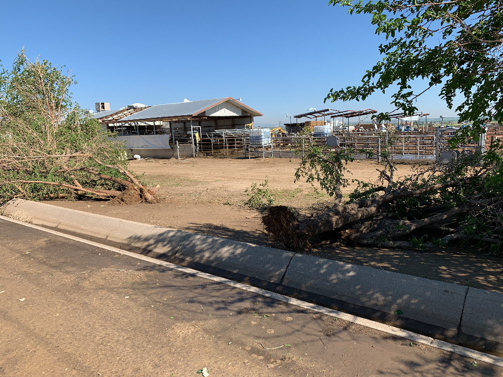
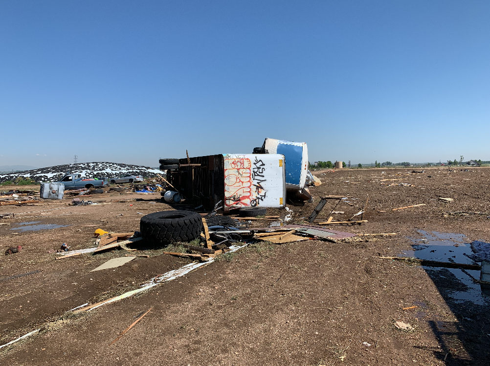
Photos & Video
 |
 |
 |
 |
 |
|
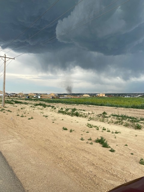
Tornado at 459 pm. Courtesy Nate Scott
|
(NWS Boulder) |
(NWS Boulder) | (NWS Boulder) |
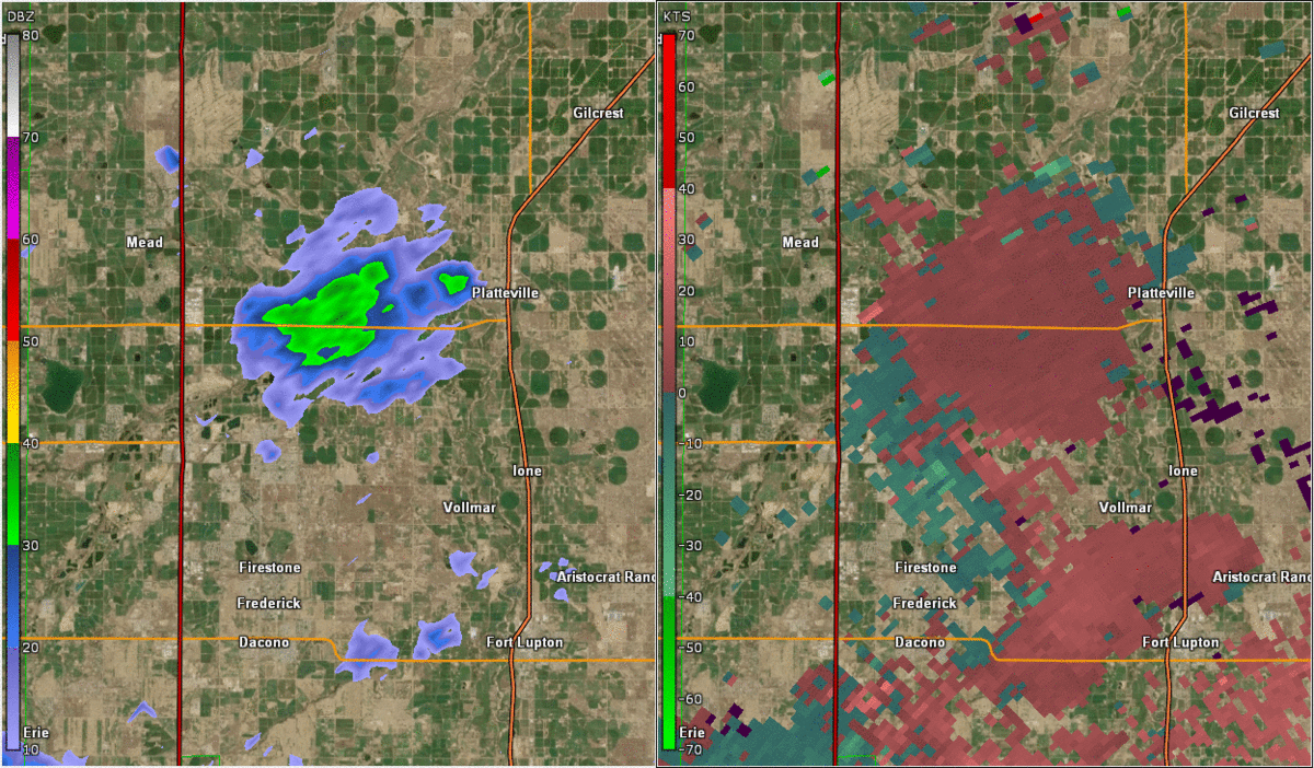
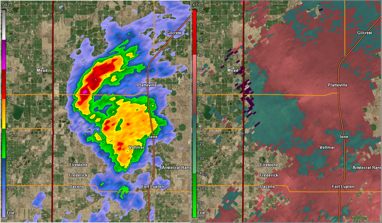
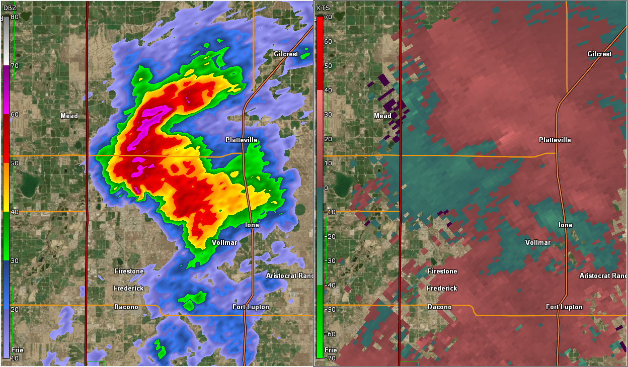
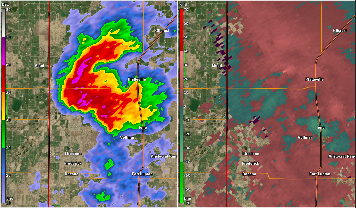
Radar
 |
 |
 |
 |
| Radar Loop | Better defined velocity couplet by 515 pm nearing Hwy 66. |
Velocity couplet north of Hwy 66 by 522 pm |
Last small velocity couplet by 525 pm |
 |
Media use of NWS Web News Stories is encouraged! Please acknowledge the NWS as the source of any news information accessed from this site. |
|

