Larimer County Weather Decision Support
| Click on any area for more detailed information on each Warning, Watch or Advisory. (Current Fires depicted by a green triangle) |
Severe Weather/Flash Flooding Decision Support
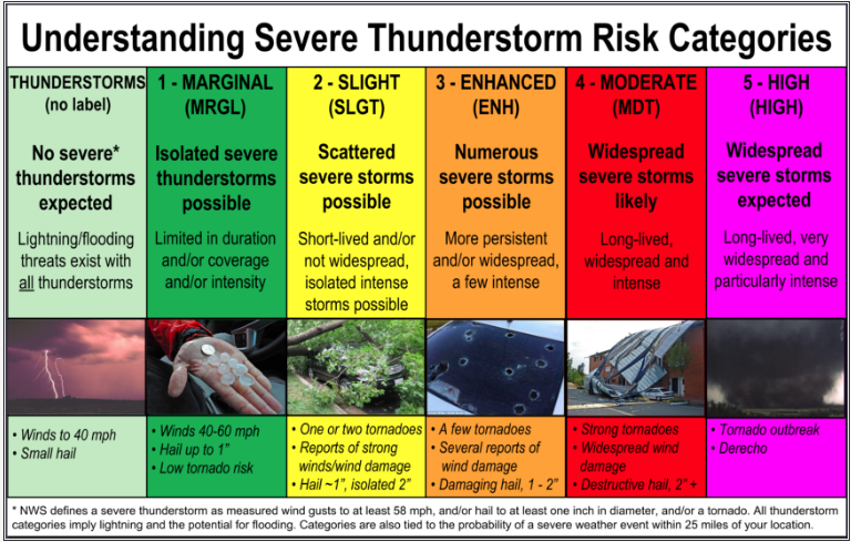
Today's Severe Weather Outlook
 |
Today's Tornado Potential
Today's Hail Potential
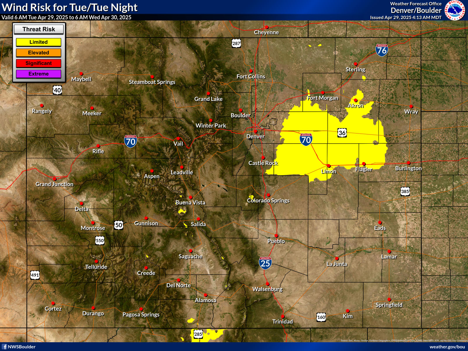
Today's Thunderstorm Wind Gust Potential
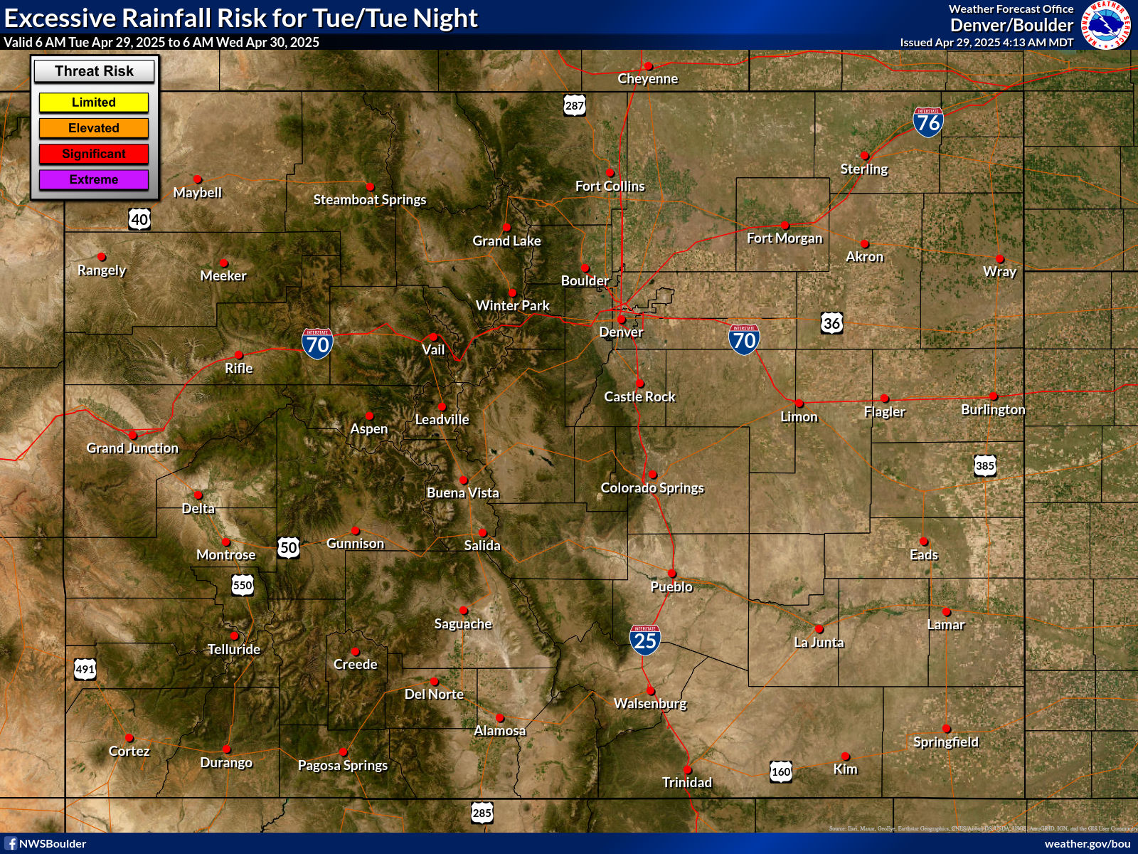
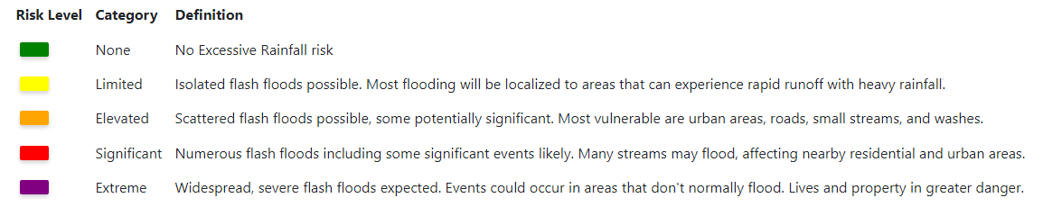
Today's Flash Flood Potential
 |
 |
Winter Weather Decision Support
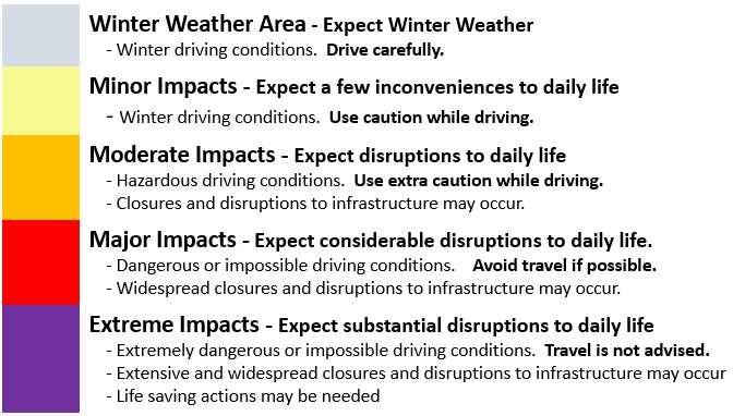
Potential Winter Weather Impacts
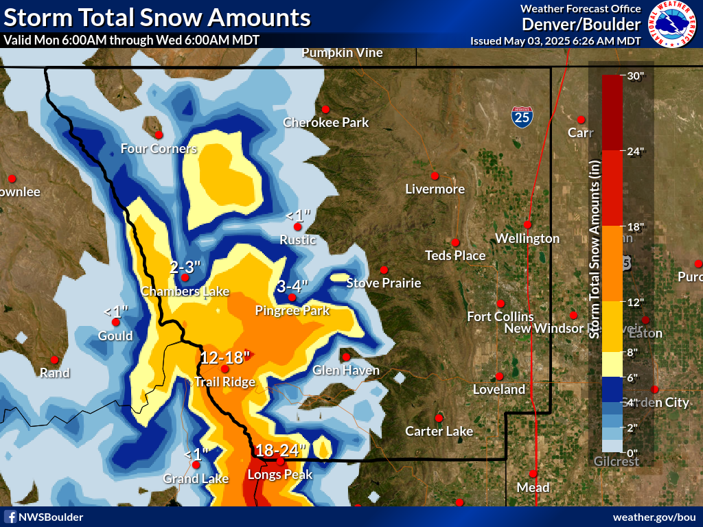
Snow Forecast
 |
   |
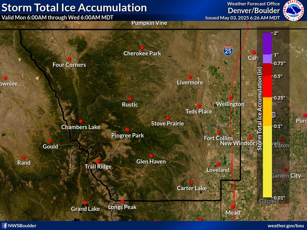
Ice Potential
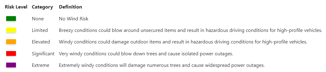
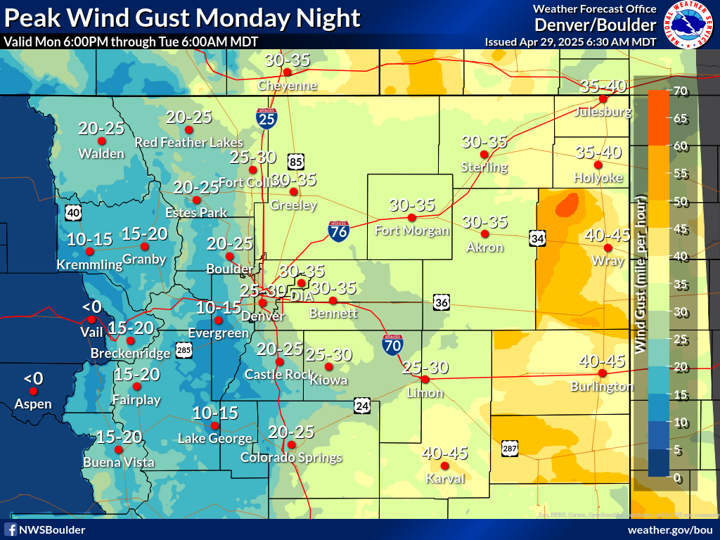
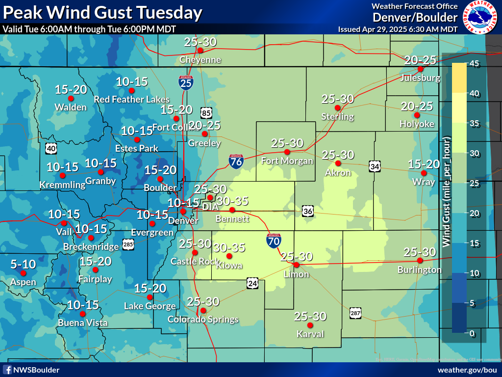
High Wind Decision Support
|
|
 |
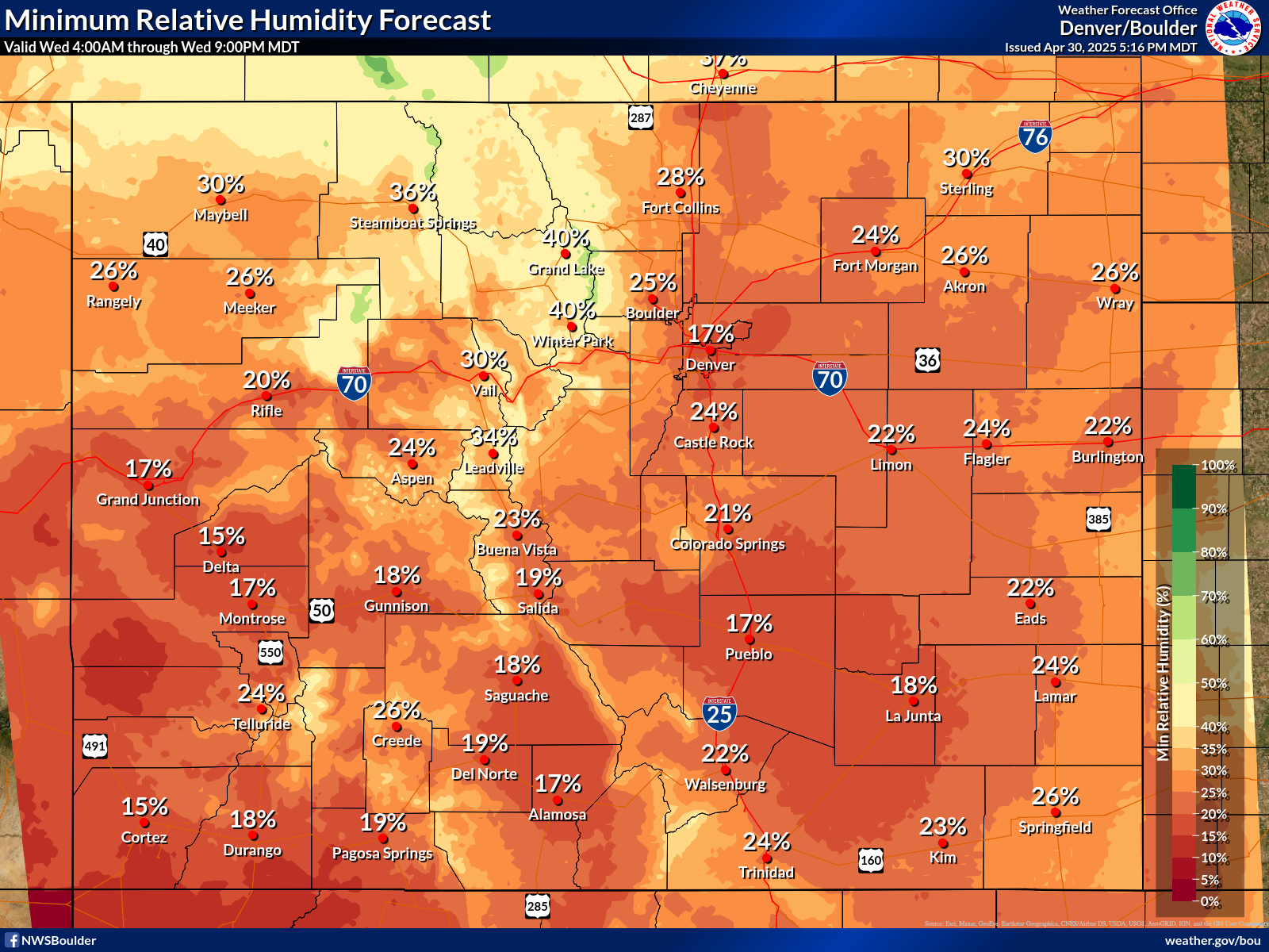
Fire Weather Decision Support
Today's Fire Potential

| Fire Weather Legend | Wildfire weather Safety Tips |
| Risk Level |
|
 |
Low | Open burning is usually safe with proper containers and precautions under low fire danger conditions. Residents should always check on local ordinances that prohibit open burning under any conditions. |
 |
Moderate |
Open burning is usually safe with the proper precautions. |
 |
High | Approaching Red Flag conditions. All open burning is discouraged due to increased wind and lower humidity except by experienced fire personnel. Increasing winds and lower humidity contribute to drying fuels. Fires escape control more easily and containment is difficult for inexperienced fire personnel. |
 |
Very High | Open burning should not be attempted. Open fires can quickly escape and are very difficult to control, even for experienced fire fighters. Conditions exceed minimum criteria for a Red Flag Warning in most cases. |
 |
Severe | Very strong winds, well in excess of Red Flag Criteria combined with moderate to low humidity. Fires will spread very quickly with spot fires common. Fire control is extremely difficult due to very strong winds. |
| ***These definitions are geared towards the general public and general emergency management and should not be confused with the standard National Fire Danger Rating System (NFDRS) adjectives used by wildland fire personnel |
 |
|
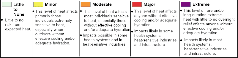
Heat/Cold Risk
(Use the Slider Bar to advance through the next 7 Days)
Hourly/Weekly Weather Forecast
(Click on any spot for an Hourly Forecast out to 7 Days)
Current Radar and Warnings
Real Time Lightning Data